- Mestia
-
Mestia
მესტიაA general view of Mestia with Mt Ushba in the background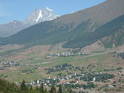 Location of Mestia in Georgia
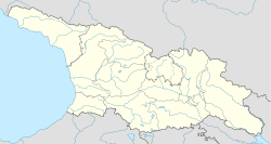
 Mestia
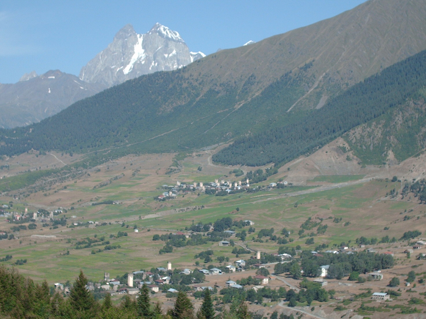
მესტიაCoordinates: 43°02′44″N 42°43′47″E / 43.04556°N 42.72972°E Country Georgia Mkhare Samegrelo-Zemo Svaneti Population (2002) - City 2,600 - Metro 14,248 Time zone Georgian Time (UTC+4) Mestia (Georgian: მესტია) is a highland townlet in northwest Georgia, at an elevation of 1,500 meters in the Caucasus Mountains.
Contents
General information
According to the current administrative subdivision of Georgia, Mestia is located in the Samegrelo-Zemo Svaneti region (mkhare), some 128 km northeast of the regional capital of Zugdidi. Mestia and the adjoining 132 villages form Mestia District (raioni). Its area is 3,044 km²; population – 14,248 (2,600 in the town itself; 2002 Georgia census). The population is mostly Svans, a cultural and linguistic subgroup of the Georgians. In Mestia is Queen Tamar Airport since 2010 and the airport is operated by the state-owned company United Airports Georgia.
Historically and ethnographically, Mestia has always been regarded a chief community of Zemo, or Upper Svaneti province. It was formerly known as Seti (სეთი). Despite its small size, the townlet was an important centre of Georgian culture for centuries and contains a number of medieval monuments - churches and forts - included in a list of UNESCO World Heritage Sites. In 1968, it was granted a status of a townlet (Georgian: daba).
Architecture and attractions
The townlet is dominated by stone defensive towers of a type seen in Ushguli ("Svan towers"). A typical Svan fortified dwelling consisted of a tower, an adjacent house (machub) and some other household structures encircled by a defensive wall.
Unique icons and manuscripts are kept in Mestia Historical-Ethnographic Museum. Mestia is also a center of mountaineer tourism and alpinism.
Twin towns
 San Gimignano, Italy (since 1975)[1]
Born in Mestia
- Mikheil Khergiani (1932–1969), a mountain climber
- Subdivisions of Georgia
- List of World Heritage Sites in Asia and Australasia
References
External links
- (German) Frescos and icons from Svaneti
Coordinates: 43°02′44″N 42°43′47″E / 43.04556°N 42.72972°E
Cities and towns in Georgia Autonomous Republic of Abkhazia Sokhumi · Akhali Atoni · Gagra · Gali · Gudauta · Ochamchire · Tkvarcheli · Bichvinta · Gantiadi · Gulripshi · Leselidze · Miusera.
Autonomous Republic of Adjara Guria Imereti Kakheti Mtskheta-Mtianeti Samegrelo-Zemo Svaneti Zugdidi, · Abasha · Anaklia · Jvari · Khobi · Martvili · Poti · Senaki · Tsalenjikha · Chkhorotsqu · MestiaSamtskhe-Javakheti Akhaltsikhe · Akhalkalaki · Borjomi · Ninotsminda · Vale · Abastumani · Adigeni · Akhaldaba · Aspindza · Bakuriani · Bakurianis Andeziti · Tsagveriacha-Lechkhumi and Kvemo Svaneti Kvemo Kartli Shida Kartli Cities with local Government Capital City Categories:- Cities and towns in Samegrelo-Zemo Svaneti
- World Heritage Sites in Georgia (country)


Wikimedia Foundation. 2010.