Mondawmin (Metro Subway station)

Mondawmin (Metro Subway station)

Infobox Station
style=
name = Mondawmin

logo_size =


image_size = 300px
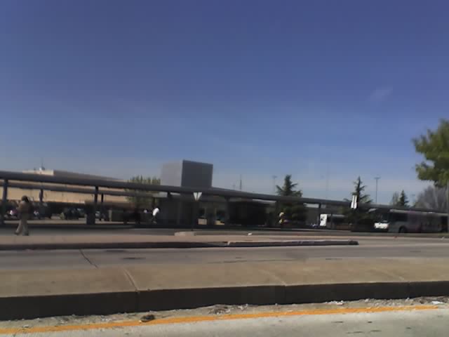
image_caption = Outside of Mondawmin Metro Subway Station
address = Liberty Heights Avenue at Reisterstown Road
Baltimore, MD 21215
line = rail color box|system=Baltimore Metro Subway|line=Green
other =
platform = 1 island platform
tracks = 2
parking =
bicycle =
passengers =
pass_year =
pass_percent =
opened = 1983
rebuilt =
ADA =
code =
owned = Maryland Transit Administration
zone =
services =
###@@@KEYEND@@@###

Mondawmin is a rapid transit station on the Metro Subway in Mondawmin, Baltimore, Maryland, United States. It is located under the intersection of Reisterstown Road and Liberty Heights Avenue, adjacent to the Mondawmin Mall. The station is the northernmost underground station on the line, and a major transfer point to many bus routes.

The station's location next to Mondawmin Mall, Baltimore's oldest mall, has led its owners to plan an expansion. [Andrea K. Walker, The Baltimore Sun, Bigger stores in works for Mondawmin Mall, February 15, 2006]

On the surface, a bus loop connects to Reisterstown Road and Liberty Heights Avenue. This loop and the adjacent streets are used by a number of bus routes, many of which terminate in it:
*Route 1 via Greenspring Avenue to Sinai Hospital and via Fulton Avenue and other streets through downtown to Fort McHenry
*Route 5 via Druid Hill Avenue/McCulloh Street and other streets through downtown to Cedonia
*Route 7 via Pennsylvania Avenue and other streets through downtown to Canton
*Route 16 to Brooklyn
*Route 22 to Johns Hopkins Bayview Medical Center
*Route 51 to Patapsco Light Rail Stop
*Route 97 (Mondawmin Shuttle) to local places near the station
*Route M-1 via Liberty Heights Avenue to Rolling Road
*Route M-2 via Reisterstown Road to Old Court Metro Subway Station
*Route M-3 via Park Heights Avenue to Milford Mill Metro Subway Station

Several routes were cut back to Mondawmin on June 18, 1984, about seven months after the station opened, and Routes M-1, M-2, and M-3 were formed at that time to replace the portions of those routes beyond Mondawmin. Specifically, Route M-1 was split from Route 28 (now Route 5 near Mondawmin), Route M-2 was split from Route 7, and Route M-3 was split from Route 5.Fact|date=April 2007

References


Wikimedia Foundation. 2010.

Игры ⚽ Поможем написать реферат

Look at other dictionaries:

  • Mondawmin (Baltimore Metro Subway station) — Mondawmin Outside of Mondawmin Metro Subway Station Station statistics Address 2307 Liberty Heights Avenue Baltimore, MD 21215 …   Wikipedia

  • Charles Center (Baltimore Metro Subway station) — Charles Center The outside of the Charles Center Metro Subway Station Station statistics Address Baltimore Charles Streets …   Wikipedia

  • Old Court (Baltimore Metro Subway station) — Old Court Old Court Station as viewed from Old Court Road. It access point is via the covered bridge running right in the photo to the bus terminal. Station stati …   Wikipedia

  • Milford Mill (Baltimore Metro Subway station) — Milford Mill Baltimore Metro departing the Milford Mill Subway station. Station statistics Address 4400 Milford Mill R …   Wikipedia

  • Owings Mills (Baltimore Metro Subway station) — Owings Mills Station statistics Address 5018 Painters Mill Road Owings Mills, MD 21117 Coordinates …   Wikipedia

  • Milford Mill (Metro Subway station) — Infobox Station style= name = Milford Mill logo size = image size = 300px image caption = Baltimore Metro departing the Milford Mill Subway station. address = Roman Frasier Drive at Bedford Road Pikesville, MD 21208 line = rail color… …   Wikipedia

  • Old Court (Metro Subway station) — Infobox Station style= name = Old Court logo size = image size = image caption = address = Old Court Road at Greenwood Road Pikesville, MD 21208 line = rail color box|system=Baltimore Metro Subway|line=Green other = platform = 1 island platform… …   Wikipedia

  • Metro Subway — Infobox rail line name = Metro Subway image width = 250px caption = Metro Subway train entering the Reisterstown Plaza station, bound for Owings Mills type = Rapid transit system = status = Operational locale = Baltimore, Maryland start = Owings… …   Wikipedia

  • Mondawmin, Baltimore — Mondawmin is a neighborhood located in the United States city of Baltimore, Maryland. The neighborhood is surrounded by Druid Hill Park and the Whitelock Community. Included within its boundaries are Frederick Douglass High School, and Mondawmin… …   Wikipedia

  • Mondawmin Mall — px Location Baltimore, Maryland, United States Address 2401 Liberty Heights Avenue Opening date October 14, 1956 Developer James Rouse Company Management …   Wikipedia

Share the article and excerpts

Direct link
Do a right-click on the link above
and select “Copy Link”