- Salcantay
-
Salcantay 
SW face of Nevado Salcantay from close to Salcantay trail (Mollepata to Colpapampa) at 4640m passElevation 6,271 m (20,574 ft) [1][2][3][4] or 6,264 metres (20,551 ft)[5][6] Prominence 2,540 metres (8,330 ft) [5][6] Listing Ultra Location Cusco Region, Peru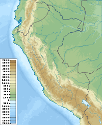
 Salcantay
Range Cordillera Vilcabamba, Andes[3][4][6][7][8] Coordinates 13°20′01″S 72°32′40″W / 13.33361°S 72.54444°WCoordinates: 13°20′01″S 72°32′40″W / 13.33361°S 72.54444°W Climbing First ascent August 4, 1952 by Fred D. Ayres, David Michael, Jr., W. V. Graham Matthews, George I. Bell, Claude Kogan, M. Bernard Pierre Easiest route Northeast ridge: technical glacier/snow/ice climb (French grade AD)[4] Salcantay (Nevado Salcantay) or Salkantay (Nevado Salkantay), Sallqantay in Quechua is the highest peak of the Cordillera Vilcabamba, part of the Peruvian Andes. It is located in the Cusco Region, about 60 km (40 mi) west-northwest of the city of Cusco. It is the 38th highest peak in the Andes, and the twelfth highest in Peru. However, as a range highpoint in deeply incised terrain, it is the second most topographically prominent peak in the country, after Huascarán.
Contents
Overview
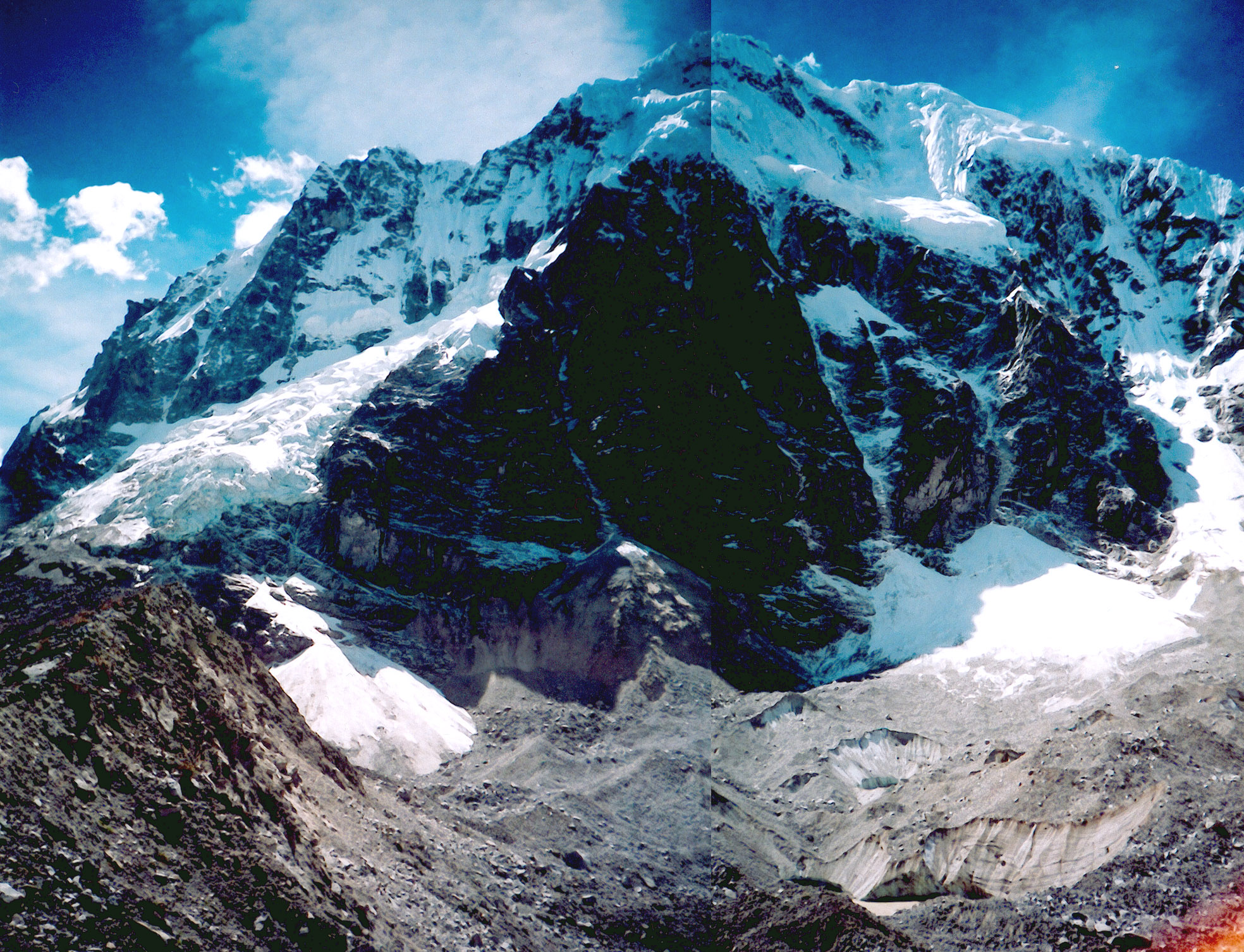
Salcantay is a large, steep peak, "the most spectacular peak of the region",[9] with great vertical relief, particularly above the low valleys to the north, which are tributaries of the Amazon River.
Salcantay was first climbed in 1952 by a French-American expedition comprising Fred D. Ayres, David Michael, Jr., John C. Oberlin, W. V. Graham Matthews, Austen F. Riggs, George I. Bell, Claude Kogan, M. Bernard Pierre, and Jean Guillemin. All except Oberlin, Riggs, and Guillemin made the summit.[9]
The standard route on the mountain is the Northeast ridge. Accessing the route typically involves three days of travel from Cusco. The climb involves about 1,800 m (5,900 ft) of vertical gain, on glacier, snow, ice, and some rock. The route is graded AD on the French adjectival scale.[4]
The name Salkantay is from sallqa, a Quechua word meaning wild, uncivilized, savage, or invincible, and was recorded as early as 1583.[10] The name is thus often translated as "Savage Mountain".
Directly to the north of Salkantay lies Machu Picchu, which is at the end of a ridge that extends down from this mountain. Viewed from Machu Picchu's main sundial, the Southern Cross is above Salkantay's summit when at its highest point in the sky during the rainy season. The Incas associated this alignment with concepts of rain and fertility, and considered Salkantay to be one of the principal deities controlling weather and fertility in the region west of Cuzco. [11]
 View from the southwest.
Salcantay Trek
Salcantay's proximity to Machu Picchu makes trekking around it an attractive alternative to the oversubscribed Inca Trail. There are three possible routes starting from Mollepata. All three begin with a day of approach, heading north along a dirt road. Then they diverge:
- The longest route, heads north to the base of the mountain, then turns right, following the east side of the mountain, then heads northeast to eventually join the Inca Trail itself at Wayllabamba. This route takes 4 days to reach the Inca Trail, then another 2 days to reach Machu Picchu.
- The most common route used by trekking companies heads north, then west around the west side of the mountain, over Salcantay Pass at 4600m. It continues as far as the village of La Playa, where buses usually make the connection to Santa Teresa. From here, trekkers walk to the Hydroelectric project then either train or walk to Aguas Calientes, at the base of Machu Picchu. This route takes 4 days in total.
- A more satisfying variation on this route turns right before reaching La Playa, over a ridge and arriving directly at Aguas Calientes two days later. This route takes 6 days in total.
See also
- List of mountains in Peru, all peaks above 6,000 meters
References
- Sources consulted
- Biggar, John (2005). The Andes: a guide for climbers. Scotland: Andes Publishing. pp. 112. ISBN 0-9536087-2-7.
- Encarta/Spanish (2007 online). "Cordillera Vilcabamba" (in Spanish). Enciclopedia Microsoft. Archived from the original on 2007-11-23. http://web.archive.org/web/20071123095528/http://es.encarta.msn.com/encyclopedia_961535950/Cordillera_Vilcabamba.html. Retrieved 2007-08-18. "Su máxima elevación es el pico Salcantay o Sarkantay (6.271 m) [...]"
- Encarta/Spanish (2007 online). "Salcantay" (in Spanish). Enciclopedia Microsoft. Archived from the original on 2007-11-27. http://web.archive.org/web/20071127132607/http://es.encarta.msn.com/encyclopedia_961535895/Salcantay.html. Retrieved 2007-08-18. "[...] constituye una de las principales elevaciones de la cordillera de Vilcabamba, [...] Alcanza una altitud de 6.271 metros."
- Ferranti, Jonathan de (compiler); et al. (2005). "Peru ultra-Prominences". Peaklist.org. http://www.PeakList.org/WWlists/ultras/peru.html. Retrieved 2007-08-18.
- Instituto Nacional de Estadística e Informática, Perú (2005) (in Spanish). Perú: Compendio Estadístico 2005. Lima: INEI. pp. 22. – Also stored at List of mountains in Peru.
- Peakbagger (2007 online). "Salcantay, Peru". Peakbagger.com. http://www.peakbagger.com/peak.aspx?pid=8487. Retrieved 2007-08-18.
- Rachowiecki, Rob (1991). Peru: a travel survival kit. Hawthorn, Australia: Lonely Planet Publications. pp. 206. ISBN 0-86442-095-1.
- Endnotes
- ^ This elevation is from a Peruvian military survey, quoted in the American Alpine Journal, 1973
- ^ INEI, Perú: Compendio Estadístico 2005, op. cit.
- ^ a b Encarta/Spanish, "Cordillera Vilcabamba" and "Salcantay", op. cit.
- ^ a b c d Biggar 2005, op. cit.
- ^ a b Ferranti 2005, "Peru ultra-Prominences", op. cit.
- ^ a b c Peakbagger, "Salcantay, Peru", op. cit.
- ^ INEI, Perú: Compendio Estadístico 2005, op. cit., attaches three peaks including the Salcantay to the Cordillera Vilcanota instead of Vilcabamba, but this was identified as a typo, and all other sources disagreed. Details in the endnotes to article "List of mountains in Peru".
- ^ Rachowiecki 1991, op. cit.
- ^ a b John C. Oberlin and W. V. Graham Matthews, "The First Ascent of Mount Salcantay", American Alpine Journal, 1953, pp. 387-396.
- ^ Rose, Mark (1999-09-01). "Exploring the Inca Heartland". Archaeological Institute of America. http://www.archaeology.org/online/features/peru/mountains.html.
- ^ Reinhard, Johan; Ceruti, Constanza (2005). "Sacred Mountains, Ceremonial Sites, and Human Sacrifice Among the Incas.". Archaeoastronomy XIX: pp. 1–43. http://www.utexas.edu/utpress/journals/jarch.html#XIX.
External links
- Gallery of Salcantay photos annotated by trekkers at TrekEarth.com
Categories:- Mountains of Peru
- Cusco Region


Wikimedia Foundation. 2010.