- Mary's Igloo, Alaska
-
Mary's Igloo is an abandoned village located in Nome Census Area in the U.S. state of Alaska.
Geography

Mary's Igloo is located at 65°09′N 165°04′W / 65.15°N 165.067°WCoordinates: 65°09′N 165°04′W / 65.15°N 165.067°W [1].
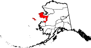
Mary's Igloo is located on the northwest bank of the Kuzitrin River, on the Seward Peninsula. It is northeast of Nome and 65 km (40 mi) southeast of Teller.
According to the United States Census Bureau, the city has a total area of 2.1 square miles (5.5 km²), of which, 1.9 square miles (5.0 km²) of it is land and 0.2 square miles (0.5 km²) of it is water. The total area is 9.00% water.
History
The Inupiat village of Kauwerak was located about 25 km (15 mi) downriver from Mary's Igloo. By 1900, Kauwerak was abandoned and most of its residents moved to Teller or Nome because of schools and employment opportunities. A few settled at the site of Mary's Igloo, which they called Aukvaunlook, meaning "black whale."
During the gold prospecting period of the early 1900s, non-Natives named the village "Mary's Igloo," after an Inupiat woman named Mary, who welcomed miners, trappers and others into her home for coffee. During that period, Mary's Igloo was a transfer point for supplies for the gold fields upriver on the Kuzitrin and Kougarok rivers. The supplies were offloaded from ocean boats onto barges, which were towed to their destinations. A post office and store were opened at Mary's Igloo in 1901. By 1910, Mary's Igloo was a large community of Inupiat and Anglo-Americans, who were miners, innkeepers, missionaries and support crews for the barges. It had schools, a post office and other services.
The flu epidemic of 1918 and 1919 and a tuberculosis epidemic, two years later, decimated the community's population. Catholic and Lutheran orphanages opened in the area to care for children left without parents.
The schools closed in 1948 and 1950 for lack of students and the post office and store also closed in 1952. Most of the residents moved to Nome or Teller.
The site of Mary's Igloo presently has no permanent population. It is used as a seasonal fish camp by some residents of Teller.
References
- ^ "US Gazetteer files: 2010, 2000, and 1990". United States Census Bureau. 2011-02-12. http://www.census.gov/geo/www/gazetteer/gazette.html. Retrieved 2011-04-23.
Municipalities and communities of Nome Census Area, Alaska Cities Brevig Mission | Diomede | Elim | Gambell | Golovin | Koyuk | Nome | Savoonga | Shaktoolik | Shishmaref | St. Michael | Stebbins | Teller | Unalakleet | Wales | White Mountain
CDP Ghost towns Council | Mary's Igloo
Categories:- Unincorporated communities in Alaska
- Geography of Nome Census Area, Alaska

Wikimedia Foundation. 2010.