- Vynohradiv
-
Vynohradiv
ВиноградівCentral Vynohradiv looking towards Black Mountain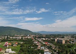
Coat of armsMap of Zakarpattia Oblast with Vynohradiv. Location of Vynohradiv
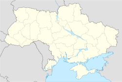
 Vynohradiv
Coordinates: 48°08′59″N 23°01′30″E / 48.14972°N 23.025°E Country
Oblast
Raion Ukraine
 Zakarpattia Oblast
Vynohradiv RaionFounded 1262 as Sevliush Incorporated 1946 Government – Mayor Stepan Bochkaj (István Bocskai) Area – Total 32.09 km2 (12.4 sq mi) Elevation 134 m (440 ft) Population (2010) – Total 27,600 Time zone CET (UTC+1) – Summer (DST) CEST (UTC+2) Postal code 90300 Website http://www.rada.vynogradiv.com.ua/ Vynohradiv (Ukrainian: Виноградів, Hungarian: Nagyszőlős, Romanian: Seleuşu Mare, Rusyn: Cивлюш (Syvlyush), Russian: Виноградово (Vinogradovo), Yiddish: סעליש (Seylesh, Selish)) is a city in western Ukraine, Zakarpattia Oblast. It has 27,600 inhabitants (2010). It is center of Vynohradiv Raion.
Contents
Location
The city lies near the river Tisza and the border with Romania. It is 35 kilometres from Berehove.
Name
The city was called Sevlush (the Rusyn transliteration of szőllős) in 1946, then became Vynohradiv. Vinogradovo, Vynohradiv, and Nagyszőlős all mean 'Grape City' in Russian, Ukrainian, and Hungarian respectively. It was also known as Vynohradovo in the Old Ukrainian language (Ruthenian language).
History
It was first mentioned in 1262 by the name Zceuleus. Its Hungarian name, Nagyszőlős comes from the word szőlő meaning grape, since the area is an important wine district. The town was one of the oldest in Ugocsa comitatus, and was inhabited by winemakers of the royal court. In 1329 King Charles Robert granted privileges to the town, which became the seat of the comitatus (the city held this rank until the Treaty of Trianon was signed in 1920).
In 1717 most of the citizens of the town were killed by an invading Tartar horde. By 1880 the population was about 4,400 (with 500 native Romanians). In 1881 a secondary school was opened. In 1910 it had a population of 7,811 (5943 or 76% Hungarians, 1266 or 16% Ruthenians (Rusyns) and 540 or 7% Germans). The religious make-up was 3311 Greek Catholics (42.5%), 2237 Jewish (28.6%) and 1124 Calvinists (14.4%).
This city had a Jewish ghetto in 1944, at its height from May to June 1944 when most of the Jews of this section of northern Transylvania were deported to the Auschwitz concentration camp to be gassed shortly after arrival. Jews from the area typically spent about 2 weeks in the ghetto before being deported. Conditions were extremely cramped with many families housed in a single room, a deliberate arrangement meant to cause suffering and disease.
In 1944, Carpathian Ruthenia became part of the Soviet Union.
Today 26% of the population is Hungarian (census of 2001).
Demographics
According to the 2001 census, the population included: [1]
- Ukrainians (71.4%)
- Hungarians (26.2%)
- Russians (1.2%)
- Roma people (0.8%)
Tourist sights
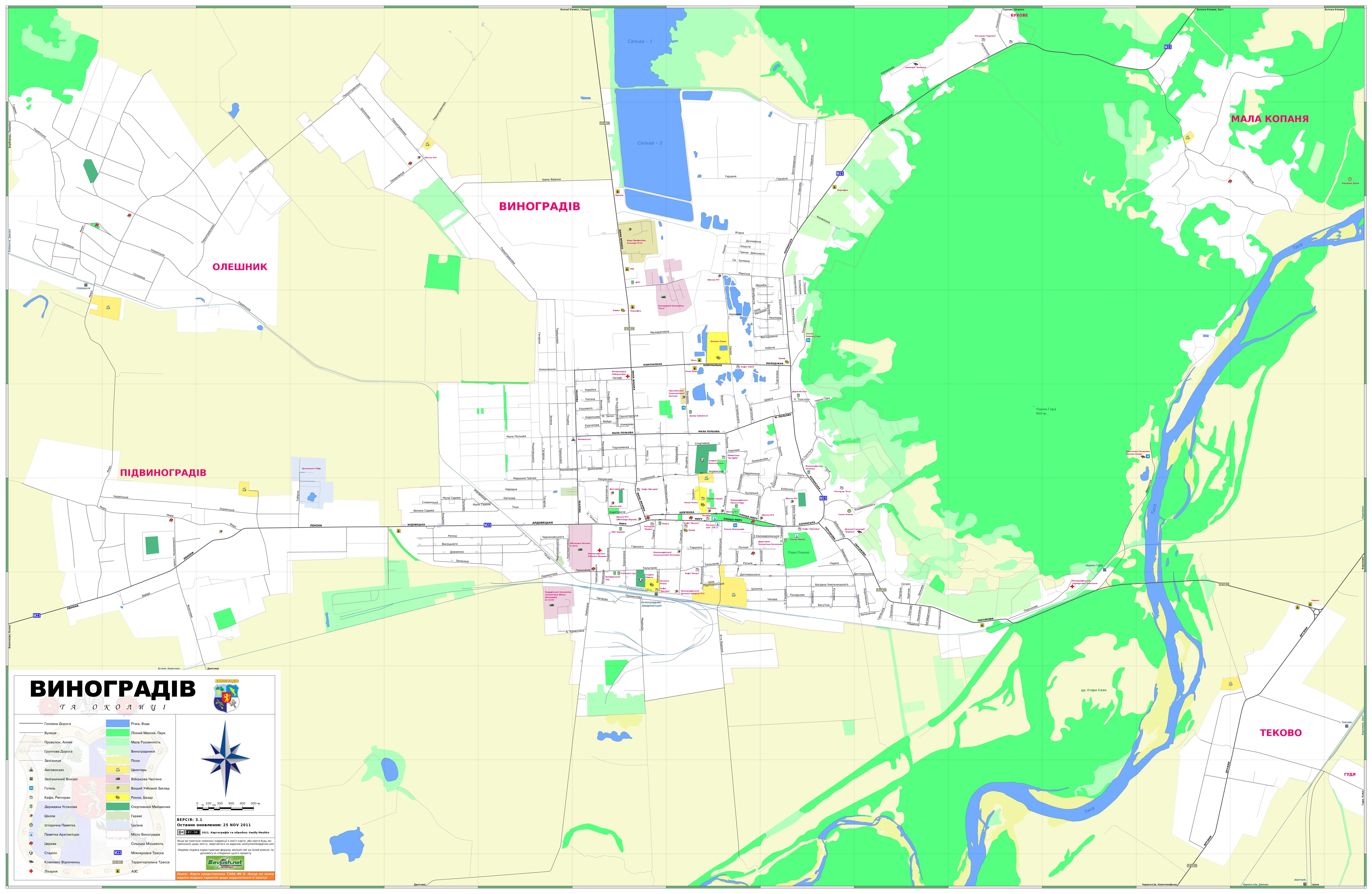
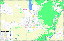 Street map of Vynohradiv and surrounding area (Ukrainian).
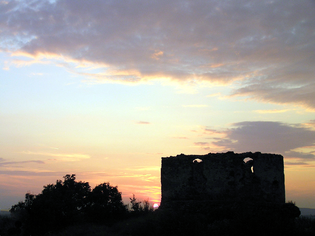
 Ugocsa Castle
- Ugocsa Castle (ruins; 13th century). It was first mentioned in 1308. In 1315 King Charles Robert attacked and destroyed it. In the 15th century the area was given to monks of the Franciscan order, they built a monastery there, which was inhabited until 1558. There is a small 14th century chapel south of the ruins.
- Perényi Castle. It was built by the Perényi noble family from 1399, later rebuilt in Baroque style into a mansion.
- Franciscan church and monastery (built in 1744, rebuilt in 1889).
- Our Lady's Church (13th century, rebuilt in the 15th century in Gothic style, restored in the early 20th century. Its furniture was destroyed after 1945. The Church got it back in 1989.
- Franciscan monastery (founded in the 15th century). In 1556 local Protestants attacked the monastery, killed the monks and threw the body of St. John Capistrano into a well. The Perényi family invited monks of the order to the town again, but the monastery burnt down in 1747. Its current building was erected in 1889.
 The ruins of a castle in Vynohradiv.
- Protestant church (Neoclassical, 1828).
- Old county hall (now the building of the Zsigmond Perényi Secondary School) and statue of Perényi (1906).
Famous people
- Composer Béla Bartók lived in the house opposing the mansion between 1889 and 1892; his mother worked here as a teacher. Bartók held his first concert here in the county hall.
- József Csorba doctor, physicist was born here in 1789.
- János Majos Kuruc captain was born here.
- Imre Révész painter was born here in 1859. He is buried in the local cemetery.
- Endre Nagy writer, stage director was born here in 1877.
Other Names
- Rusyn: Cивлюш (Syvlyush),Севлюш (Sevlyush)(before 1946)"
- Russian: Виноградoв (Vinogradov)
- Hungarian: Nagyszől(l)ős,
- Romanian: Seleuşu Mare,
- Slovak: (Veľký) Sevľuš / Vinohradov
- Czech: (Velká) Sevl(j)uš / Vinohradov
- Polish: Winogradów
- Yiddish: סעליש Seylesh, Selish
International relations
See also: List of twin towns and sister cities in UkraineTwin towns — Sister cities
Vynohradiv is twinned with:
 Nyírbátor in Hungary
- Fehérgyarmat in Hungary
 Dynów in Poland
 Vranov nad Topľou in Slovakia
See also
Raions 

Cities Urban-type
settlementsVillages Categories:- Vynohradiv
- Cities in Ukraine
- Zakarpattia Oblast


Wikimedia Foundation. 2010.