- Burnett River
Infobox River
river_name = Burnett River
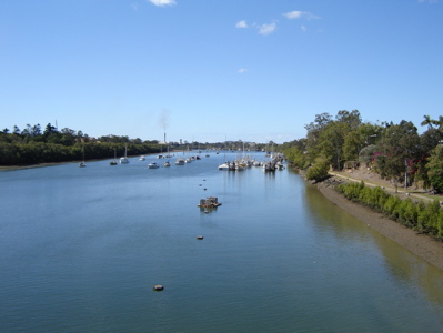
caption = The Burnett River with the city ofBundaberg to the right
origin = Mt Gaeta, nearMonto, Queensland
mouth =Pacific Ocean atBurnett Heads, Queensland
basin_countries =
length = 435km
elevation =
discharge =
watershed = 32,220 km²The Burnett River is a river in central
Queensland ,Australia that empties into thePacific Ocean near the city of Bundaberg. The Burnett River region is largely given over to growingsugar cane .The Burnett River, together with the nearby Mary River, is home to the
Queensland Lungfish , one of the most ancient of the extant vertebrate species.Construction of the Paradise Dam on the Burnett River, 80 kilometres upstream from Bundaberg, was completed in
November 2005 . The dam has a capacity of 300,000 megalitres. Thedam is named after the oldgold mining township of Paradise, which is now submerged under the waters of the reservoir. All of the structures and artefacts found at the site have been transferred to the nearby town of Biggenden. The design of the dam complies with strict environmental guidelines and includes a 'fishway' that allowsfish such as the Queenslandlungfish to travel upstream as well as downstream from the dam wall.The river rises close to Mt Gaeta, east of Monto, flowing in a general southerly direction past Eidsvold and Mundubbera. Downstream of Mundubbera, the river swings east, going through the townships of Gayndah and Wallaville before entering the city of Bundaberg. The river flows into the ocean at Burnett Heads, roughly 20 km from Bundaberg.
Tributaries
Major tributaries of the Burnett River include:
*Three Moon Creek: Rises nearKroombit Tops National Park north of Monto. Flows south through Monto and Mulgildie before emptying into the Burnett River south-east of Abercorn. Part of the creek is dammed near Cania Gorge to form Lake Cania.
*Nogo River: Rises in the hills north-west of Monto. Flows south-east to join the Burnett near Ceradotus. Part of the Nogo River is dammed west of Abercorn to form Wuruma Lake, a popular fishing spot.
*Auburn River: Rises in the hills about 20km west of Cracow. Flows south before swinging to the north-east at its confluence with Johnson Creek. Passes throughAuburn River National Park , a little known and untouched piece of pristine bush including Auburn Waterfall. Flows into the Burnett River west of Mundubbera.
*Boyne River: Rises in theBunya Mountains National Park south-west of Kingaroy. Flows in a general northerly direction, emptying into the Burnett River near Mundubbera (and only 5km from the Burnett River-Auburn River confluence). Part of the Boyne River is dammed near Proston to form Lake Boondooma (which suplies water for the Tarong Power Station near Kingaroy). Note another Boyne River, not part of the Burnett system, is located near Gladstone.
*Barambah Creek: Rises in the hills between Kingaroy and the Sunshine Coast, north of Jimna. Flows in a general northerly direction before meeting the Burnett River north-east of Gayndah. Part of Barambah Creek is dammed south of Murgon to from Lake Barambah, also known as Bjelke-Petersen Dam, named after former PremierJoh Bjelke-Petersen .External links
* [http://www.bom.gov.au/hydro/flood/qld/brochures/burnett/map.shtml Map of Burnett and its tributaries from the Bureau of Meteorology Australia]
* [http://www.sunwater.com.au/burnettwater.htm Burnett Water Pty. Ltd.]
Wikimedia Foundation. 2010.