- Monto, Queensland
-
Monto
Queensland
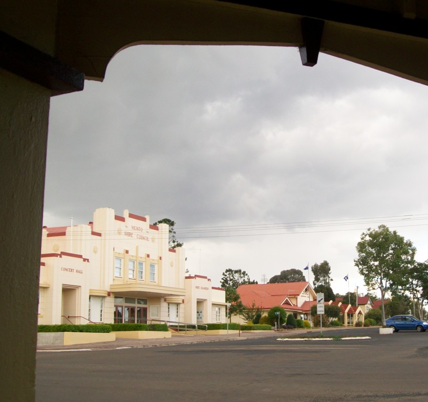
View looking across from the Albert Hotel in Monto's main street, across to the Monto Concert Hall and Shire Council building
 Monto
MontoPopulation: 1,459[1] Established: 1924 Postcode: 4630 Coordinates: 24°52′S 151°07′E / 24.867°S 151.117°ECoordinates: 24°52′S 151°07′E / 24.867°S 151.117°E Elevation: 248.7 m (816 ft) Location: LGA: North Burnett Region State District: Callide Federal Division: Division of Flynn Mean max temp Mean min temp Annual rainfall 27.3 °C
81 °F12.8 °C
55 °F732.6 mm
28.8 inMonto (
 /ˈmɒntoʊ/)[2] is a town in Queensland, Australia, located on the Burnett Highway 500 kilometres (310 mi) north-west of Brisbane and 235 kilometres (146 mi) south of Rockhampton. The town was the administrative centre of Monto Shire. At the 2006 census, Monto had a population of 1,159.[1]
Contents
History
Europeans settled in the area in the late 1840s, maintaining large pastoral holdings at the northern end of the Burnett Valley. Gold unearthed along Three Moon Creek — a tributary of the Burnett River — in the 1870s attracted further settlers. The original site of the diggings, 30 kilometres (19 mi) north of present-day Monto, has since been flooded by construction of Cania Dam. The township of Monto was not formally established until 1924. With dwindling gold reserves, Monto turned its economy towards farming and logging, two of the region's major industries today. Deposits of thermal coal and limestone have been discovered in the shire.
Tourism
Tourism is also a major industry in the region. Besides being a major highway town, the chief local attraction is Cania Gorge National Park, 20 kilometres (12 mi) north of town.
Mining
In 2006, Monto Minerals floated on the Alternative Investment Market in London, raising approximately A$41 million before expenses.[3] It has since announced its plans to begin commercial production of Feldspar, Ilmenite, Apatite and Titanomagnetite from its site at the Goondicum crater, just outside the eastern border of Monto Shire by the second quarter of 2007.[4]
Coal mining company Macarthur Coal also owns large amounts of land in the Mulgildie area.
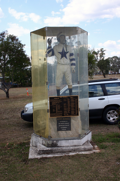
 Memorial to Monto's most famous son, jockey Kenny Russell.
Notable persons from Monto
- Gil Jamieson
- Kenny Russell[5]
- Jeff Seeney
See also
- Shire of Monto
- The Boyne Valley
- Cania Gorge National Park
References
- ^ a b Australian Bureau of Statistics (25 October 2007). "Monto (Urban Centre/Locality)". 2006 Census QuickStats. http://www.censusdata.abs.gov.au/ABSNavigation/prenav/LocationSearch?collection=Census&period=2006&areacode=UCL339800&producttype=QuickStats&breadcrumb=PL&action=401. Retrieved 2007-10-25.
- ^ Macquarie Dictionary, Fourth Edition (2005). Melbourne, The Macquarie Library Pty Ltd. ISBN 1-876429-14-3
- ^ Monto Minerals announcement 25 May 2006, FIRST DAY OF DEALINGS ON AIM £16.7 MILLION RAISED BY PLACING. Available online
- ^ Monto Minerals Announcement 22 August 2006, Countdown to Production... Monto Minerals Commences Industrial Minerals Project Construction. Available online
- ^ Kenny Russell
External links
- University of Queensland: Queensland Places: Monto
- Monto Shire Council
- Monto: The Age newspaper write-up (includes historical information)
- Monto Online
Towns and communities in the North Burnett Region | Wide Bay-Burnett | Queensland Abercorn · Ban Ban Springs · Biggenden · Binjour · Byrnestown · Ceratodus · Coulston Lakes · Dallarnil · Degilbo · Didcot · Eidsvold · Gayndah · Gooroolba · Humphery · Ideraway · Kalpowar · Moonford · Monto · Mount Perry · Mulgildie · Mundubbera · Mungungo
Main Article: Local Government Areas of QueenslandCategories:- Towns in Queensland

Wikimedia Foundation. 2010.