- Downers Grove Township, DuPage County, Illinois
-
Downers Grove Township — Township — Location in DuPage County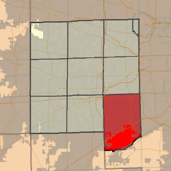 DuPage County's location in Illinois
Coordinates: 41°45′15″N 87°58′32″W / 41.75417°N 87.97556°WCoordinates: 41°45′15″N 87°58′32″W / 41.75417°N 87.97556°W Country  United States
State  Illinois
County DuPage Settled November 6, 1849 Government - Supervisor Barbara J. Wheat Area - Total 50.89 sq mi (131.81 km2) - Land 50.24 sq mi (130.12 km2) - Water 0.65 sq mi (1.69 km2) 1.28% Elevation 758 ft (231 m) Population (2000) - Total 148,110 - Density 2,948/sq mi (1,138.3/km2) Time zone CST (UTC-6) - Summer (DST) CDT (UTC-5) ZIP codes 60439, 60480, 60514-60517, 60521, 60523, 60527, 60559, 60561 GNIS feature ID 0428909 Downers Grove Township is one of nine townships in DuPage County, Illinois, USA. As of the 2000 census, its population was 148,110[1]. It is the largest township in the county, both in terms of area and population.
Contents
Geography
According to the United States Census Bureau, Downers Grove Township covers an area of 50.89 square miles (131.8 km2); of this, 50.24 square miles (130.1 km2) (98.72 percent) is land and 0.65 square miles (1.7 km2) (1.28 percent) is water.
Cities, towns, villages
- Bolingbrook (partial)
- Burr Ridge (west three-quarters)
- Clarendon Hills
- Darien
- Downers Grove (southeast three-quarters)
- Hinsdale (partial)
- Lemont (partial)
- Oak Brook (partial)
- Westmont (south three-quarters)
- Willow Springs (partial)
- Willowbrook
- Woodridge (partial)
Unincorporated towns
- Fullersburg at 41°49′05″N 87°55′06″W / 41.8180865°N 87.918394°W
- Lace at 41°45′07″N 87°58′03″W / 41.7519754°N 87.9675603°W
- Palisades at 41°42′49″N 87°56′01″W / 41.7136425°N 87.9336693°W
(This list is based on USGS data and may include former settlements.)
Extinct towns
(These towns are listed as "historical" by the USGS.)
Cemeteries
The township contains these ten cemeteries: Cass, Clarendon Hills, Downers Grove, Fullersburg, Hinsdale Animal, Oak Hill, Pierce Downer, Saint Johns Lutheran, Saint Mary of Gostyn and Saint Patricks Catholic.
Major highways
Airports and landing strips
- Argonne Heliport
- Brookridge Airport
- Darien-Woodridge Fire Department Heliport
- Madison Avenue Venture Heliport
- Midwest Heliport
Rivers
Lakes
- Bruce Lake
- Golfview Lake
- Maple Lake
- Picadilly Lake
- Ruth Lake
Landmarks
- Argonne National Laboratory
- Dupage County Waterfall Glen Forest Preserve
School districts
- Westmont Community Unit School District 201
Political districts
- Illinois's 13th congressional district
- State House District 42
- State House District 47
- State House District 82
- State Senate District 21
- State Senate District 24
- State Senate District 41
References
- "Downers Grove Township, DuPage County, Illinois". Geographic Names Information System, U.S. Geological Survey. http://geonames.usgs.gov/pls/gnispublic/f?p=gnispq:3:::NO::P3_FID:0428909. Retrieved 2010-01-10.
- United States Census Bureau 2008 TIGER/Line Shapefiles
- United States National Atlas
External links
Municipalities and communities of DuPage County, Illinois County seat: Wheaton Cities Aurora‡ | Batavia‡ | Chicago‡ | Darien | Elmhurst‡ | Naperville‡ | Oakbrook Terrace | St. Charles‡ | Warrenville | West Chicago | Wheaton | Wood Dale

Villages Addison | Bartlett‡ | Bensenville‡ | Bloomingdale | Bolingbrook‡ | Burr Ridge‡ | Carol Stream | Clarendon Hills | Downers Grove | Elk Grove Village‡ | Glendale Heights | Glen Ellyn | Hanover Park‡ | Hinsdale‡ | Itasca | Lemont‡ | Lisle | Lombard | Oak Brook‡ | Roselle‡ | Schaumburg‡ | Villa Park | Wayne‡ | Westmont | Willowbrook | Winfield | Woodridge‡
Townships Addison | Bloomingdale | Downers Grove | Lisle | Milton | Naperville | Wayne | Winfield | York
Unincorporated
communitiesCloverdale | Eola | Flowerfield | Keeneyville | Lakewood | Medinah | Palisades | York Center
Footnotes ‡This populated place also has portions in an adjacent county or counties
Categories:- Townships in DuPage County, Illinois
- Downers Grove, Illinois
- Populated places established in 1849


Wikimedia Foundation. 2010.