- Craigneuk
-
Coordinates: 55°46′51″N 3°57′44″W / 55.780812°N 3.9622049°W
Craigneuk 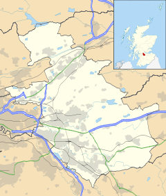
 Craigneuk
Craigneuk shown within North LanarkshireCouncil area North Lanarkshire Lieutenancy area Lanarkshire Country Scotland Sovereign state United Kingdom Post town WISHAW Postcode district ML2 Dialling code 01698 Police Strathclyde Fire Strathclyde Ambulance Scottish EU Parliament Scotland UK Parliament Motherwell and Wishaw Scottish Parliament Motherwell and Wishaw
Central ScotlandList of places: UK • Scotland • Coordinates: 55°46′51″N 3°57′44″W / 55.780812°N 3.9622049°W Craigneuk is a suburb of Wishaw, North Lanarkshire, Scotland. The original village of Craigneuk was located in the area where Meadowhead Road meets Glasgow Road. It was originally part of Dalziel parish along with the other rural weaving villages of Flemington, Windmillhill and Motherwell. Craigneuk village was located close to the boundary with Cambusnethan parish.
Mining of coal and iron ore in the 1840s lead to industrialisation and rapid population growth from rural Scotland and large numbers of migrants from Ireland. Nearby, in Cambusnethan parish the industrial communities of Sheildmuir and Berryhill were established on the road leading to Wishaw. In 1920 the joint Burgh of Motherwell and Wishaw was created and later abolished in the 1970s. In the 1930s the burgh council undertook a massive housing development program in the area to the east of Glasgow Road stretching from the village of Craigneuk to Berryhill. The entire area became known as Craigneuk. At the same time much of the area known as the "Berryhill Rows" was demolished to make way for the King George V Playing Fields.
The Ravenscraig Steelworks was established in the area during the 1950s and the main employer until it was closed in 1992 and later demolished. Ravenscraig, a new residential and commercial area is now emerging on this site to the north east of the original village. Wishaw General Hospital was established in 2001 on the site of the original Berryhill School.
According to SIPs the population of Craigneuk was 3030 in 2000.
Contents
Industry
Despite the closure of most of its heavy industry, Craigneuk still retains the Lanarkshire Welding company which supply heavy steel components for the construction business, and heavy goods vehicles can often be seen on John Street transporting heavy fabricated steel items.
Street names
Several of the street names to the west of Glasgow Road are named after towns made famous by sieges and battles in the Boer War, such as Ladysmith Street, Mafeking Street and Kimberley Street.
Education
Craigneuk has one primary school, the non-denominational Berryhill Primary School. The original Berryhill Primary School was located on the land now occupied by Wishaw General Hospital, but the school was demolished due to mining subsidence and rebuilt in its current location on Hillcrest Avenue in the early 1970s. St. Matthews Roman Catholic Primary School in nearby Wishawhill closed in 2010.
There are no high schools located in Craigneuk but it is in the catchment area for both Dalziel High School in Motherwell and Clyde Valley High School in Overtown. Roman Catholic high schools in the catchment area include Our Lady's High School in Motherwell and St. Aidan's High School in Wishaw.
A new campus for Motherwell College was opened in August 2009 at nearby Ravenscraig.
Shops
The Caledonian Centre on Glasgow Road has national store chains such as Argos, Matalan, JJB Sports and Homebase. Nearby a KFC drive-thru restaurant is located on the site of the former Texaco petrol station. There are a small number of independent shops and pubs along Shieldmuir Street and Craigneuk Street.
On the residential streets there is a Spar grocery store at the western end of Laurel Drive and an independent newsagent on Hillcrest Avenue known locally as "Bell's" and another on Briarwood Road known as "Feeney's" These names refer to previous owners but have remained in common use.
Community Life
The Craigneuk Community Centre was named the Jim Foley Community Centre in 1999 to honour the long serving local Councillor. It is the venue for many community activities including majorettes, exercise and slimming classes, services for the disabled and the Clyde Valley Community Church. Craigneuk Public Library and the Craigneuk War Memorial are located next to the community centre.
The Craigneuk & Belhaven Old Parish Church (Church of Scotland) opened for worship on Craigneuk Street in 1897 and St Patrick's Roman Catholic Church on Shieldmuir Street in 1898 are major landmarks of the suburb.
There is also a small mosque just off Craigneuk Street.
King George V Playing Fields is a park next to Wishaw General Hospital which has a child's swing park and a games field. It is also used by the hospital as a helicopter landing pad. There are several areas of parkland in the suburb, including a swing park in a grassy area on Broompark Road. There was also originally a swing park in a small area behind Charles Street known locally as "the Ashey" (because of it once being surfaced with red shale - i.e. "ashes") This became a haunt of drinkers and has now been abandoned due the dangers of many years of deposited broken glass.
A junior football team, Craigneuk Amateurs, formed in 1995.
Transport
The A721 between Motherwell and Wishaw runs though Craigneuk. From Wishaw the suburb begins after driving under under railway bridge at Glasgow Road and from Motherwell under the railway bridge at Craigneuk Street. A bus service runs along Glasgow Road and through some of the residential streets with a coach service to Glasgow operated run by Irvines of Carluke.
Shieldmuir Station has trains to Motherwell, Glasgow and Lanark, and is an important mail hub. The station opened in 1990 to give Craigneuk residents a closer alternative to Wishaw Station.
References
- Robert Duncan Wishaw: Life and Labour in a Lanarkshire Industrial Community 1790-1914, 1986, ISBN 0903207958.
- Robert Duncan Steelopolis: The Making of Motherwell c.1750-1939, 1991, ISBN 0903207990.
- Alan B. Campbell The Lanarkshire Miners: A Social History of their Trade Unions, 1775-1874,1979, ISBN 0859760480.
Categories:- Areas of Wishaw

Wikimedia Foundation. 2010.