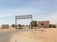
- Dakhla Airport
-
Dakhla Airport 
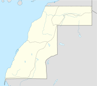
IATA: VIL – ICAO: GMMH Location of airport in Western Sahara Summary Airport type Public / Military Operator Office National Des Aéroports (ONDA) /
Forces Royales Air (FRA)Serves Dakhla Location Western Sahara Elevation AMSL 36 ft / 11 m Coordinates 23°43′05″N 015°55′55″W / 23.71806°N 15.93194°W Runways Direction Length Surface m ft 03/21 3,000 9,842 Asphalt Statistics (2008) Aircraft movements 1,574 Passengers 42,066 Cargo (tonnes) 34.43 Sources: ONDA,[1] DAFIF[2][3] Dakhla Airport (IATA: VIL, ICAO: GMMH) is an airport serving Dakhla (also known as ad-Dakhla, formerly Villa Cisneros), a city in Western Sahara.
The airport is operated as a Moroccan airport, with public facilities managed by the Moroccan state-owned company ONDA.
The status of Western Sahara is disputed, see: Legal status of Western Sahara.
Contents
History
During World War II, the airport was used by the United States Army Air Force Air Transport Command as a stopover for cargo, transiting aircraft and personnel on the North African Cairo-Dakar transport route for cargo, transiting aircraft and personnel. It connected to Dakar Airport in the South and Agadir Airport to the north.[4]
Airport and facilities
The Dakhla airport is used as public airport and by the Royal Moroccan Air Force. The 3 km (1.9 mi) long runway can receive a Boeing 737 or smaller planes. Parking space of 18,900 square metres (203,000 sq ft) or one Boeing 737.
The passenger terminal covers 670 square metres (7,200 sq ft) and is capable to handle up to 55,000 passengers per year. Public facilities available include a medical post and a prayer room.
The airport offers the following radio-navigation aids: VOR and DME.
Airlines and destinations
Airlines Destinations Canary Fly Las Palmas de Gran Canaria Royal Air Maroc Agadir, Casablanca, Laayoune Traffic statistics
Item 2008 2007 2006 2005 2004 2003 Aircraft movements[5] 1,574 1,492 839 674 606 492 Passengers[6] 42,066 36,354 21,253 21,442 11,670 12,149 Cargo (tonnes)[7] 34.43 48.63 59.77 61.06 140.96 107.81 References
 This article incorporates public domain material from websites or documents of the Air Force Historical Research Agency.
- ^ Dakhla airport information from Office National Des Aéroports (ONDA)
- ^ Airport information for GMMH from DAFIF (effective October 2006)
- ^ Airport information for VIL at Great Circle Mapper. Source: DAFIF (effective Oct. 2006).
- ^ The airport was then paved over in the 1960s by Francoist Spain.File:Atcroutes-1sep1945.jpg
- ^ Statistics until 2006 from Statistics Movements, PDF document
- ^ Statistics until 2006 from Overview passengers stats MA, PDF document
- ^ Statistics until 2006 from freight stats, PDF document
External links
Categories:- Airports in Western Sahara
- Airports in Morocco
- USAAF Air Transport Command Airfields - North Africa
- North African airport stubs
Wikimedia Foundation. 2010.

