- Grindleford
-
Coordinates: 53°17′31″N 1°38′17″W / 53.292°N 1.638°W
Grindleford 
Grindleford/: Sir William Hotel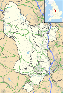
 Grindleford
Grindleford shown within DerbyshireDistrict Derbyshire Dales Shire county Derbyshire Region East Midlands Country England Sovereign state United Kingdom Post town HOPE VALLEY Postcode district S32 Dialling code 01433 Police Derbyshire Fire Derbyshire Ambulance East Midlands EU Parliament East Midlands UK Parliament High Peak List of places: UK • England • Derbyshire Grindleford is a village and parish in the county of Derbyshire, in the East Midlands of England. It lies at an altitude of 150 metres (492 ft) in the valley of the River Derwent in the Peak District National Park. On the west side of the valley is the 429 metres (1,407 ft) high Sir William Hill, and to the south-east lies the gritstone escarpment of Froggatt Edge. Grindleford became a parish in 1987, merging the parishes of Eyam Woodlands, Stoke, Nether Padley and Upper Padley.
The nearest city to Grindleford is Sheffield, the centre of which is about 7 miles (11 km) away. For rail travellers, the Sheffield suburb of Totley is less than three miles away at the other end of the Totley Tunnel. This is the second-longest rail tunnel in the UK: first-time travellers from the Sheffield direction enter the tunnel in the suburbs and are surprised to find themselves in the middle of Peak District countryside when they emerge. Grindleford railway station (confusingly located in Upper Padley, half a mile away) is at the western portal of the rail tunnel - on the scenic Hope Valley Line between Sheffield and Manchester.
Grindleford is popular with walkers and climbers due to its proximity to a variety of landscapes, including open moorland, wooded river valleys (including Padley Gorge), several gritstone escarpments, and the broad Hope Valley. Visitors seeking refreshment are well catered for by a number of establishments, including the Sir William Hotel, the Maynard Hotel and Bar, the National Trust Longshaw Estate Visitor Centre, and Grindleford Station Cafe (in the old station house).
Padley Chapel
 The chapel and remains of Padley Hall
Padley Hall (or Padley Manor) was a large double courtyard house where, in 1588, two Catholic priests (Nicholas Garlick and Robert Ludlum) were discovered and then, two weeks later, hung, drawn and quartered in Derby. They became known as the 'Padley Martyrs'. Padley Hall today is mostly in ruins, although part of it - probably originally the central gatehouse range - survives, and in 1933 was converted to a Roman Catholic chapel in honour of the martyrs.[1]. The chapel stands not far from the railway line, a short distance westwards from the station. A pilgrimage takes place every year in July.
References
- ^ Redfern, R., Portrait of the Hope Valley, The Cottage Press, 1988, p11
External links
Categories:- Villages in Derbyshire
- Towns and villages of the Peak District
- Civil parishes in Derbyshire


Wikimedia Foundation. 2010.