- Curral Velho, Cape Verde
-
Curral Velho
Kurral Bedju or Kurral Bédj'Statistics Island: Boa Vista Municipality: Boa Vista Location:
Latitude:
Longitude:
15.9833 (15° 59") N
22.8 (22° 48") WDistance from the island capital of Sal Rei:
about 35 to 40 km southeastAltitude:
Lowest:
Centre:
HighestAtlantic Ocean (north)
around 5 to 10 mMonte Estancia (north)
Curral Velho (Capeverdean Crioulo, (written in ALUPEC): Kurral Bédj’) is a settlement in the southern part of the island of Boa Vista, Cape Verde. The village is around 40 km southeast of the island capital of Sal Rei and about 15 km south of Norte and is linked with remote roads with linking to Povoação Velha to the west, Rabil and the island capital to the north and Norte to the northeasta.
Contents
Nearest places
- Estância de Baixo, northeast
Geography
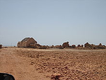 Curral Velho seen from the north
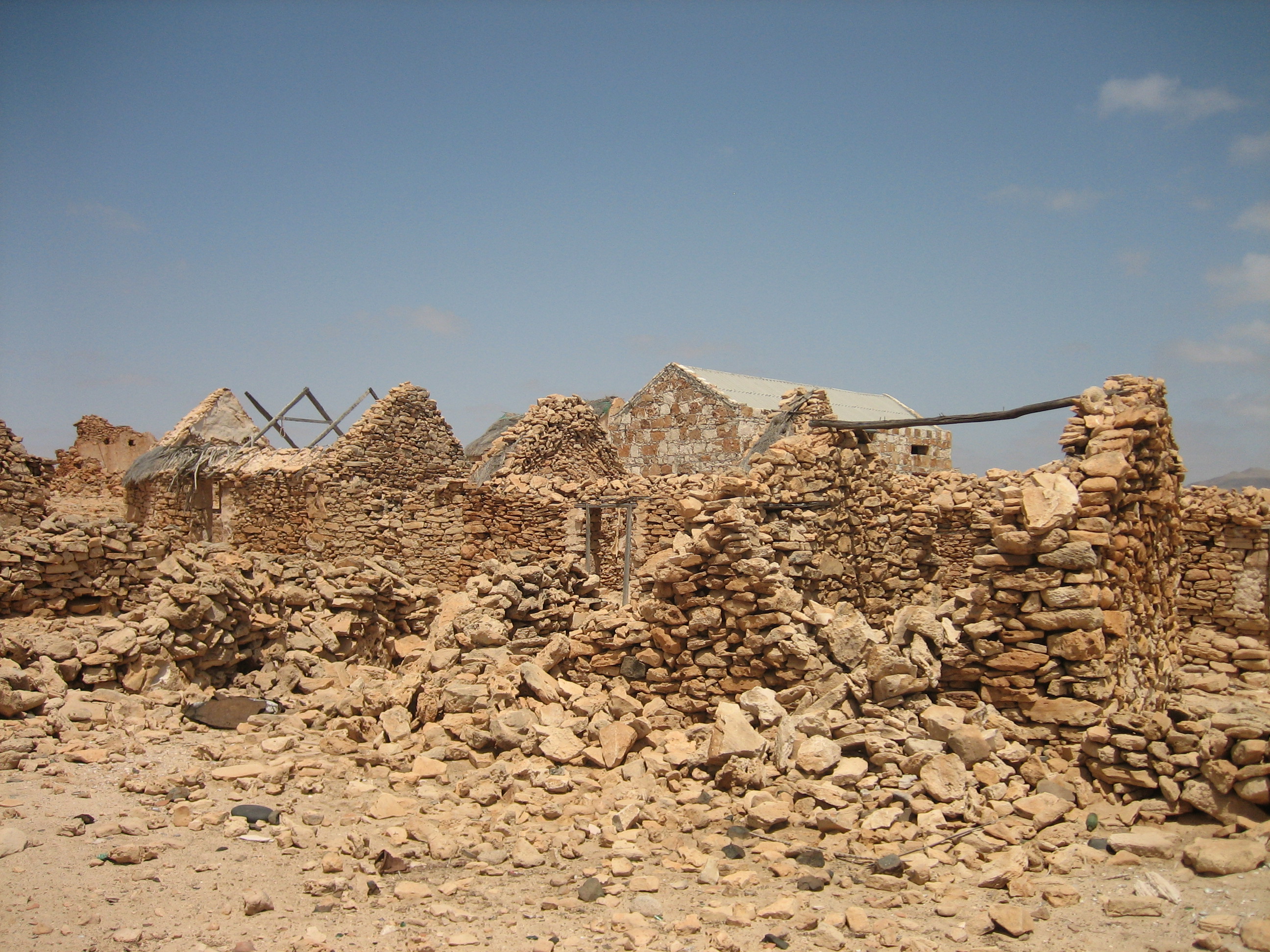
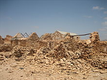 The ruins inside Curral Velho
The village is situated in the dry desert climate and it receives little or no precipitation annually. Farmlands are nearly unavailable and are mainly of cattle and rarely some fruit productions and are nearly the size of the football field and its only has about tens of farms, many foodstuffs are received from the northern and the southern parts of the nation. The remaining area are desert and are covered with bushes within the coastline and are without vegetation and rocky elsewhere, its soil colour ranges from butterscotch to red, Monte Estancia is to the northeast and represents the island's tallest mountain. Hills are rarely founded except to the northwest and the northeast.
Other information
The village is in the island's lowest class. Most of the houses are either built with mud and brick or stone and concrete, several houses are built with either steel reinforced concrete or with stone and wood. All of its population are farmers and are based in agriculture. The area received no income until the mid to late-20th century and is the island's poorest settlement. Some farms are in the form of paddies and stone walls. However, a part of the needy materials comes from the island capital, the island capital and the diaspora. But for other needs, electricity, communications and appliances are partially available in the area as well as phone lines since the late-20th century. A part of the necessities also comes from the island capital.
Curral Velho was designated a Ramsar wetland of international importance on July 18, 2005.
External links
- Map and aerial photos:
- Street map information from: Mapquest, LiveLocal or Google or Yahoo! Maps
- Satellite images: Google or Microsoft Virtual Earth - image now available
- Coordinates: 15°59′0″N 22°48′0″W / 15.983333°N 22.8°W
See also
The island of Boa Vista and the surrounding islands Communities and settlements Bafureira · Cabeço do Tarafes · Curral Velho · Ervatão · Estancia de Baixo · Funda das Figueiras · Gata · João Barreiro · João Galego · Norte · Povoação Velha · Rabil · Sal Rei · Santo TirsoParishes Mountains Other geographical features Categories:- Villages and settlements in Boa Vista, Cape Verde
- Ramsar sites in Cape Verde

Wikimedia Foundation. 2010.