- Dongtai
-
Dongtai (Chinese: 东台) is a city under the jurisdiction of Yancheng, Jiangsu, in the People's Republic of China, located on the west coast of the Pacific ocean and 190 kilometers north of Shanghai. It has a population of roughly 1,170,000 estimated for 2007. Out of the total population, about 260,000 live in the Dongtain urban core, others are distributed in the 23 suburban towns and rural regions (Some famous towns include Touzao, Anfeng, Qingdong, Sancang, Qianggang, Fu'an, Tangyang, etc.).
Transportation in Dongtai is fairly convenient. There are four International airports (Shanghai Pudong, Shanghai Hongqiao, Nanjing Lukou, Yancheng Nanyang) within 200 kilometers. There are also several other domestic airports nearby. The Xinchang Railway traverses the downtown. No. 204 national highway, No. 333 provincial highway, An-qiang provincial road, and The Coastal Expressway pass through the Dongtai area. The coastal railway from the northeast Heilongjiang province to the southeast Fujian province is under construction. When construction is complete on this railway, transportation will be made more effective in Dongtai. That will further stimulate the city's economic development.
The dialect in Dongtai is quite different from Mandarin (which mainly comes from dialects of Northern China). The local accent is close to that in nearby Taizhou, Haiyan, Xinghua, Dafeng area. The population who speak Dongtai language are around 10 million. But it has no problem to do business in Dongtai, since most of local people speak Mandarine quite well, and a lot of young people there also speak English.
The food style in Dongtai belongs to Huai-Yang series. The taste is not strong, and that is different from most of other regions in China. In Dongtai, people also have chance to eat different seafoods.
Tourist can also find fun in Dongtai. Xi-xi ancient town is the cradle of Dongtai and it is also a Holy land of Buddhism. The Yellow Sea (Huanghai) National Park is on the east coastal region of Dongtai and there are also a national everglade protection region and a five-A (the highest level) precious animal protection region nearby.
Climate
Climate data for Dongtai (1971–2000) Month Jan Feb Mar Apr May Jun Jul Aug Sep Oct Nov Dec Year Average high °C (°F) 6.2
(43.2)7.7
(45.9)12.2
(54.0)18.9
(66.0)24.5
(76.1)27.9
(82.2)30.9
(87.6)30.8
(87.4)26.7
(80.1)21.8
(71.2)15.4
(59.7)9.3
(48.7)19.36
(66.84)Average low °C (°F) −1.3
(29.7)−0.1
(31.8)3.6
(38.5)9.1
(48.4)14.6
(58.3)19.6
(67.3)23.8
(74.8)23.4
(74.1)18.6
(65.5)12.6
(54.7)6.4
(43.5)0.5
(32.9)10.90
(51.62)Precipitation mm (inches) 34.6
(1.362)41.6
(1.638)69.1
(2.72)69.6
(2.74)87.2
(3.433)176.0
(6.929)199.9
(7.87)140.5
(5.531)101.3
(3.988)54.2
(2.134)53.1
(2.091)23.8
(0.937)1,050.9
(41.374)% humidity 76 76 77 77 77 81 85 85 83 79 76 74 78.8 Avg. precipitation days (≥ 0.1 mm) 7.1 7.8 10.5 8.9 10.5 11.7 13.4 11.5 9.4 8.0 7.0 5.1 110.9 Sunshine hours 150.0 141.6 158.2 187.9 211.4 178.8 200.4 227.9 186.2 188.5 170.0 168.9 2,169.8 Source: 中国气象局 External links
- Dongtai City English guide (Jiangsu.NET)
Jiangsu topics Nanjing (capital) General Geography Cities • Grand Canal of China • Yellow Sea • East China Sea • Xishan Island •
Yangtze River • Lake Tai • Hongze Lake • Yangcheng Lake • Huai RiverEducation Culture Visitor attractions Purple Mountain • Sun Yat-sen Mausoleum • Ming Xiaoling Mausoleum • Jiming Temple • Nanjing Yangtze River Bridge • Hanshan Temple • Huqiu Tower • Grand Buddha at Ling Shan • Chaotian Palace • Qixia Temple • Tianning Temple PagodaJiangsu Province county-level divisions Nanjing (capital) Nanjing: Xuanwu District · Baixia District · Qinhuai District · Jianye District · Gulou District · Xiaguan District · Pukou District · Luhe District · Qixia District · Yuhuatai District · Jiangning District · Lishui County · Gaochun County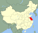 Jiangsu in China
Wuxi: Chong'an District · Nanchang District · Beitang District · Binhu District · Huishan District · Xishan District · Wuxi New District · Jiangyin City · Yixing City
Xuzhou: Yunlong District · Gulou District · Jiuli District · Jiawang District · Tongshan District · Quanshan District · Pizhou City · Xinyi City · Suining County · Pei County · Feng County
Changzhou: Zhonglou District · Tianning District · Qishuyan District · Xinbei District · Wujin District · Jintan City · Liyang City
Suzhou: Jinchang District · Canglang District · Pingjiang District · Huqiu District · Wuzhong District · Xiangcheng District · Wujiang City · Kunshan City · Taicang City · Changshu City · Zhangjiagang City
Nantong: Chongchuan District · Gangzha District · Haimen City · Qidong City · Tongzhou District · Rugao City · Rudong County · Hai'an County
Lianyungang: Xinpu District · Lianyun District · Haizhou District · Ganyu County · Guanyun County · Donghai County · Guannan County
Huai'an: Qinghe District · Qingpu District · Chuzhou District · Huaiyin District · Jinhu County · Xuyi County · Hongze County · Lianshui County
Yancheng: Tinghu District · Yandu District · Dongtai City · Dafeng City · Sheyang County · Funing County · Binhai County · Xiangshui County · Jianhu County
Yangzhou: Guangling District · Weiyang District · Hanjiang District · Yizheng City · Jiangdu City · Gaoyou City · Baoying County
Zhenjiang: Jingkou District · Runzhou District · Dantu District · Yangzhong City · Danyang City · Jurong City
Taizhou: Hailing District · Gaogang District · Jingjiang City · Taixing City · Jiangyan City · Xinghua City
Suqian: Sucheng District · Suyu District · Shuyang County · Siyang County · Sihong County■ = Sub-provincial city ■ = Prefecture-level city Coordinates: 32°47′37″N 120°31′05″E / 32.79361°N 120.51806°E
Categories:- Yancheng
- County-level divisions of Jiangsu
- Jiangsu geography stubs

Wikimedia Foundation. 2010.