- Meander River, Alberta
-
Meander River — Settlement — Location of Meander River in Alberta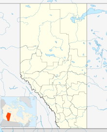

Coordinates: 59°02′05″N 117°42′24″W / 59.03472°N 117.70667°WCoordinates: 59°02′05″N 117°42′24″W / 59.03472°N 117.70667°W Country  Canada
Province  Alberta
Region Northern Alberta Census division No. 17 I.R. Upper Hay River 212 Elevation 328 m (1,076 ft) Population (2006) - Total 122 Time zone MST (UTC−7) - Summer (DST) MDT (UTC−6) Highways Alberta Highway 35 Meander River, is a settlement in Upper Hay River 212, a part of the Dene Tha' Band,[1] in Northern Alberta. It serves as a transportation service center between Alberta and the Northwest Territories.[2]
Contents
Geography
 The Meander River Trading Post in 1956
The settlement is located on the banks of the Hay River, at an elevation of 328 meters (1,076 ft). The plant hardiness zone of Meander River is 0B, the second lowest possible within Canada, due primarily to its Northern latitude.[3]
Employment
The major source of employment in Meander River is provided via commute to High Level, 70 km to the South along the Mackenzie Highway. There are three other sources of employment within the community, a provincially funded school built in 1996, a Dene Tha' Band office and a general store.
Infrastructure
The community is connected to the internet via Alberta SuperNet with fiber optic cabling.[4]
Two FM Radio stations are broadcast to the reserve, CFWE 89.9 FM and CIAM 92.3 FM.[5]
There is one school in Meander River, Upper Hay River School.[6]
Medical care is provided by the Meander River Health Station.[7]
Recreation
- Recreational hockey/ball hockey league
- Recreational volleyball league.
- The area provides easy access to cross-country skiing, snowmobiling, canoeing, hunting and fishing.
Religion
There is one church in Meander River, the Catholic Mission.
References
External links
 Subdivisions of Alberta
Subdivisions Regions · Census divisions · Municipal districts (counties) · Specialized municipalities · School districts · Regional health authoritiesCommunities Cities · Towns · Villages · Summer villages · Hamlets · Indian reserves · Métis settlements · Ghost towns · Designated placesCities and Urban
Service AreasAirdrie · Brooks · Calgary · Camrose · Cold Lake · Edmonton (capital) · Fort McMurray · Fort Saskatchewan · Grande Prairie · Lacombe · Leduc · Lethbridge · Lloydminster · Medicine Hat · Red Deer · Sherwood Park · Spruce Grove · St. Albert · Wetaskiwin Category ·
  Portal ·
  WikiProjectCategories:


Wikimedia Foundation. 2010.