- Kurwai
-
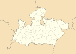
Kurwai — city — Coordinates 24°7′2″N 78°2′18″E / 24.11722°N 78.03833°ECoordinates: 24°7′2″N 78°2′18″E / 24.11722°N 78.03833°E Country India State Madhya Pradesh District(s) Vidisha Population 13,737 (2001[update]) Time zone IST (UTC+05:30) Kurwai is a town and a Nagar Panchayat in Vidisha district in the Indian state of Madhya Pradesh.
Contents
History
Main article: Kurwai StateKurwai was formerly a Muslim princely state of British India. The state was 368 km² in area and in 1892 boasted a population of 30,631. The state, which came under British sovereignty in the early nineteenth century, was founded in 1730 by Mohammed Dalal Khan, an Afghan rising through merit in the Mughal Army . His descendants ruled the state until 15 June 1948, when the last ruling Nawab acceded to the Indian Government. Kurwai became part of the newly-created state of Madhya Bharat, and was added to Vidisha District. Madhya Bharat was merged into Madhya Pradesh on 1 November 1956.
Demographics
As of 2001[update] India census,[1] Kurwai had a population of 13,737. Males constitute 52% of the population and females 48%. Kurwai has an average literacy rate of 61%, higher than the national average of 59.5%: male literacy is 69%, and female literacy is 53%. In Kurwai, 18% of the population is under 6 years of age.
References
- ^ "Census of India 2001: Data from the 2001 Census, including cities, villages and towns (Provisional)". Census Commission of India. Archived from the original on 2004-06-16. http://web.archive.org/web/20040616075334/http://www.censusindia.net/results/town.php?stad=A&state5=999. Retrieved 2008-11-01.
External links
- RoyalArk- History and Genealogy of the ruling chiefs of Kurwai's Firoz Khel dynasty linking to other dynasties, e.g.:
- Genealogy of Abida Sultan, wife of the last ruling Nawab of Kurwai
- Audio with Princess Abida Sultaan of Bhopal
Cities and towns in Bhopal Division Bhopal district Raisen district Badi • Baraily • Begamganj • Bhojpur • Gairatganj • Manideep • Obedullaganj • Raisen • Sultanpur • UdaipuraRajgarh district Sehore district Vidisha district Related topics Cities and towns
in other DivisionsCategories:- Cities and towns in Vidisha district
Wikimedia Foundation. 2010.


