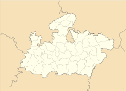
- Sarangpur, Madhya Pradesh
-
Sarangpur — city — Coordinates 23°34′N 76°28′E / 23.57°N 76.47°ECoordinates: 23°34′N 76°28′E / 23.57°N 76.47°E Country India State Madhya Pradesh District(s) Rajgarh Population 32,295 (2001[update]) Time zone IST (UTC+05:30) Area
• 410 metres (1,350 ft)
Sarangpur is a city and a municipality in Rajgarh district in the Indian state of Madhya Pradesh.
Contents
Geography
Sarangpur is located at 23°34′N 76°28′E / 23.57°N 76.47°E[1]. It has an average elevation of 410 metres (1345 feet).
Demographics
As of 2001[update] India census[2], Sarangpur had a population of 32,295. Males constitute 52% of the population and females 48%. Sarangpur has an average literacy rate of 55%, lower than the national average of 59.5%: male literacy is 64%, and female literacy is 45%. In Sarangpur, 18% of the population is under 6 years of age. Saranpur has more Muslims than Hindus.
Transport
Bus service is available in Sarangpur. Sarangpur is served by Agra Mumbai Highway NH3. It is 126
km from Indore, the business capital of Madhya Pradesh. It is 160 km from Bhopal, the capital.
The Sabarmati Express and Bina Nagda Passenger railway lines stop in Sarangpur
References
- ^ Falling Rain Genomics, Inc - Sarangpur
- ^ "Census of India 2001: Data from the 2001 Census, including cities, villages and towns (Provisional)". Census Commission of India. Archived from the original on 2004-06-16. http://web.archive.org/web/20040616075334/http://www.censusindia.net/results/town.php?stad=A&state5=999. Retrieved 2008-11-01.
Cities and towns in Bhopal Division Bhopal district Raisen district Badi • Baraily • Begamganj • Bhojpur • Gairatganj • Manideep • Obedullaganj • Raisen • Sultanpur • UdaipuraRajgarh district Sehore district Vidisha district Related topics Cities and towns
in other DivisionsCategories:- Cities and towns in Rajgarh district
- Rajgarh
- Madhya Pradesh geography stubs
Wikimedia Foundation. 2010.


