- Sumner Avenue Line and New Lots Avenue Line
-
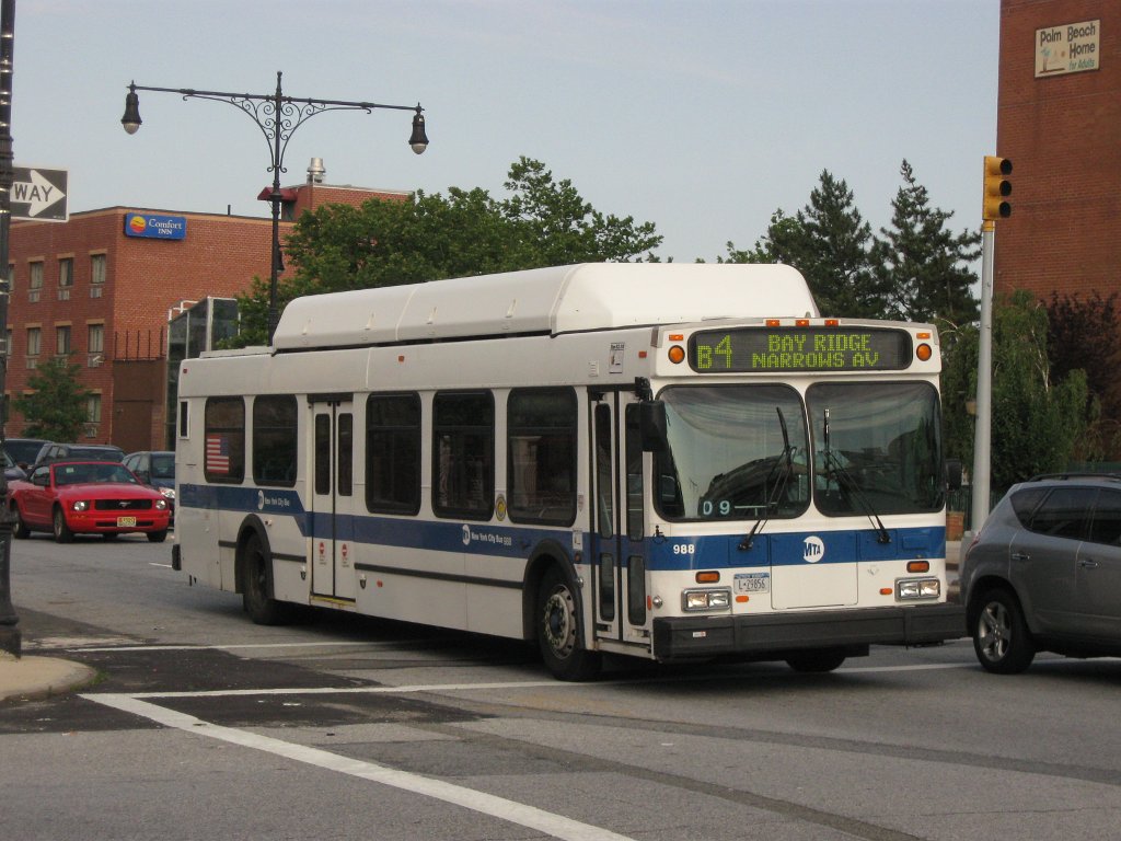
The Sumner Avenue Line and New Lots Avenue Line were two streetcar lines in Brooklyn, New York City, running mainly along Marcus Garvey Boulevard (formerly Sumner Avenue), East 98th Street, and New Lots Avenue between northern Bedford-Stuyvesant and New Lots. Originally streetcar lines, the two lines were combined as a bus route in 1947. That bus route became the present B15 Marcus Garvey Boulevard/New Lots Avenue, operated by MTA New York City Bus' East New York Depot in East New York. The B15 continues east from New Lots to JFK Airport in Queens. The Brooklyn General Mail Facility in Spring Creek is also served by the route with buses going through there at night and select buses from Bedford-Stuyvesant using it as a terminal during the day.
Contents
History of the Sumner Avenue Line
The Yates Avenue and Flatbush Railroad was organized in 1881 to build a branch of the Broadway Railroad, beginning at Broadway and Yates Avenue (present-day Marcus Garvey Boulevard) in Bedford-Stuyvesant, continuing south on Yates to Fulton Street, then east on Fulton, where it ran over the Brooklyn City Rail Road's Fulton Street Line, to Troy Avenue, where it continued south on Troy to end at Bergen Street.[1] The Broadway Railroad leased the line on December 31, 1881[2]. The Brooklyn, Queens County and Suburban Railroad, owned by the Long Island Traction Company (later the Brooklyn Rapid Transit Company), leased the Broadway Railroad in early 1894, and the line was electrified in late October.[3] After the Nassau Electric Railroad, which owned the Bergen Street Line, was leased to the Brooklyn Heights Railroad (another BRT property) in 1899, Sumner Avenue cars were extended south/east along the Bergen Street, Saint Johns Place, and Ralph Avenue lines to Brownsville and west along the Bergen Street Line to Hamilton Ferry in Red Hook.[citation needed]
Buses were substituted for most streetcar service on July 20, 1947 with direct Bedford-Stuyvesant-Red Hook service unreplaced.[citation needed]
B15 bus route
When the New Lots Avenue Line was converted to buses in 1941,[citation needed] it was assigned the B10 designation, running from the Canarsie Depot at Rockaway Avenue and Hegeman Avenue continuing east along Hegeman Avenue and Linden Boulevard to Atkins Avenue in East New York. Buses replaced Sumner Avenue Line trolleys in 1947, and the route was cut back from Williamsburg Bridge Plaza to its current terminal at Marcus Garvey Boulevard (Sumner Avenue) and Broadway, and became part of the B10.[4] In 1991, the route was extended to the Brooklyn General Mail Facility in Spring Creek and, in 1993, to its current terminal at John F. Kennedy International Airport's Terminal 4 in Jamaica, Queens. When the route was extended to Kennedy Airport it was redesignated as the B15 to avoid confusion with the Q10, an existing route serving the airport, at the time operated by Green Bus Lines (now part of MTA Bus Company).
Route description
The B15 bus route runs between the Woodhull Medical and Mental Health Center and Flushing Avenue (J) subway station in Bedford-Stuyvesant and the Brooklyn General Mail Facility in Spring Creek or John F. Kennedy International Airport's Terminal 4 in Queens with the two branches combined during the overnight hours.
The B15 bus route heads south through Bedford-Stuyvesant along Marcus Garvey Boulevard (southbound) and Lewis Avenue (northbound). After crossing Fulton Street, buses use a number of streets through Crown Heights and Ocean Hill, eventually turning south on Ralph Avenue and southeast on East 98th Street. In Brownsville and East New York, buses head east on Hegeman Avenue and New Lots Avenue, jogging south to Linden Boulevard and merging onto Conduit Avenue after entering Queens. B15 buses then serve several areas of JFK Airport and end at Terminal 4. Along the way, transfers can be made to the subway at Kingston-Throop Avenues (IND Fulton Street Line), Sutter Avenue–Rutland Road (IRT New Lots Line), New Lots Avenue (BMT Canarsie Line), and New Lots Avenue (IRT New Lots Line). Outside of JFK Airport property, B15 buses run non-stop in Queens.
References
- ^ Brooklyn Daily Eagle, A New Street Railroad, March 13, 1881, page 4
- ^ Brooklyn Daily Eagle, Railroad Bills, March 8, 1883, page 4
- ^ Brooklyn Daily Eagle, Real Estate Market, October 24, 1894, page 14
- ^ New York Board of Transportation, Report for the Three and One-half Years Ending June 30, 1949
Former streetcar lines in Brooklyn and other B&QT lines 2 Bergen - 3 Sumner - 5 St. Johns - 7 Tompkins - 9 Rockaway - 10 Ralph-Rockaway - 11 Ralph - 13 Gravesend-Church - 14 Wilson - 15 Crosstown - 16 Graham - 17 Greenpoint - 19 Nassau - 21 DeKalb - 24 Broadway - 25 Fulton - 26 Putnam - 27 Jamaica - 28 Erie Basin - 29 Meeker-Marcy - 30 Eighth - 31 86th - 32 Fifth - 33 Hamilton - 34 Bay Ridge - 35 Church - 36 Sea Gate - 37 Third - 38 West End - 41 Flatbush - 42 Holy Cross - 43/44 Nostrand - 46 Utica-Reid - 47 Franklin - 48 Lorimer - 49 Ocean - 50 Bushwick - 50 McDonald - 52 Greene-Gates - 53 Metropolitan - 54 Myrtle-Court - 55 Richmond Hill - 56 Union Av - 57 Flushing - 58 Flushing-Ridgewood - 59 Grand - 67 Seventh - 68 Smith-Coney Island - 69 McDonald-Vanderbilt - 71 Union St - 73 Norton's Point - 75 Smith St - 77 Fifteenth - 82 Bergen Beach - 83 Norton's Point ShuttleAdams-Boerum - Brooklyn Bridge - Brooklyn & North River - Court - Furman - Hicks - Hoyt-Sackett - Hudson - Manhattan Bridge 3¢ - Montague - New Lots - Queensboro BridgeCurrent bus routes in Brooklyn  Categories:
- Streetcar lines in Brooklyn
- MTA Regional Bus routes
Wikimedia Foundation. 2010.