- Middlebrook, Greater Manchester
-
Coordinates: 53°34′48″N 2°32′06″W / 53.580°N 2.535°W
Middlebrook 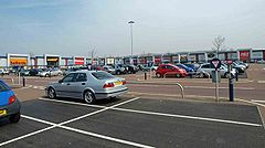
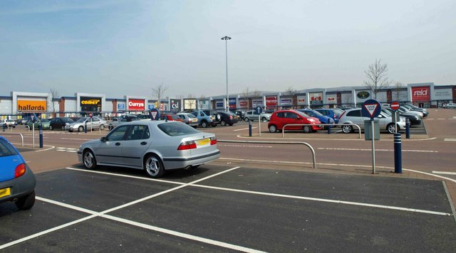
Middlebrook Retail Park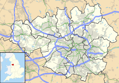
 Middlebrook
Middlebrook shown within Greater ManchesterOS grid reference SD645094 Metropolitan borough Bolton Metropolitan county Greater Manchester Region North West Country England Sovereign state United Kingdom Post town BOLTON Postcode district BL6 Dialling code 01204 Police Greater Manchester Fire Greater Manchester Ambulance North West EU Parliament North West England UK Parliament Bolton West List of places: UK • England • Greater Manchester Middlebrook is a locality that spans the boundaries of Horwich and Lostock in the Metropolitan Borough of Bolton, Greater Manchester, England.
Historically part of Lancashire, the name Middlebrook is derived from the watercourse which starts at Red Moss, the mossland south of Horwich. Further downstream the Middlebrook joins with other tributaries and becomes the River Croal which runs through Bolton and eventually joins the River Irwell at Kearsley.
Middlebrook is an out-of-town complex of retail, leisure and business parks and location of the Reebok Stadium and Horwich Police Station.
Contents
History
The name Middlebrook (or Middle Brook) comes from the Old English words "mycel" and "broc" meaning "great brook". In 1292 the name was written "Mikelbrok" and over the centuries it became Middlebrook.[1]
Before the stadium and retail park were built Middlebrook was the site of Sefton Fold Farm in Horwich. The 1666 timber-framed farmhouse was re-built in 1811. Before demolition in 1996 the University of Manchester's Archaeological Unit spent three weeks on the Sefton Fold Farm site. The team excavated a moated site of late mediaeval origins and pottery believed to date from the late 16th or early 17th centuries was found.[2] When development started, the site was partly covered by a roundabout. The farmhouse's 1666/1811 date stone, 1860s cooking range and other items were saved and can be seen at the Heritage Centre in Horwich.[3]
Development
Construction on the 200 acre Middlebrook retail, leisure and business complex[4] started in 1996 and the first businesses were operating from the site in 1998. The out-of-town retail centre, contains retail shops and stores, a twelve screen cinema, ten-pin bowling alley, cafés and restaurants, two hotels, and the Bolton Arena Sports & Leisure Complex. Horwich Police Station is located on Burnden Way at the Middlebrook site.[5] At the centre of the site is the Reebok Stadium, home of Bolton Wanderers F.C. which was inaugurated on 1 September 1997 when the first game between Bolton and Everton was played.
Transport
The Middlebrook site is adjacent to Junction 6 of the M61 motorway. The A6027 connects the A6 with the motorway, the retail and business parks and the A673 road to Horwich and Bolton. There is a regular train service provided by Northern Rail at Horwich Parkway railway station where there is a Park and Ride facility with trains to Bolton, Manchester and Preston. There are also bus services which include the 505, 514, 516/517 and 714.
References
- ^ Billington, W.D. (1982). From Affetside to Yarrow : Bolton place names and their history, Ross Anderson Publications (ISBN 0-86360-003-4).
- ^ Bolton Evening News - Sefton Fold Farm. URL accessed April 8, 2007.
- ^ Horwich Heritage Centre. URL accessed 5 October 2008.
- ^ Middlebrook Bolton, Middlebrook, http://www.middlebrook-bolton.co.uk/place-to-work.htm, retrieved 2010-11-30
- ^ Bolton West Police - Horwich Police Station. URL accessed 27 May 2007.
External links
Categories:- Geography of Bolton
- Districts of Greater Manchester
- Shopping centres in Greater Manchester

Wikimedia Foundation. 2010.