- Mount Awu
-
Mount Awu 
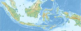
A shallow lake partially fills the summit crater in 1995Elevation 1,320 m (4,331 ft) [1] Listing Ribu Location Sangir Island, Sangihe Islands, Indonesia Coordinates 3°40′N 125°30′E / 3.667°N 125.5°ECoordinates: 3°40′N 125°30′E / 3.667°N 125.5°E Geology Type Stratovolcano Age of rock 100,000 Last eruption 2004[1] Mount Awu is the largest volcano in the Sangihe chain. Powerful eruptions occurred in 1711, 1812, 1856, 1892 and 1966 with devastating pyroclastic flows and lahars that have resulted in more than 8,000 fatalities altogether. A 4.5 km wide of crater is found at the summit and a deep valley forms a passageways for lahars, splitting the flanks from the crater. This is a volcano in the Ring of Fire.[1]
See also
References
- ^ a b c d "Awu". Global Volcanism Program, Smithsonian Institution. http://www.volcano.si.edu/world/volcano.cfm?vnum=0607-04=. Retrieved 2006-12-31.
Categories:- Stratovolcanoes
- Active volcanoes
- Mountains of Indonesia
- Volcanoes of Indonesia
- VEI-4 volcanoes
- Celebes Sea
- North Sulawesi
- Sulawesi geography stubs
Wikimedia Foundation. 2010.

