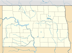
- Merrill Township, Hettinger County, North Dakota
-
Merrill Township, North Dakota — Township — Location within the state of North Dakota Coordinates: 46°14′57″N 102°12′35″W / 46.24917°N 102.20972°WCoordinates: 46°14′57″N 102°12′35″W / 46.24917°N 102.20972°W Country United States State North Dakota County Hettinger Area - Total 32.3 sq mi (83.8 km2) - Land 32.1 sq mi (83.1 km2) - Water 0.3 sq mi (0.7 km2) Elevation 2,448 ft (746 m) Population (2000) - Total 13 - Density 0.4/sq mi (0.2/km2) Time zone Mountain (MST) (UTC-7) - Summer (DST) MDT (UTC-6) Area code(s) 701 FIPS code 38-52540[1] GNIS feature ID 1037210[2] Merrill is a township in Hettinger County, North Dakota, United States. The population was 13 at the 2000 census.[3]
References
- ^ "American FactFinder". United States Census Bureau. http://factfinder.census.gov. Retrieved 2008-01-31.
- ^ "US Board on Geographic Names". United States Geological Survey. 2007-10-25. http://geonames.usgs.gov. Retrieved 2008-01-31.
- ^ U.S. Census Bureau. Census 2000. "Census Demographic Profiles, Merrill Township, Hettinger County, North Dakota" (PDF). CenStats Databases. <http://censtats.census.gov/data/>. http://censtats.census.gov/data/ND/0603804152540.pdf. Retrieved 2009-01-31.
Municipalities and communities of Hettinger County, North Dakota County seat: Mott Cities Mott | New England | Regent
Townships Acme | Ashby | Baer | Beery | Black Butte | Brittian | Campbell | Cannon Ball | Castle Rock | Chilton | Clark | Farina | Havelock | Highland | Kennedy | Kern | Kunze | Madison | Merrill | Mott | New England | Odessa | Rifle | St. Croix | Solon | Steiner | Strehlow | Tepee Butte | Wagendorf | Walker
Unorganized
territoryCentral Hettinger
Unincorporated
communitiesBentley | Burt | Havelock | Watrous
Categories:- North Dakota geography stubs
- Townships in Hettinger County, North Dakota
Wikimedia Foundation. 2010.


