- Maribondo
-
Coordinates: 09°34′37″S 36°18′18″W / 9.57694°S 36.305°W Maribondo is a municipality located in the Brazilian state of Alagoas. Its population is 15,257 (2005) and its area is 171 km²[1].
References
 Municipalities of Alagoas
Capital: Maceió Arapiraca 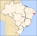
Palmeira dos Índios Traipu Litoral Norte Alagoano Maceió Mata Alagoana Penedo São Miguel dos Campos Serrana dos Quilombos Alagoana do Sertão
do São FranciscoBatalha Santana do Ipanema Serrana do Sertão Alagoano Categories:- Alagoas geography stubs
- Populated places in Alagoas

Wikimedia Foundation. 2010.