- Desborough (hundred)
-
Coordinates: 51°37′58″N 0°46′39″W / 51.63278°N 0.7775°W
Desborough Hundred 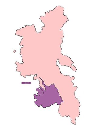
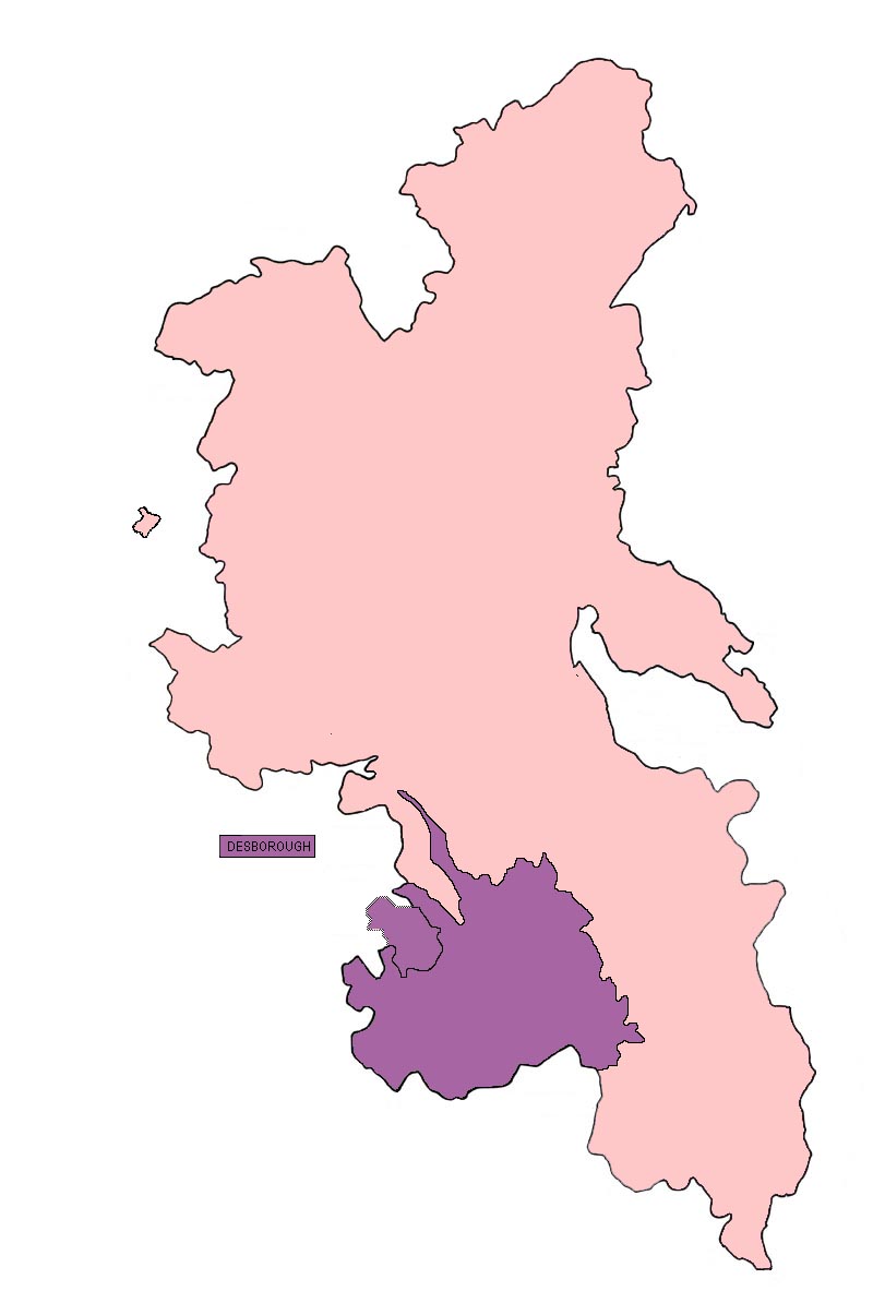
Geography Status Hundred 1871 area 45,337 acres (183.47 km2)[1] HQ Desborough Castle History Created 11th century Abolished 1880s 1871 population 19,198[2] Subdivisions Type Parishes Desborough Hundred is a hundred in Buckinghamshire, England. It is situated in the south of the county and is bounded on the west by Oxfordshire and on the south the River Thames marked the boundary with Berkshire.
Contents
History
Until at least the time of the Domesday Survey in 1086 there were 18 hundreds in Buckinghamshire. It has been suggested however that neighbouring hundreds had already become more closely associated in the 11th century so that by the end of the 14th century the original or ancient hundreds had been consolidated into 8 larger hundreds.[3] Desborough hundred is one of three hundreds which became collectively known as the Chiltern hundreds around the 13th century, the others being Burnham hundred and Stoke hundred. Even before this time these individual hundreds had become possessions of the Crown and were nominally stewarded as a royal bailiwick. The hundreds lost their collective 'Chilterns' title having become separately leased though retaining their individual administrative status as Buckinghamshire hundreds. Meanwhile the role of Steward of the Chiltern Hundreds persisted in name only becoming an appointment of the House of Commons.
Parishes and hamlets
Desborough hundred comprised the following ancient parishes and hamlets, (formerly medieval vills):[4]
Bradenham Ibstone(part of) †Stokenchurch Fawley Great Marlow Turville Fingest Little Marlow Wooburn Hambleden Medmenham Chepping Wycombe (later High Wycombe) Hedsor Radnage West Wycombe Hughenden Saunderton † Stokenchurch was originally in Oxfordshire and transferred to Buckinghamshire in the latter part of the 19th century after the hundred was superseded.
See also
References
- ^ Vision of Britain - Desborough Area Retrieved, May 23, 2009
- ^ Vision of Britain - Desborough Population Retrieved, May 23, 2009
- ^ Genuki - History of Buckinghaham Hundreds Retrieved, May 21, 2009
- ^ History on Line - Victoria County History - A History of the County of Buckingham - Desborough Hundred: Volume 3, (1925), pp. 32-34. Retrieved, May 23, 2009
Categories:- Hundreds of Buckinghamshire
Wikimedia Foundation. 2010.