- Evansburg State Park
Geobox Protected Area
name = Evansburg State Park
native_name =
other_name =
other_name1 =
category_local = Pennsylvania State Park
category_iucn = III
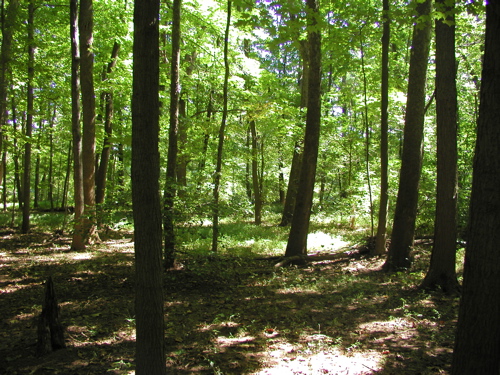
image_caption = A wooded area along a hiking trail in Evansburg State Park
etymology_type =
etymology =
country = United States
state = Pennsylvania
region_type = County
region = Montgomery
district_type = Townships
district = Lower Providence
district1 = Lower Salford
district2 = Skippack
district3 = Towamencin
district4 = Worcester
city =
city1 =
location =
lat_d = 40
lat_m = 12
lat_s = 36
lat_NS = N
long_d = 75
long_m = 22
long_s = 15
long_EW = W
location_note = cite web
url=Gnis3|1214161
title=Evansburg State Park
date =August 2 1979
work=Geographic Names Information System
publisher=United States Geological Survey
accessdate=2008-02-28]
elevation_imperial = 213
elevation_round = 1
elevation_note =
area_unit = acre
area_imperial = 3349
area_round = 1
area1_imperial =
area1_type =
length_imperial =
length_orientation =
width_imperial =
width_orientation =
highest =
highest location =
highest_lat_d =
highest_lat_m =
highest_lat_s =
highest_lat_NS =
highest_long_d =
highest_long_m =
highest_long_s =
highest_long_EW =
highest_elevation_imperial =
lowest =
lowest_location =
lowest_lat_d =
lowest_lat_m =
lowest_lat_s =
lowest_lat_NS =
lowest_long_d =
lowest_long_m =
lowest_long_s =
lowest_long_EW =
lowest_elevation_imperial =
biome =
biome_share =
biome1 =
biome1_share =
geology =
geology1 =
plant =
plant1 =
animal =
animal1 =
established_type =
established = 1979
established1_type =
established1 =
management_body = Pennsylvania Department of Conservation and Natural Resources
management_location =
management_lat_d =
management_lat_m =
management_lat_s =
management_lat_NS =
management_long_d =
management_long_m =
management_long_s =
management_long_EW =
management_elevation =
visitation =
visitation_year =
free_type = Nearest city
free =Norristown, Pennsylvania
free1_type =
free1 =

map_caption = Location of Evansburg State Park in Pennsylvania
map_locator = Pennsylvania
map_first =
website = [http://www.dcnr.state.pa.us/stateparks/parks/evansburg.aspx Evansburg State Park]Evansburg State Park is a convert|3349|acre|km2|2|adj=on Pennsylvania State Park in Lower Providence, Lower Salford, Skippack, Towamencin, and Worcester Townships in Montgomery County,
Pennsylvania in the United States. The park has a variety of habitats includingforest s,meadow s, old fields, and farmland. The park offers a variety of recreational opportunities including picnicking,golf , ball fields, biking, hiking, hunting, horseback riding, and fishing. Evansburg State Park is near Collegeville and Norristown just offPennsylvania Route 363 .History
The land on which Evansburg State Park is located was originally part of a massive tract of land purchased from the
Lenape (Delaware) byWilliam Penn in 1684. The land was quickly settled according to Willam Penn's planned "Holy Experiment." The first settlers wereMennonites . They fled religious persecution in Europe for thereligious freedom , promised by William Penn in his colony. The Mennonites cleared the land of itsvirgin forest s and builtfarm s, stores and mills that were powered by the waters of Skippack Creek. The area developed very rapidly and theSkippack Pike was constructed in 1714 to provide access to the markets of Philadelphia. The area in and surrounding Evansburg State Park remained largelyrural untilWorld War II . The growth ofsuburbs and industry forever changed the landscape of the Skippack Valley. Evansburg State Park was established in 1979 to protect the rural qualities of the area and to provide outdoor recreational opportunities for the people of southeastern Pennsylvania.cite web
url = http://www.dcnr.state.pa.us/stateparks/Parks/evansburg.aspx
title = Evansburg State Park
accessdate = 2006-12-27
publisher =Pennsylvania Department of Conservation and Natural Resources ] [cite web
url = http://www.schuylkillriver.org/Detail.aspx?id=34
title = Schuylkill River Heritage - info for Evansburg State Park
accessdate = 2006-12-27
publisher = Schuylkill River Heritage]Recreation
Fishing and hunting
Skippack Creek is stocked withbrown trout andrainbow trout ; other fish in the creek includesmallmouth bass ,catfish , sucker,carp ,panfish , and freshwater eel. All fishermen are expected to follow the rules and regulations of thePennsylvania Fish and Boat Commission .About convert|1000|acre|km2|2 of Evansburg State Park are open to hunting. Hunters are expected to follow the rules and regulations of the
Pennsylvania Game Commission . The common game species are squirrels, pheasant, rabbits andwhite-tailed deer . The hunting ofgroundhog s is prohibited.Golf
The
golf course at Evansburg State Park is known as Skippack Golf Club. It is an 18-hole convert|6007|yd|m|0,par 70 golf course. It was designed by Herris & Benahia, and opened in 1950. The course is managed by Skippack Golf Club, LLC under contract with the Pennsylvania Department of Conservation and Natural Resources. [cite web
url = http://www.golflink.com/golf-courses/golf-course.asp?course=9817
title = Skippack Golf Course
accessdate = 2006-12-27
publisher = Golflink.com]Trails
Evansburg State Park has convert|26|mi|0 of trails that are open to
hiking , horseback riding,cross-country skiing , andmountain biking . The convert|6|mi|1 of hiking trails are all rated as easy trails and pass through a variety of habitats. A mountain bike trail (convert|5|mi|1) is open at the south end of the park. Bikers are prohibited from using the hiking and equestrian trails. They are permitted to ride on the park roads. Fifteen miles of horseback riding trails are open at Evansburg State Park. Riders are also permitted to use the shoulders of the roads of the park.Nearby state parks
The following state parks are within convert|30|mi|0 of Evansburg State Park: [cite web
url = http://www.dcnr.state.pa.us/stateparks/parks/region_philadelphia.aspx
title = Map Reference for Evansburg State Park
accessdate = 2006-12-27
publisher =Pennsylvania Department of Conservation and Natural Resources ] [cite map |scale = 1:65,000| publisher= Pennsylvania Department of Transportation, Bureau of Planning and Research, Geographic Information Division
url= ftp://ftp.dot.state.pa.us/public/pdf/BPR_pdf_files/Maps/GHS/Roadnames/montgomery_GHSN.pdf
title= 2007 General Highway Map Montgomery County Pennsylvania
accessdate= 2007-07-27 "Note: shows Evansburg State Park"] cite web
last = Michels
first = Chris
year = 1997
url = http://www2.nau.edu/~cvm/latlongdist.html
title = Latitude/Longitude Distance Calculation
publisher =Northern Arizona University
accessdate = 2008-04-20]
*Benjamin Rush State Park (Philadelphia County)
*Brandywine Creek State Park (Delaware )
*Bull's Island State Park (New Jersey )
*Delaware and Raritan Canal State Park (New Jersey)
*Delaware Canal State Park (Bucks and Northampton Counties)
*Fort Washington State Park (Montgomery County)
*French Creek State Park (Berks and Chester Counties)
*Marsh Creek State Park (Chester County)
*Neshaminy State Park (Bucks County)
*Nockamixon State Park (Bucks County)
*Norristown Farm Park (Montgomery County)
*Ralph Stover State Park (Bucks County)
*Ridley Creek State Park (Delaware County)
*Tyler State Park (Bucks County)References
External links
*
Wikimedia Foundation. 2010.