- Csengersima
-
Csengersima Country  Hungary
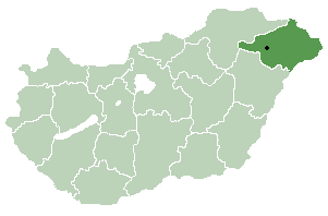
County Szabolcs-Szatmár-Bereg Area - Total 23.8 km2 (9.2 sq mi) Population (2001) - Total 741 - Density 29.71/km2 (76.9/sq mi) Time zone CET (UTC+1) - Summer (DST) CEST (UTC+2) Postal code 4743 Area code(s) 44 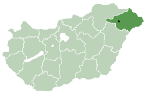 Location of Szabolcs-Szatmar-Bereg county in Hungary
Csengersima is a village in Szabolcs-Szatmár-Bereg county, in the Northern Great Plain region of eastern Hungary.
 The reformed church of Csengersima.
Contents
Geography
It covers an area of 23.8 km2 (9 sq mi) and has a population of 741 people (2001).
Sightseengs
The old romanesquechurch from the 13th century is famous, mainly because of its casetted ceiling. There are frescoes of the celestial bodies, flowers, old Biblical scenes in a beautiful drawing and coloring manner.
 Six ceiling cassettes from the reformed church of Csengersima.
References
- Balogh J. (1939): A késő-gótikus és a renaissance-kor művészete. (The late-gothic and renaissance age art.) Magyar művelődéstörténet. 2. (Szerk. Domanovszky S.), Budapest
- Bérczi Sz, Bérczi Zs., Bérczi K. (2002): Kazettás mennyezetek. (Casetted ceilings.) Licium-Art, Debrecen
- Kelemen L. (1977): Művészettörténeti tanulmányok. (Studies in Art History.) Bukarest
- Tombor I. (1968): Magyarországi festett famennyezetek és rokonemlékek a XV-XIX. századból. (Painted Casetted Ceilings from Hungary from the 15-16th Century.) Akadémiai K. Budapest
Outer links
- Short description about the church of Csengersima.
- Image from inside the church.
- Photographs of the beautiful church, outside and inside.
- The ceiling casettes of the church of Csengersima.
Coordinates: 47°52′N 22°44′E / 47.867°N 22.733°E
Categories:- Populated places in Szabolcs-Szatmár-Bereg county
- Romanesque architecture in Hungary
- Szabolcs-Szatmár-Bereg geography stubs


Wikimedia Foundation. 2010.