- Marine Corps Air Station Ewa
-
Marine Corps Air Station Ewa Oahu, Hawaii 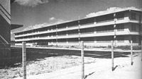
Civilian barracks at EwaType Military air station Coordinates 21°19′20″N 158°02′58″W / 21.32222°N 158.04944°WCoordinates: 21°19′20″N 158°02′58″W / 21.32222°N 158.04944°W Built 1925 – June 18, 1952 In use 1925 - 1952 Controlled by USMC Battles/wars World War II
* Attack on Pearl HarborMarine Corps Air Station Ewa (MCAS Ewa) was a United States Marine Corps air station that was located 17 miles (27 km) west of Pearl Harbor on the island of Oahu, Hawaii. The base was hit during the attack on Pearl Harbor, and later served as the hub for all Marine aviation units heading into combat in the Pacific Theater during World War II. The base was closed in 1952 because its runways were too short for jet aircraft, and expansion was impossible due to the proximity of Naval Air Station Barbers Point. Ewa has been abandoned since 1952; however, two of its runways are still visible from the air and many of the revetments still remain in good condition.
Contents
History
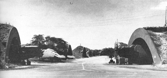
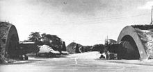 Covered concrete revetments at Ewa
It was originally founded as an airship base for the United States Navy in 1925. The airship program was cancelled after 3 of the 4 dirigibles located there crashed during the 1930s. The base's upgrade to an air station began in September 1940, and on February 3, 1941 it was commissioned Marine Corps Air Station Ewa.[1]
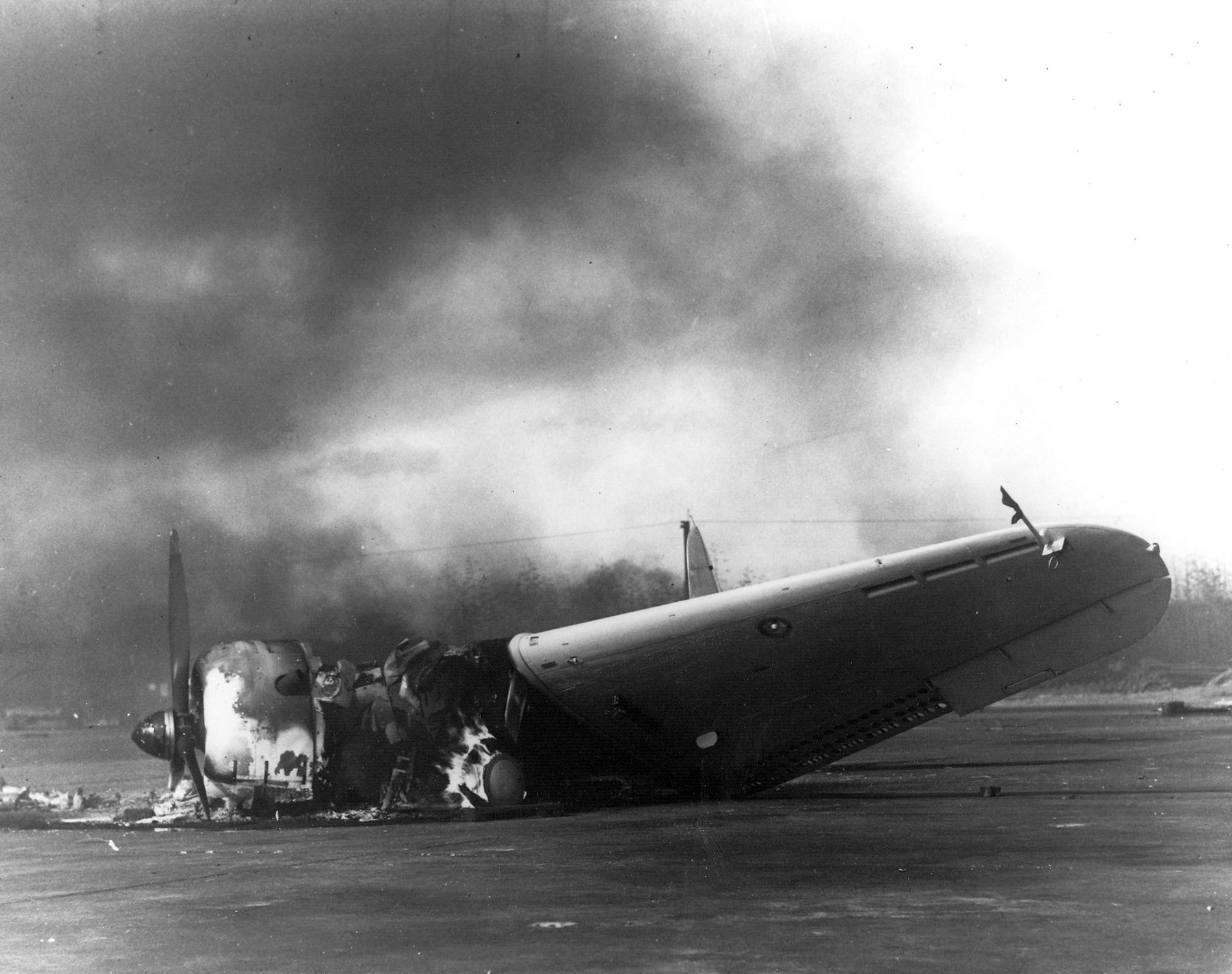
By the onset of World War II, the air station had four runways and numerous hangars. On December 7, 1941, MCAS Ewa was the first installation hit during the attack on Pearl Harbor. All forty eight aircraft based there were destroyed.[2]
In April 1944, the 3rd Marine Aircraft Wing was relocated to MCAS Ewa where they stayed for the remainder of the war.[3]
The start of the Korean War saw another surge in activity at MCAS Ewa, but because the runways were becoming more and more unsuitable for jet aircraft, the Marine Corps shifted its aviation assets to Marine Corps Air Station Kaneohe Bay. Ewa was officially closed on June 18, 1952 and its property assumed by Naval Air Station Barbers Point.
In 2008 the US Navy announced they would be leasing 499 acres (2.02 km2) of the old air station to Ford Island Properties, who plan on building expensive homes and shopping centers to create an urban center for Kapolei. The Navy has said that 4 to 5 acres (20,000 m2) of the base near the center of the old runways qualifies for the National Register of Historic Places. While some local looking to preserve the field are trying to rally support to make it a National Cemetery, it seems the Navy and Ford Island Properties are expected to conclude their lease agreement in August.[4]
See also
References
- ^ Rottman, Gordon L. (2002). U.S. Marine Corps World War II Order of Battle – Ground and Air Units in the Pacific War.. Westport, Connecticut: Greenwood Press. ISBN 0-313-31906-5.
- ^ "Abandoned & Little-Known Airfields: Hawaii, Southern Oahu Island OMG!!!". [1]. http://www.airfields-freeman.com/HI/Airfields_HI_Oahu_S.htm#ewa.
- ^ "MCAS El Toro History". [2]. Archived from the original on 2009-10-25. http://www.webcitation.org/query?url=http://www.geocities.com/a4project/3d_maw.html&date=2009-10-25+11:55:02.
- ^ Cole, William (2008-06-30). "Preserving 'Ewa Marine Corps field an uphill struggle". www.honoluluadvertiser.com. http://www.honoluluadvertiser.com/apps/pbcs.dll/article?AID=/20080630/COLUMNISTS32/806300314/1315/LOCALNEWSFRONT. Retrieved 2008-06-30.
External links
Categories:- Military facilities in Hawaii
- Defunct United States Marine Corps facilities
- Airports in Hawaii
- World War II airfields
- Buildings and structures in Honolulu County, Hawaii
Wikimedia Foundation. 2010.