- Maaninka
-
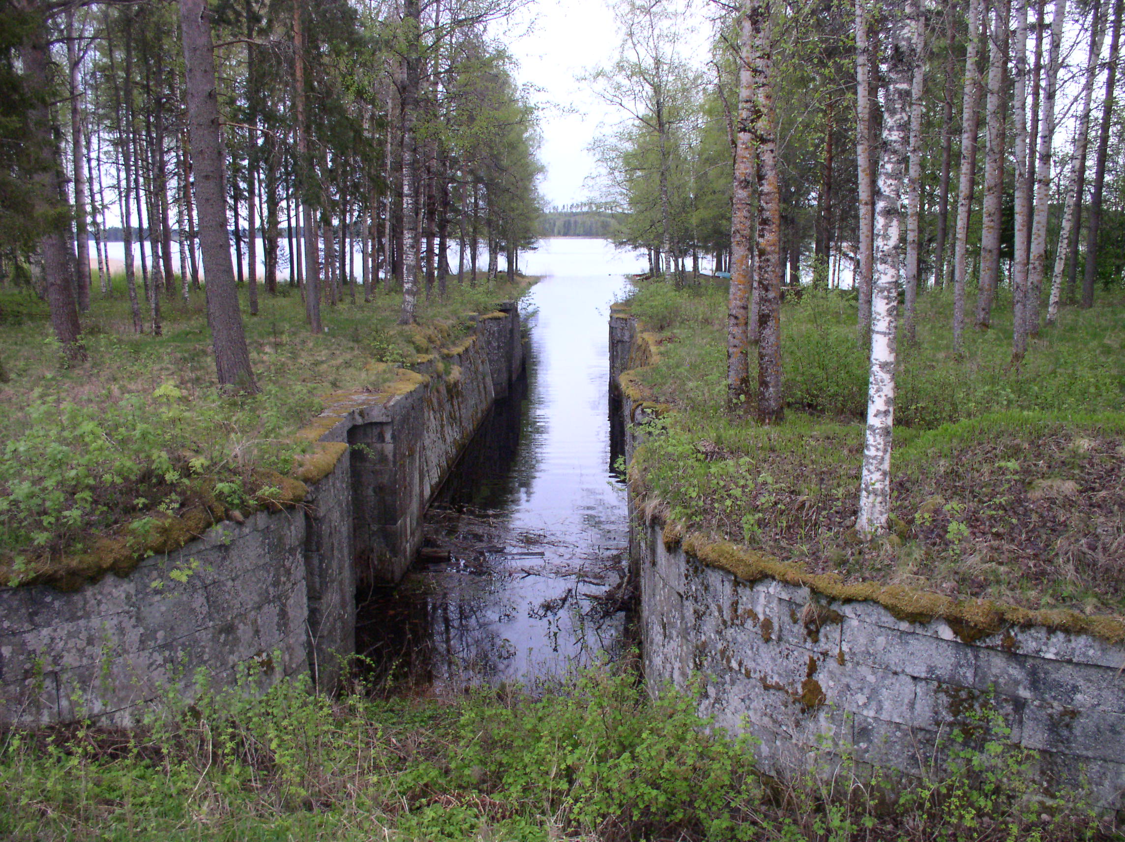
Maaninka — Municipality — Maaningan kunta Vianna channel in Maaninka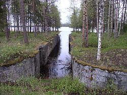
Coat of armsLocation of Maaninka in Finland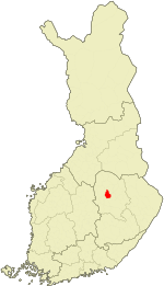
Coordinates: 63°09.5′N 027°18′E / 63.1583°N 27.3°ECoordinates: 63°09.5′N 027°18′E / 63.1583°N 27.3°E Country Finland Region Northern Savonia Sub-region Kuopio sub-region Charter 1872 Government - Municipal manager Soile Lahti Area(2011-01-01)[1] - Total 575.13 km2 (222.1 sq mi) - Land 466.51 km2 (180.1 sq mi) - Water 108.62 km2 (41.9 sq mi) Area rank 205th largest in Finland Population (2011-01-31)[2] - Total 3,837 - Rank 224th largest in Finland - Density 8.22/km2 (21.3/sq mi) Population by native language[3] - Finnish 99.3% (official) - Swedish 0.1% - Others 0.6% Population by age[4] - 0 to 14 17.9% - 15 to 64 61.5% - 65 or older 20.6% Time zone EET (UTC+2) - Summer (DST) EEST (UTC+3) Municipal tax rate[5] 19.5% Website www.maaninka.fi Maaninka (Swedish: Maninga) is a municipality of Finland.
It is located in the province of Eastern Finland and is part of the Northern Savonia region. The municipality has a population of 3,837 (31 January 2011)[2] and covers an area of 575.13 square kilometres (222.06 sq mi) of which 108.62 km2 (41.94 sq mi) is water.[1] The population density is 8.22 inhabitants per square kilometre (21.3 /sq mi).
The municipality is mostly rugged forestland. The tallest waterfall in Finland, at 46 meters high, is located in Maaninka. The site, called Korkeakoski, has been a tourist site since the 19th century.
The municipality is unilingually Finnish.
Notable residents
References
- ^ a b "Area by municipality as of 1 January 2011" (in Finnish and Swedish) (PDF). Land Survey of Finland. http://www.maanmittauslaitos.fi/sites/default/files/pinta-alat_2011_kunnannimenmukaan.xls. Retrieved 9 March 2011.
- ^ a b "Population by municipality as of 31 January 2011" (in Finnish and Swedish). Population Information System. Population Register Center of Finland. http://vrk.fi/default.aspx?docid=4258&site=3&id=0. Retrieved 18 February 2011.
- ^ "Population according to language and the number of foreigners and land area km2 by area as of 31 December 2008". Statistics Finland's PX-Web databases. Statistics Finland. http://pxweb2.stat.fi/Dialog/varval.asp?ma=060_vaerak_tau_107_fi&ti=V%E4est%F6+kielen+mukaan+sek%E4+ulkomaan+kansalaisten+m%E4%E4r%E4+ja+maa%2Dpinta%2Dala+alueittain++1980+%2D+2008&path=../Database/StatFin/vrm/vaerak/&lang=3&multilang=fi. Retrieved 29 March 2009.
- ^ "Population according to age and gender by area as of 31 December 2008". Statistics Finland's PX-Web databases. Statistics Finland. http://pxweb2.stat.fi/Dialog/varval.asp?ma=050_vaerak_tau_104_fi&ti=V%E4est%F6+i%E4n+%281%2Dv%2E%29+ja+sukupuolen+mukaan+alueittain+1980+%2D+2008&path=../Database/StatFin/vrm/vaerak/&lang=3&multilang=fi. Retrieved 28 April 2009.
- ^ "List of municipal and parish tax rates in 2011". Tax Administration of Finland. 29 November 2010. http://www.vero.fi/nc/doc/download.asp?id=7996;193801. Retrieved 13 March 2011.
External links
 Media related to Maaninka at Wikimedia Commons
- Municipality of Maaninka – Official site (Finnish)
Municipalities of Northern Savonia Municipalities Iisalmi · Juankoski · Kaavi · Keitele · Kiuruvesi · Kuopio · Lapinlahti · Leppävirta · Maaninka · Nilsiä · Pielavesi · Rautalampi · Rautavaara · Siilinjärvi · Sonkajärvi · Suonenjoki · Tervo · Tuusniemi · Varkaus · Vesanto · Vieremä
Former municipalities Iisalmen maalaiskunta · Karttula · Kuopion maalaiskunta · Muuruvesi · Riistavesi · Säyneinen · Varpaisjärvi · VehmersalmiCategories:- Municipalities of Northern Savonia Region
- Populated places established in 1872
- Eastern Finland geography stubs


Wikimedia Foundation. 2010.