- La Costa Partido
-
La Costa
Official name Partido de la Costa Capital Mar del Tuyú Country
ProvinceArgentina
Buenos AiresFoundation
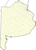
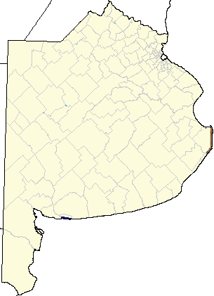
Founder1978 Population: - Total 60,483 - Density 267.62 Inhabitants/km² - Population change +56.68% (1991-2001) Demonym Telephone code 02246 Post Code B7108 Location - Coordinates 36°34′S 56°41′W / 36.567°S 56.683°W Area 225 km2 (87 sq mi) Distance: - to Buenos Aires 450 km (280 mi) - to La Plata Patron Saint Mayor Juan Pablo de Jesus, PJ Web Site http://www.lacosta.gov.ar IFAM Statistics IFAM La Costa Partido is a partido located on the Atlantic coast of Buenos Aires Province in Argentina.
Contents
Overview
The provincial subdivision has a population of about 60,000 inhabitants in an area of 225 km2 (87 sq mi), and its capital city is Mar del Tuyú, which is located 450 km (280 mi) from Buenos Aires.
The economy of La Costa Partido is dominated by the summer tourist season (December-February), which sees tens of thousands of vacationers make their way to the Atlantic coast from Buenos Aires and the Greater Buenos Aires urban area.
History
Noticed by Ferdinand Magellan in 1520, who gave nearby Cape San Antonio its name, Spanish authorities first surveyed the area in 1580. The waterfront area was purchased in the 18th century by the Ortiz de Rozas family, one of Argentina's most well-established landowners. Sold to another prominent family, the Leloirs, in 1816, the area became a sheep ranch. A descandant of the Ortiz de Rozas', Buenos Aires Province Governor Juan Manuel de Rosas, designated the area as the Partido del Rincón de Ajó in 1839, following a local insurrection against his repressive rule and poor conditions. A fishing wharf became Ajó's economic hub in subsequent decades, and had been prominent as a supply route during the 1838 French blockade against Rosas. The area was renamed Partido de General Lavalle, after one of Rosas' erstwhile foes, in 1891. The installation of abattoirs (since closed) was followed by new fishermen's docks, a canal, a Buenos Aires Great Southern Railway terminal, and two lighthouses built between 1878 and 1902.
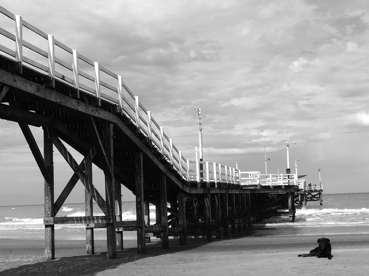
 The La Lucila del Mar pier, one of five in the county.
The area became a tourist attraction during the 1920s, when County Mayor Jorge Gibson promoted its shores for their seclusion and scenic value. He had the local coastline graded into public beaches, and in 1932, a provincial gravel road reached the area. The oldest official municipalities, San Clemente del Tuyú and Mar de Ajó, were established in 1935, followed by San Bernardo del Tuyú (1942), Mar del Tuyú (1945), and Santa Teresita (1946).
During the last dictatorship, the military-appointed Governor, General Ibérico Saint Jean, signed Decree 9024, the Urban Jurisdictions Law of June 11, 1978, by which the Lavalle District was divided into three (the others being Pinamar and Villa Gesell). Mar del Tuyú was chosen as the county seat to avoid disputes between residents of the county's northernmost town, San Clemente del Tuyú, and the southernmost, Mar de Ajó (both of which are the largest in the district).
Elections in 1983 brought Justicialist candidate Juan de Jesús to office. His administration two hospitals built and numerous public infrastructure works, thereby helping integrate the neighboring communities in the district. The economic malaise Argentina suffered in the 1980s and the boom in overseas travel following recovery in the early 1990s took its toll on municipal finances, however. The administration of Mayor Guillermo Magadán (who had been the military-appointed mayor in the late 1970s) had a nature theme park, Parque Bahía Aventura, opened in 1997. Drawing few crowds, the area was slated for closure when, in 2003, mineral hot springs were discovered at the spot. Returned to office that year, Mayor de Jesús set aside part of Bahía Aventura and opened Termas Marinas, today one of Argentina's most popular hot springs; his son, Juan Pablo, was elected mayor in 2007. The county's population has grown by over 4% a year since 1980, climbing from under 26,000 that year, to over 60,000 as of the 2001 census [INDEC].
Settlements
- San Clemente del Tuyú
- Las Toninas
- Costa Chica
- Santa Teresita
- Mar del Tuyú
- Costa del Este
- Aguas Verdes
- La Lucila del Mar
- Costa Azul
- San Bernardo del Tuyú
- Mar de Ajó
- Pinar del Sol
- Costa Esmeralda
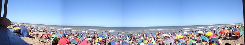 Beachgoers in Santa Teresita
External links
- (Spanish) San Clemente del Tuyú
- (Spanish) San Bernardo del Tuyú
- (Spanish) Santa Teresita
- (Spanish) Partido De La Costa Website
 Turismo Carretera
Champion
drivers1939 Ángel Lo Valvo · 1940-41 Juan Manuel Fangio · 1947-48, 1953-54, 1960 Oscar Alfredo Gálvez · 1949-52, 1955-58, 1961 Juan Gálvez · 1959 Rodolfo de Álzaga · 1962-65 Dante Emiliozzi · 1966 Juan Manuel Bordeu · 1967 Eduardo Copello · 1968 Carlos Pairetti · 1969 Gastón Perkins · 1970-71 Rubén Luis di Palma · 1973 Nasif Estéfano · 1974-76 Héctor Gradassi · 1977-78, 1995-97, 1999 Juan María Traverso · 1979-80 Francisco Espinosa · 1980-81 Antonio Aventín · 1982 Jorge M. Boero · 1983-85 Roberto Mouras · 1986 Oscar Angeletti · 1987-89 Oscar Castellano · 1990 Emilio Satriano · 1991-92 Oscar Aventín · 1993 Walter Hernández · 1994 Eduardo Ramos · 1998, 2000-02 Guillermo Ortelli · 2003 Ernesto Bessone · 2004 Omar Martínez · 2005 Juan Manuel Silva · 2006 Norberto Fontana · 2007 Christian Ledesma · 2008 Guillermo Ortelli · 2009 Emanuel Moriatis
Cars Circuits Balcarce · Buenos Aires · Comodoro Rivadavia · La Plata · Mar de Ajó · Nueve de Julio · Paraná · Posadas · Rafaela · Río Cuarto · Río Gallegos · San Luis
Categories:- 1978 establishments
- Partidos of Buenos Aires Province
- Buenos Aires Province geography stubs


Wikimedia Foundation. 2010.