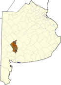
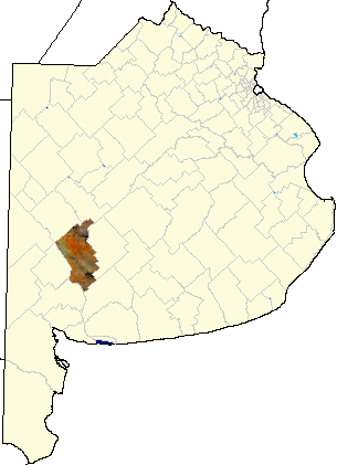
- Coronel Suárez Partido
-
Coronel Suarez
Official name Partido de Coronel Suarez Capital Coronel Suárez Country
ProvinceArgentina
Buenos AiresFoundation
FounderMay 28, 1883
Eduardo CaseyPopulation: - Total 36,828 - Density 6.15 Inhabitants/km² - Population change +3.13% (1991-2001) Demonym suarense Telephone code 02926 Post Code B7540 Location - Coordinates 31°28′S 61°56′W / 31.467°S 61.933°W Area 6,000 km2 (2,317 sq mi) Distance: - to Buenos Aires 550 km (342 mi) - to La Plata 590 km (367 mi) Patron Saint Mayor Ricardo Alejo Moccero, Partido Vecinista Web Site http://www.sua.mun.gba.gov.ar IFAM Statistics IFAM The partido of Coronel Suárez (German: Partido Oberst Suárez) is a subdivision of the Province of Buenos Aires in Argentina. Located in the south-central part of the province, it was created in 1882 by the provincial government when they divided the territory of Tres Arroyos into the partidos of Coronel Suárez, Tres Arroyos and Coronel Pringles.
It has a population of about 37,000 inhabitants in an area of 6,000 km2 (2,317 sq mi), and its capital city is Coronel Suárez, which is 550 km (342 mi) from Buenos Aires.
Its population is mainly of Volga German descent.
Contents
Settlements
- Coronel Suárez, 22,311
- Huanguelén, pop.4,955, 56 km (35 mi) from Suárez
- Santa Trinidad, pop.1,859
- San José, pop.2,127
- Santa María, pop.1,770
- Villa Arcadia, pop.305
- Pasman, 208, 37 km (23 mi) from Suárez
- Curamalal, 104, 22 km (14 mi) from Suárez
- D'Orbigny, 49, 40 km (25 mi) from Suárez
- Cascada, 16, 52 km (32 mi) from Suárez
- Quiñihual, 57 km (35 mi) from Suárez
- Bathurts, 20 km (12 mi) from Suárez
- Ombú, 49 km (30 mi) from Suárez
- Primavera, 18 km (11 mi) from Suárez
- Otoño, 71 km (44 mi) from Suárez
- Piñeyro, 18 km (11 mi) from Suárez
- Zoilo, 94 km (58 mi) from Suárez
Airfield
- Brig D Hector Eduardo Ruiz (SAZC)[1]
- Elevation: 234 m (768 ft)
- Paved runway, coordinates: 37°26'46"S 61°53'21"W
- Runways: One paved runway, 1,318 m (4,324 ft) × 27 m (89 ft)
External links
- (Spanish) Coronel Suarez city website
- (Spanish) Radio Online of Coronel Suarez
- (Spanish) Argentina Turismo
- (Spanish) Diario Nuevo Día: Newspaper Coronel Suárez, Huanguelén and German Colonies
- (Spanish) Information on Coronel Suárez
References
- ^ http://gc.kls2.com/airport/SAZC Airports database
Categories:- 1883 establishments in Argentina
- Partidos of Buenos Aires Province
- Buenos Aires Province geography stubs
Wikimedia Foundation. 2010.