- Countersett
-
Coordinates: 54°17′10″N 2°07′33″W / 54.28615°N 2.12591°W
Countersett 
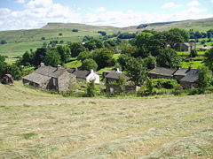
Looking over Countersett to Raydale
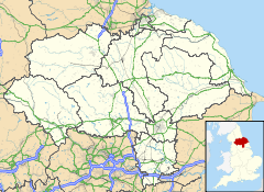
 Countersett shown within North Yorkshire
OS grid reference SD919878 District Richmondshire Shire county North Yorkshire Region Yorkshire and the Humber Country England Sovereign state United Kingdom Postcode district DL8 Police North Yorkshire Fire North Yorkshire Ambulance Yorkshire EU Parliament Yorkshire and the Humber List of places: UK • England • Yorkshire Countersett is the largest of the three settlements based around Semer Water in the Richmondshire district of North Yorkshire, England. It is in the Yorkshire Dales to the north of the lake. The Boar East and West were once one farm, and before that a pub called The Boar Inn. The date 1667 was above the door, along with a Latin inscription which translated as "Now mine, once thine, but whose afterwards I do not know" (ref. Wensleydale, by Ella Pontefract, Dent & Sons, 1936)
External links
- detailed map of Countersett showing the positions and names of all 12 buildings in the village and the roads to Stalling Busk, Marsett, Burtersett and Bainbridge
This Richmondshire location article is a stub. You can help Wikipedia by expanding it.

