- Golovin Airport
-
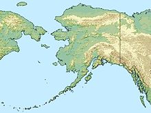
Golovin Airport IATA: GLV – ICAO: PAGL – FAA LID: GLV Summary Airport type Public Owner State of Alaska DOT&PF - Northern Region Serves Golovin, Alaska Elevation AMSL 59 ft / 18 m Coordinates 64°33′02″N 163°00′26″W / 64.55056°N 163.00722°WCoordinates: 64°33′02″N 163°00′26″W / 64.55056°N 163.00722°W Map Location of airport in Alaska Runways Direction Length Surface ft m 2/20 4,000 1,219 Gravel Source: Federal Aviation Administration[1] Golovin Airport (IATA: GLV[2], ICAO: PAGL, FAA LID: GLV, formerly N93) is a state-owned public-use airport located in Golovin,[1] a city in the Nome Census Area of the U.S. state of Alaska.
As per Federal Aviation Administration records, the airport had 1,753 passenger boardings (enplanements) in calendar year 2010, an increase of 8.4% from the 1,617 enplanements in 2009.[3] This airport is included in the FAA's National Plan of Integrated Airport Systems for 2011–2015, which categorized it as a general aviation airport.[4]
Contents
Facilities
Golovin Airport covers an area of 225 acres (91 ha) at an elevation of 59 feet (18 m) above mean sea level. It has one runway designated 2/20 with a gravel surface measuring 4,000 by 75 feet (1,219 x 23 m).[1]
Airlines and non-stop destinations
- Bering Air (Elim, White Mountain)[5]
- Frontier Flying Service (Elim, Nome, White Mountain)[6]
- Hageland Aviation Services (Elim, White Mountain)[7]
References
- ^ a b c FAA Airport Master Record for GLV (Form 5010 PDF). Federal Aviation Administration. Effective 25 August 2011.
- ^ Golovin, Alaska (IATA: GLV). Great Circle Mapper. Retrieved 22 August 2010.
- ^ "Primary, Non-primary Commercial Service, and General Aviation Airports (by State) (PDF, 5.4 MB)". CY 2010 Passenger Boarding and All-Cargo Data. Federal Aviation Administration. 4 October 2011. http://www.faa.gov/airports/planning_capacity/passenger_allcargo_stats/passenger/media/cy10_all_enplanements.pdf.
- ^ "2011–2015 NPIAS Report, Appendix A (PDF, 2.03 MB)". 2011–2015 National Plan of Integrated Airport Systems. Federal Aviation Administration. 4 October 2010. http://www.faa.gov/airports/planning_capacity/npias/reports/media/2011/npias_2011_appA.pdf.
- ^ Bering Air: Nome Flight Schedule (PDF). Retrieved 29 August 2007.
- ^ Frontier Flying Service: 2007 Timetable (PDF). Retrieved 29 August 2007.
- ^ Hageland Aviation Services: Scheduled Flights (PDF). Retrieved 29 August 2007.
External links
- FAA Alaska airport diagram (GIF)
- Topographic map from USGS The National Map
- Resources for this airport:
Categories:- Airports in the Nome Census Area, Alaska
Wikimedia Foundation. 2010.

