Muir Beach Overlook

Muir Beach Overlook
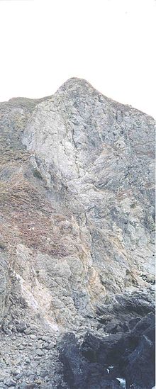
View from the bottom

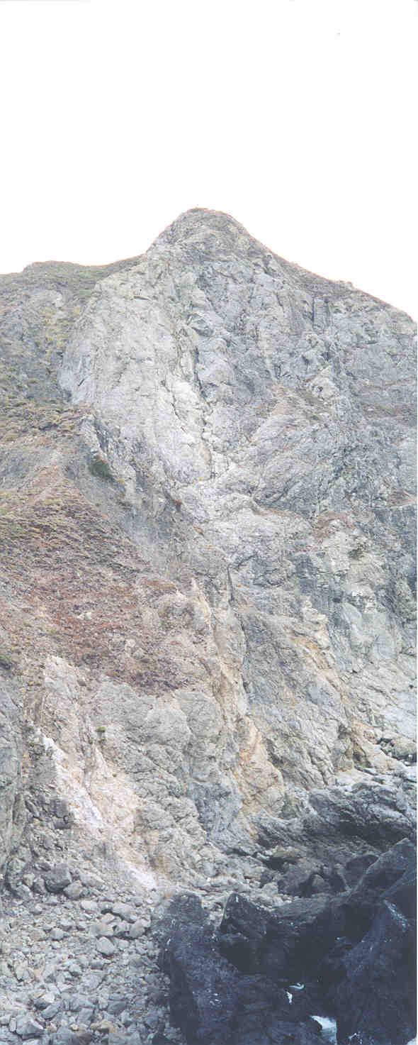
Muir Beach Overlook is part of the Golden Gate National Recreation Area. People may visit this cliffside park when driving on State Route 1 (also known as Highway 1) north of San Francisco, California and south of Stinson Beach, California. It has views of Pacific oceanside cliffs and on clear days you can see San Francisco. You can also view migrating blue whales between November and June.[1]

Contents

Location

Located 0.5 miles (0.8 km) north of Muir Beach on Highway One in Marin County.[2]

History

Muir Beach Overlook contains several historic base-end stations. From these stations, soldiers viewed ships and triangulated the distance, speed, and direction of these ships in coordination with different stations.[3] These stations were mostly important for artillery units stationed on the coast to attack any invasion.[4] They gained particular importance during World War II immediately after the bombing of Pearl Harbor when many in California feared San Francisco or Los Angeles would be the next target.[5] With the advent of radar and its widespread use, these stations became obsolete.

A few of them remain open like ruins where you may enter them to get somewhat of a perspective of the soldiers who were therein stationed.

Pictures

Top of Muir Beach Overlook Base End Station at Muir Beach Overlook
Top of Muir Beach Overlook.jpg Base End Station Muir Beach Overlook.jpg

External links

National Park Service: Muir Beach & Muir Beach Overlook [1]

Footnotes

37°51′47″N 122°35′08″W / 37.86306°N 122.58559°W / 37.86306; -122.58559


Wikimedia Foundation. 2010.

Игры ⚽ Нужно сделать НИР?

Look at other dictionaries:

  • Muir — A Muir is the Scots word for moorland, and Scots Gaelic for sea, and is the etymological origin of the surname and Clan Muir/Mure/Moore in Scotland and other parts of the world. Contents 1 Geography 1.1 Settlements 1.2 Other …   Wikipedia

  • Mount Tamalpais — Mt. Tamalpais as seen from Muir Beach Overlook Elevation 2,574 feet (784 metres) …   Wikipedia

  • Mount Tamalpais State Park — Main article: Mount Tamalpais Mount Tamalpais State Park IUCN Category III (Natural Monument) …   Wikipedia

  • Golden Gate National Recreation Area — Infobox protected area | name = Golden Gate National Recreation Area iucn category = V caption = locator x = 4 locator y = 77 location = San Francisco Bay Area, California, USA nearest city = San Francisco, California lat degrees = 37 lat minutes …   Wikipedia

  • Marin Headlands — The Marin Headlands, as seen from the Golden Gate Bridge. The Marin Headlands is a hilly area at the southernmost end of Marin County, California, just north of the Golden Gate Bridge. The Headlands are located just north of San Francisco,… …   Wikipedia

  • Marin Headlands — Marin Headlands, visto desde el Puente Golden Gate. Marin Headlands (en español: Promontorio Marin) es un área montañosa en el extremo sur del condado de Marin, California, justo al norte del Puente Golden Gate. Los promontorios están localizados …   Wikipedia Español

  • Base end station — is a structure built into a cliffside facing a body of water and used to triangulate positions of ships with other similar stations scattered throughout the area. [http://www.nps.gov/archive/muwo/mube/muir overlook.htm] ] Once these base end… …   Wikipedia

  • Chino Hills State Park — Coordinates: 33°57′16″N 117°42′07″W / 33.954325°N 117.701855°W / 33.954325; 117.701855 …   Wikipedia

  • Don Edwards San Francisco Bay National Wildlife Refuge — Coordinates: 37°30′N 122°07′W / 37.5°N 122.117°W / 37.5; 122.117 …   Wikipedia

  • Sequoia National Forest — IUCN Category VI (Managed Resource Protected Area) …   Wikipedia

Share the article and excerpts

Direct link
Do a right-click on the link above
and select “Copy Link”