- New York State Route 29A
-
NYS Route 29A
Route information Auxiliary route of NY 29 Maintained by NYSDOT and the city of Gloversville Length: 35.48 mi[2] (57.10 km) Existed: 1930[1] – present Major junctions West end:  NY 29 in Salisbury
East end: NY 29 in BroadalbinLocation Counties: Herkimer, Fulton Highway system Numbered highways in New York
Interstate • U.S. • N.Y. (former) • Reference • County← NY 29NY 30  →
→New York State Route 29A (NY 29A) is a state highway in the western portion of the Capital District of New York in the United States. The western terminus of the route is at an intersection with NY 29 in the Herkimer County hamlet of Salisbury Center. Its eastern end is at another junction with NY 29 about 36 miles (58 km) to the east near the Fulton County hamlet of Vail Mills. NY 29A enters Gloversville via Rose Street and continues through downtown on Fulton Street.
Originally, NY 29A turned right on Saratoga Boulevard and continued via Steele Avenue Extension to NY 29 about 2 miles (3.2 km) away. Later, NY 29A was taken off Saratoga Boulevard, and was concurrent with NY 30A to its crossing with Steele Avenue Extension, following Steele Avenue Extension after that. In 1980, NY 29A was removed from Steele Avenue Extension as well as the concurrency with NY 30A. Instead, it continued east on Turkey Farm Road, which meant no turns, to its present terminus at NY 29 west of Vail Mills.
Contents
Route description
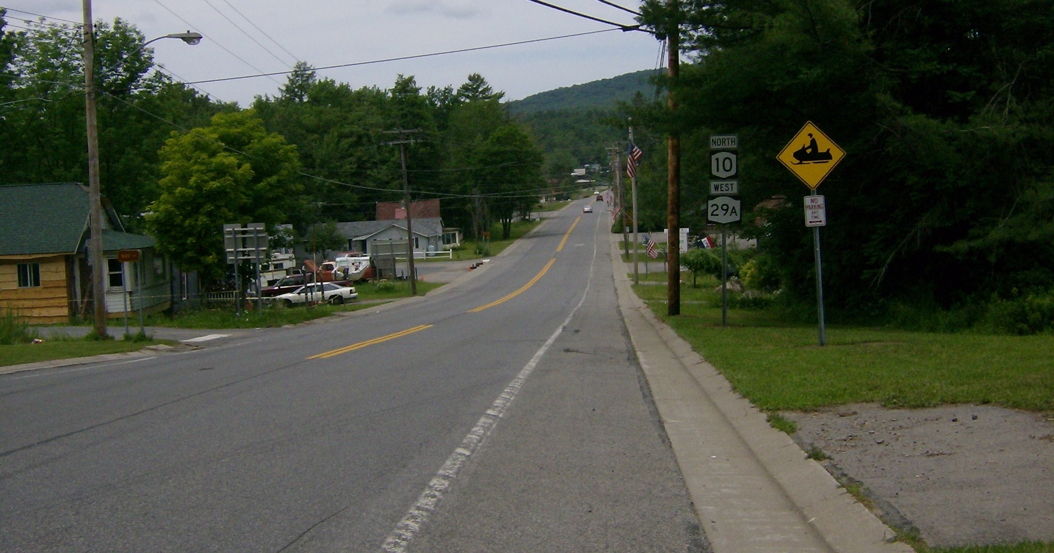
 NY 29A overlaps NY 10 in Caroga Lake
NY 29A begins at an intersection with NY 29 in the town of Salisbury. It follows a more northerly routing than its parent through Herkimer and Fulton Counties. At Stratford, NY 29A enters Adirondack Park. The highway remains in the park through Caroga to the town of Johnstown, where it enters the city of Gloversville and intersects NY 30A. It proceeds eastward from Johnstown, paralleling NY 29 into Broadalbin before curving south to end at its parent west of Vail Mills.
History
NY 29A was assigned as part of the 1930 renumbering of state highways in New York. The route initially followed its current alignment from Salisbury to downtown Gloversville, where it turned southeast to follow Saratoga Boulevard and Steele Avenue Extension to NY 29 in the town of Johnstown.[1] When the NY 30A arterial was completed in the mid-1950s,[3][4] NY 29A was rerouted to remain on East Fulton Street to the Arterial, where it turned south and overlapped NY 30A to its intersection with the original route.[citation needed]
On April 1, 1980, ownership and maintenance of Turkey Farm Road from the Gloversville city line to NY 29 just west of Vail Mills was transferred from Fulton County to the state of New York as part of a highway maintenance swap between the two levels of government.[5] NY 29A was realigned to follow the new state highway—reaching NY 29 3 miles (5 km) farther east than before—while the portion of its former routing on Steele Avenue Extension south of the Gloversville city line became NY 920J, an unsigned reference route 2.08 miles or 3.35 kilometres in length. Reference markers along NY 920J still read "29A" for its former designation.[2]
Major intersections
County Location Mile[2] Destinations Notes Herkimer Salisbury 0.00 NY 29Fulton Caroga 14.62  NY 10 north
Northern terminus of NY 10 / NY 29A overlap at Pine Lake 19.97 NY 10 southSouthern terminus of NY 10 / NY 29A overlap at Caroga Lake Gloversville 29.70  NY 309 (Bleecker Street)
Western terminus of NY 309 Town of Johnstown 31.05  NY 30A
Town of Broadalbin 35.48 NY 291.000 mi = 1.609 km; 1.000 km = 0.621 mi References
- ^ a b Standard Oil Company of New York (1930). Road Map of New York (Map). Cartography by General Drafting.
- ^ a b c "2008 Traffic Volume Report for New York State" (PDF). New York State Department of Transportation. June 16, 2009. pp. 88, 266. https://www.nysdot.gov/divisions/engineering/technical-services/hds-respository/NYSDOT%20TVR%202008%20by%20Route.pdf. Retrieved January 31, 2010.
- ^ Esso (1956). New York with Special Maps of Putnam–Rockland–Westchester Counties and Finger Lakes Region (Map). Cartography by General Drafting (1957 ed.).
- ^ Esso (1958). New York with Special Maps of Putnam–Rockland–Westchester Counties and Finger Lakes Region (Map). Cartography by General Drafting (1958 ed.).
- ^ New York State Legislature. "New York State Highway Law § 341". http://public.leginfo.state.ny.us/LAWSSEAF.cgi?QUERYTYPE=LAWS+&QUERYDATA=$$HAY341$$@TXHAY0341+&LIST=LAW+&TARGET=VIEW. Retrieved June 24, 2010.
External links
Categories:- State highways in New York
- Transportation in Herkimer County, New York
- Transportation in Fulton County, New York

Wikimedia Foundation. 2010.