- Lachin
-
Laçın 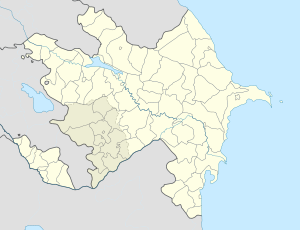
 Laçın
LaçınCoordinates: 39°38′27″N 46°32′49″E / 39.64083°N 46.54694°E Country  Azerbaijan (de jure)
 Nagorno-Karabakh Republic (de facto)
Rayon Lachin Population (2005) – Total 2,300 Time zone AZT (UTC+4) – Summer (DST) AZT (UTC+5) Lachin (Azerbaijani: Laçın, Armenian: Բերդձոր Berddzor, Kurdish: Laçîn; also Abdallyar, Datschin) is a town in Azerbaijan and the regional center of the Lachin Rayon. Since 1992 the area has been under the control of the de facto independent unrecognized Nagorno-Karabakh Republic, which has renamed the town Berdzor (Armenian: Բերդձոր).[1] The town and its surrounding region serve as the strategic Lachin corridor connecting the Nagorno-Karabakh Republic with Armenia. With about 1,700 inhabitants in 2009 (down from 2,300 in 2005),[2] population numbers are still declining despite a proactive settlement policy by the authorities.
Contents
History
Lachin was known as Abdalyar until 1923.[3][4] On 15 May 1992, during the Nagorno-Karabakh War, Lachin was captured by Nagorno Karabakh forces, opening the first land-corridor to Armenia.[5] Previously, Turkey had threatened Armenia on May 13, 1992, "that it would intervene militarily if Shusha and Lachin were not restored to Azerbaijan".[6] Russia responded by signing a military agreement with Armenia, pledging military aid if its security were threatened. On the May 20, 1992, Turkey reassured Russia, that it would not intervene militarily.[6] Thus, after a three year blockade, a land bridge linking the Republic of Armenia with the territory of Nagorno Karabakh was established. In the fall of 1992, Azerbaijani forces tried to regain control over Lachin, but were repulsed. Most of Lachin's Azerbaijani and Kurdish population fled as a result of the fall of the region to Nagorno-Karabakh forces.
Demographics (1989)
- Azeris 61.5% (7.902)
- Kurds 20.1% (2.613)
- Armenians 18% (2.210)
- Other 0.4% (52)[citation needed]
Kurds
The town was settled by the first Kurdish tribes coming from Iranian Kurdistan in the early 19th[citation needed] century. Eventually, this population became the majority in most parts of the region, particularly around Lachin.[citation needed] In the early 1920s, Vladimir Lenin's letter to Narimanov "had implied that Lachin was to be included in Azerbaijan, but the authorities in Baku and Yerevan were given promises that were inevitably contradictory."[7] The town of Lachin on July 7, 1923, became the capital of Kurdistan Uyezd often known as Red Kurdistan. It was dissolved on April 8, 1929: Kurdish schools and newspapers were closed.[8] According to what Bushkapin[who?] wrote, official statistics of 1931 showed that there were 3,322 Kurdish speakers in Lachin. These figures did not include those individuals who did not speak Kurdish but nonetheless defined themselves as Kurds.[citation needed] Most of the Kurdish population in Lachin were Shi'a Muslims and were deported by the Soviet authorities, in late 1930s. However, many Kurds still were able to remain in the town and there was a Kurdish minority in the area before the Nagorno-Karabakh war started.
Terrain
The town is scenically built on the side of a mountain on the left bank of Akera river.[9]
Nagorno-Karabakh war
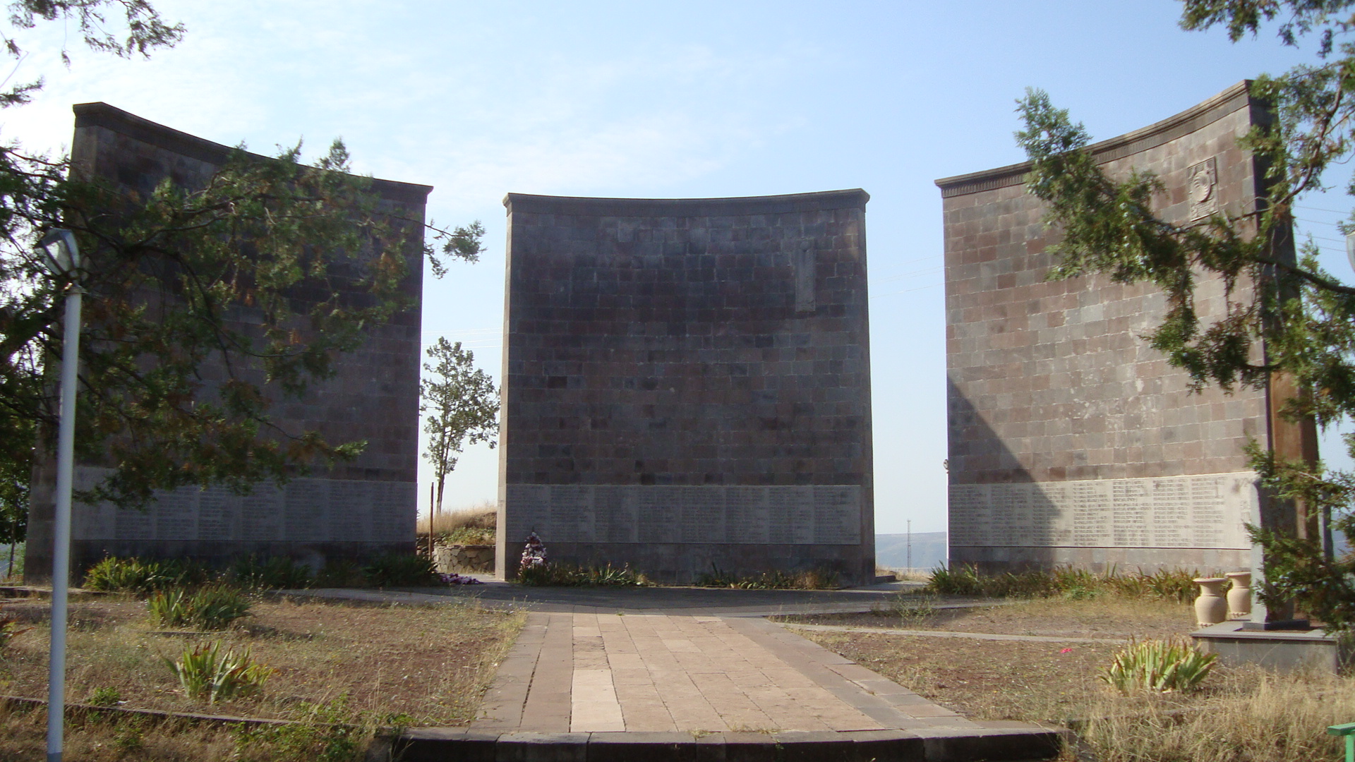
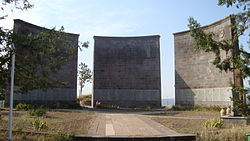 A monument complex built by Armenians after they established military control over the region[citation needed]
Lachin town and the surrounding rayon were the location of severe fighting during the 1990-1994 Nagorno-Karabakh war, and the town has not recovered from the destruction of that war. Lachin is the most important town under Armenian control because of the Lachin corridor which attaches Armenia to Nagorno-Karabakh. The OSCE Minsk group co-chairs noted that "Lachin has been treated as a separate case in previous negotiations." This is because Lachin is Nagorno Karabakh's humanitarian and security corridor. Without it, Nagorno-Karabakh would remain an isolated enclave. It is because of Lachin's political and geographic reality and security dimension, that it is viewed differently in the negotiation process.[citation needed] The Lachin corridor and the Kelbajar district have been at the center of Armenian demands during the Nagorno-Karabakh peace talks with Azerbaijan.[10] According to Emmanuel Karagiannis[who?], the Lachin corridor is "too strategic a position for Karabakh Armenians to let Azerbaijan place its military forces there, driving, a wedge between the enclave and Armenia."[11]
Administrative divisions
Before the Nagorno-Karabakh war there were 125 villages, one city-type settlement, Minkend, and the capital city in the Lachin district.
Religious
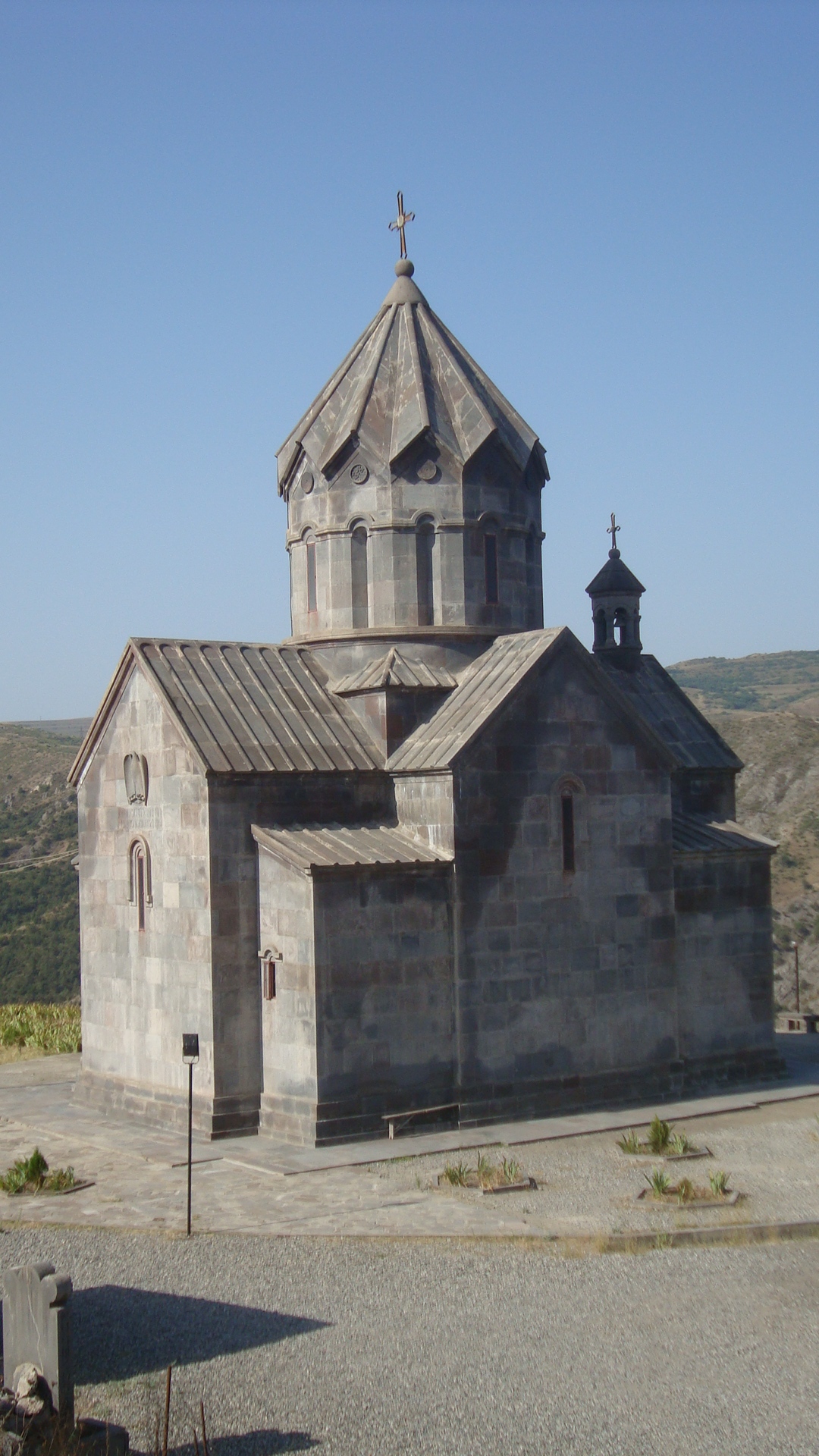
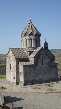 New city church
In this region is located the fifth century Armenian Tsitsernavank Monastery.
See also
External links
- Pictures of Lachin
- Demographic Crisis in Lachin (Berdzor)
- More information about Lachin (Berdzor) from Armeniapedia.com
- "Lachin (Berdzor)". Azerb.com. http://www.travel-images.com/az-lachin.html. Retrieved 2007-02-04.
- "History of Artsakh (Part 3)". http://www.armenianhistory.info/artsakh3.htm.
- Lachin (as Laçın) at GEOnet Names Server
Notes
- ^ Holding, Nicholas (2006). Armenia with Nagorno Karabagh, 2nd: The Bradt Travel Guide. Guilford, Connecticut: Globe Pequot Press, p. 208. ISBN 1-8416-2163-3.
- ^ census.stat-nkr.am/nkr Official census in 2005, page 15
- ^ Karapetian, Samvel. Armenian Cultural Monuments in the Region of Karabagh. Yerevan: Gitutiun Publishing House, 2001, p. 169.
- ^ Map of Armenia and Adjacent Countries by H. F. B. Lynch and F. Oswald in Armenia, Travels and Studies. London: Longmans, 1901.
- ^ Baev, Pavel K. The Russian Army in a Time of Troubles. International Peace Research Institute, 1996, p. 124. ISBN 0-7619-5187-3.
- ^ a b A Study of Crisis, by Michael Brecher, Jonathan Wilkenfeld, 1997, p. 565
- ^ Alexandre Bennigsen and S. Enders Wimbush. Muslims of the Soviet Empire. C. Hurst & Co Publishers, 1986, pp. 202, 286. ISBN 1-8506-5009-8.
- ^ Soviet Kurds Face Loss of Their Identity, by Catherine Cosman, Director, Helsinki Watch Washington, New York Times, May 13, 1991 June 2, 1991
- ^ Great Soviet Encyclopedia
- ^ CountryWatch - Interesting Facts Of The World
- ^ Karagiannis, Emmanuel. (2002). Energy and Security in the Caucasus. London: RoutledgeCurzon. p. 50. ISBN 0-7007-1481-2.
Coordinates: 39°38′N 46°33′E / 39.633°N 46.55°E
Cities Stepanakert (capital)
Provinces
(Մարզեր marzer)Provincial capitals 1 Claimed by the Nagorno-Karabakh Republic but under Azerbaijani control.
2 Claimed by the Nagorno Karabakh Republic as the capital of the province of Shahumyan.Categories:- Populated places in Lachin Rayon
- Nagorno-Karabakh
- Nagorno-Karabakh conflict
- Armenia–Azerbaijan border crossings


Wikimedia Foundation. 2010.