- Claremont, Western Australia
-
This article is about a suburb of Perth, Western Australia.. For the local government area, see Town of Claremont.
Claremont
Perth, Western Australia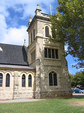
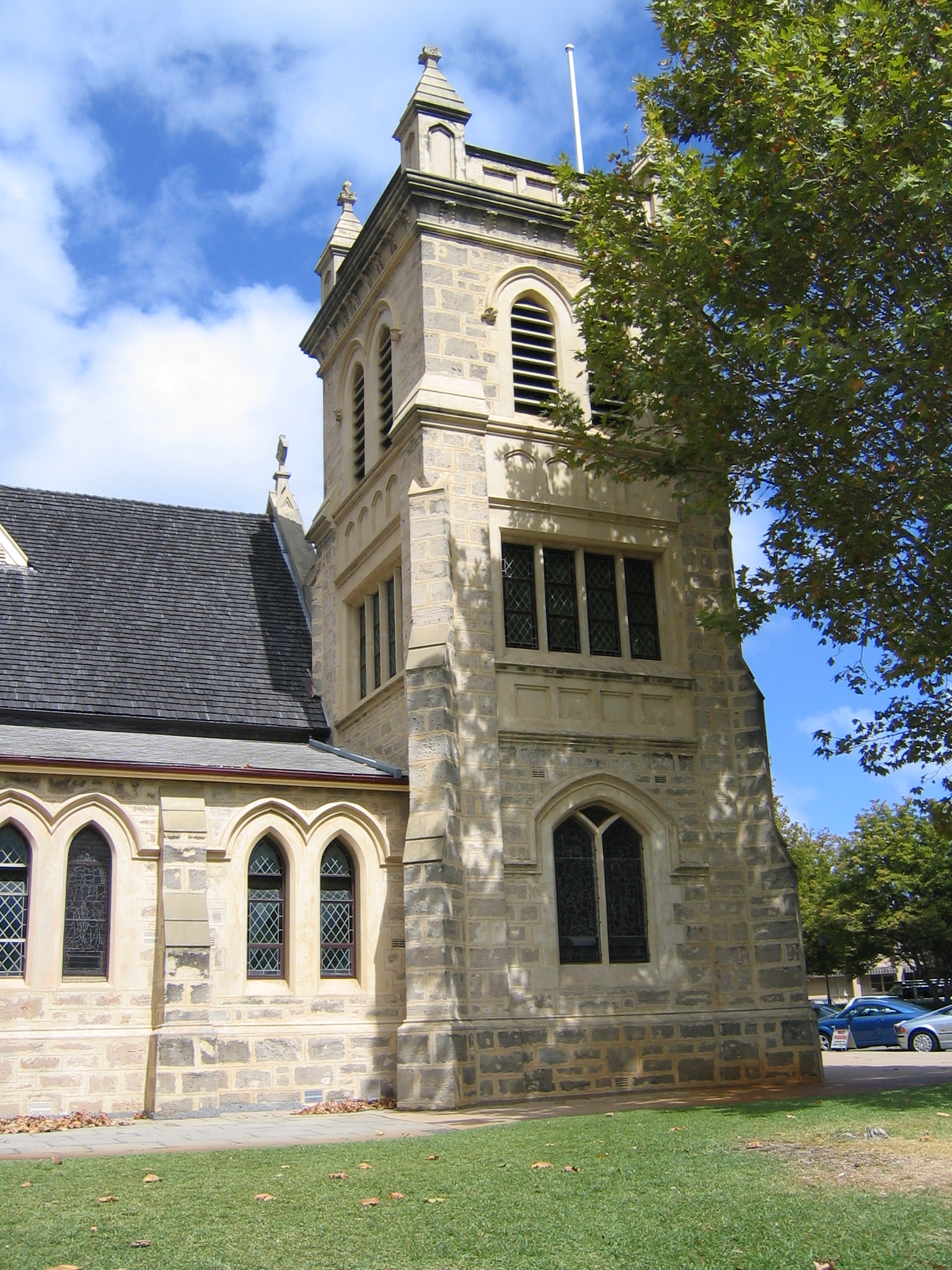
Christ Church, Claremont. Built 1892.
 Claremont
Population: 7,154 (2006 census)[1] Established: 1890s Postcode: 6010 Area: 3.6 km² (1.4 sq mi) Location: 9 km (6 mi) WSW of Perth LGA: State District: Cottesloe Federal Division: Curtin Suburbs around Claremont: Mount Claremont Mount Claremont Karrakatta Swanbourne Claremont Nedlands Cottesloe Peppermint Grove Dalkeith Coordinates: 31°58′48″S 115°46′55″E / 31.98°S 115.782°E
 Princess Road, Claremont
Claremont is a western suburb of Perth, Western Australia on the north bank of the Swan River.
Contents
History
Prior to European settlement, the Noongar people used the area as a source of water, for fishing and for catching waterfowl. In 1830, John Butler, a settler, set up an inn at Freshwater Bay (in modern-day Peppermint Grove) to attract travellers on the road from Perth to Fremantle. After the arrival of convicts in the colony in 1850, work began on constructing the Fremantle Road. The Government allocated land on the foreshore and at Lake Claremont (then known as Butler's Swamp) to 19 pensioner guards and their families, and a permanent convict depot was established on Freshwater Bay, operating until 1875.
As the community grew, a school (1862) and church were built, and a community grew around what is now Victoria Avenue. In the 1870s, a number of influential men, including the Trigg, Sandover and Stirling families, bought land in the district and settled in what is now the Christ Church Grammar School and surrounding areas. Some of their homes have been maintained as school buildings.
In 1881, the railway line from Perth to Fremantle came through and the community's focus shifted to the area between Fremantle Road (Stirling Highway) and the railway, particularly around Bay View Terrace. The community was named Claremont by Mr James Morrison, the owner of Swan Location 702, after his wife, Clara - the name was first used for the railway station in 1883. The Freshwater Bay school ceased to play a central role, and became a boarding house nicknamed "Appy One" in 1892 (and in 1975 a museum).
Land speculators bought in the area and subdivided blocks at varying sizes, leading to a wide class diversity within the suburb. By about 1903, the entire suburb, other than a dozen or so streets, had been subdivided, and by the Second World War, the community was firmly established.[2]
Geography
Claremont is bounded by Airlie Street to the south; Stirling Highway, Congdon Street and Stirling Road to the west; Alfred Road to the north and Loch Street and Bay Road to the east. A large part of Claremont is residential, although a significant shopping area is located along Stirling Highway, and the Claremont Showgrounds and the eastern half of Lake Claremont are within Claremont's boundaries.[3]
Claremont has grand homes in the Agett Road and Richardson Avenue areas on the south side of Stirling Highway, while lesser areas include the areas around Ashton Avenue to the north.
At the ABS 2001 census, Claremont had a population of 6,406 people living in 3,502 dwellings, many of which were flats or townhouses. The ABS identified property and health as the two main occupations.
Facilities
Claremont includes the Claremont Showgrounds and the Claremont Oval, home ground of the Claremont Football Club, as well as a significant shopping area along Stirling Highway, most concentrated on the St Quentins Avenue precinct. The suburb also contains several nightspots including Claremont Hotel, On the Terrace and Club Bay View.
Several private schools including Methodist Ladies' College, Christ Church Grammar School, Presbyterian Ladies' College and Scotch College are either in Claremont or within 50 m of the suburb boundary. Claremont also contains a small private hospital (Bethesda) and two state primary schools; Claremont Primary School and East Claremont Primary School, as well as a number of jetties on the Swan River.
Every year, Claremont hosts the annual Perth Royal Show.
Transport
Claremont is served by the Claremont railway station and Loch Street railway station at regular times, as well as the Showgrounds railway station during special events. Various buses, including the CircleRoute, travel along Stirling Highway and through Claremont's northern and southern sections. All services are operated by the Public Transport Authority.
Politics
Claremont is part of the federal division of Curtin. The federal seat is held by the centre-right Liberal Party. It is regarded as a safe seat as it has been continually retained by the Liberal Party with the exception of former Liberal member Allan Rocher as an Independent politician between 1996 and 1998. For the parliament of Western Australia, Claremont is divided between the state electoral districts of Cottesloe and Nedlands, both held by the Liberal Party.
See also
- Claremont serial murders - unsolved murders in Claremont during the 1990s
- Town of Claremont
- Claremont Football Club
- Claremont Showgrounds
References
- ^ Australian Bureau of Statistics (25 October 2007). "Claremont (State Suburb)". 2006 Census QuickStats. http://www.censusdata.abs.gov.au/ABSNavigation/prenav/LocationSearch?collection=Census&period=2006&areacode=SSC51296&producttype=QuickStats&breadcrumb=PL&action=401. Retrieved 2008-10-05.
- ^ Town of Claremont. "Claremont - Heritage". Archived from the original on 2006-10-19. http://web.archive.org/web/20061019025943/http://claremont.wa.gov.au/heritage.html. Retrieved 2006-11-12.
- ^ 2006 StreetSmart directory, Department of Lands and Surveys, Perth.
External links
Western suburbs of Perth, Western Australia City Beach · Claremont · Cottesloe · Crawley · Daglish · Dalkeith · Floreat · Jolimont · Karrakatta · Mosman Park · Mount Claremont · Nedlands · Peppermint Grove · Shenton Park · Subiaco · Swanbourne · Wembley · Wembley Downs · West Leederville
Categories:- Suburbs of Perth, Western Australia


Wikimedia Foundation. 2010.