- Medway Viaducts
-
Medway Viaduct 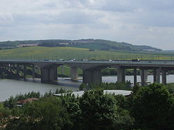
Carries Original:4 lanes of M2 plus hard shoulder & Bridleway
New: 4 lanes of M2 plus hard shoulder
Rail: 2 tracks of High Speed 1Crosses River Medway Locale Cuxton, England Design Cantilever Total length Original: 997.3 metres (3,272 ft)
New:
Rail: 1,300 metres (4,265 ft)Width Original: 34.44 metres (113 ft)
New:
Rail:Longest span Original: 152.4 metres (500 ft)
New:
Rail:152.4 metres (500 ft)Clearance below Original: 35.5 metres (116 ft) at maximum
New:
Rail:Opened Original: 29 May 1963
New:2003
Rail: September 2003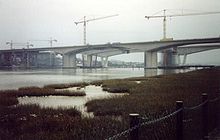 Under construction
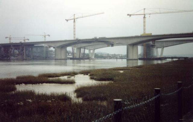
 All three bridges seen from the north west bank
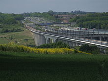 All three bridges seen from the south east bank
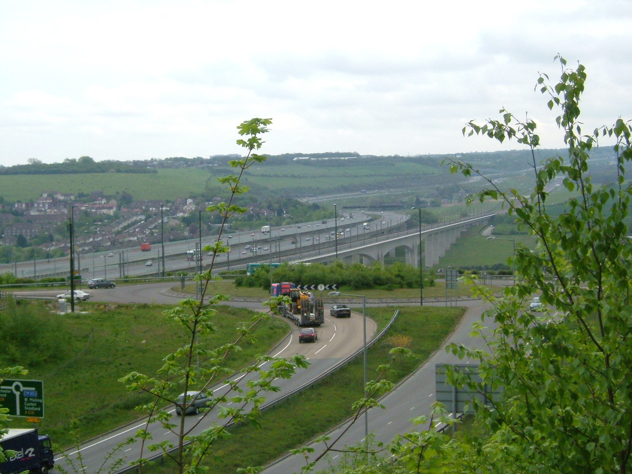
There are three Medway Viaducts, two of which carry the two carriageways of the M2 motorway. The other viaduct carries High Speed 1 across the River Medway near Rochester in north Kent, England.
Contents
M2 Motorway viaduct (old)
A six-lane (two London-bound, two coast-bound, two hard shoulder) bridge was opened in May 1963[1] as part of the construction of the M2 motorway. In addition, a footpath (actually a small service road) was placed on either side of the bridge as part of the North Downs Way, offering panoramic views of the Medway Valley.
As part of the recent M2 widening, a second bridge was built alongside, to the south, to carry the London-bound carriageways (four lanes and a hard shoulder). The existing bridge was rebuilt into a four-carriageway road (coastbound). The south "footpath" is now closed, as it lies within the central reservation at both ends, leaving only the north-facing footpath. Prior to this, the bridge had been undergoing extensive refurbishment and strengthening. This included the said footpaths being reduced in width and thus making the bridge narrower. The central span, which was made of concrete beams, was replaced with steel girders. The concrete beams were lowered down on to a river barge. Presumably, these would be broken up on land.
As part of the M2 widening, the bridges are now fitted with street lighting. This was the first time the bridge had lighting on it.
An image of the bridge without the central span can be seen on the link below.
The bridges pass over two railway lines: the Medway Valley Line (to Paddock Wood) and the Chatham Main Line (to Victoria).
During the construction of the new bridges, a support boat was positioned in the river. This is presumably as a safety requirement, should a member of the workforce get into difficulty near the river.
M2 Motorway viaduct (new)
This bridge is the newest bridge to cross the River Medway at this point.
In 2003, this particular bridge won the Concrete Society’s Civil Engineering Category award for, "outstanding merit in the use of concrete". It was presented to Doka UK Formwork Technologies.
A small plaque can be seen on one of the upright support legs, on the Strood side.
A link below shows the winning certificate.
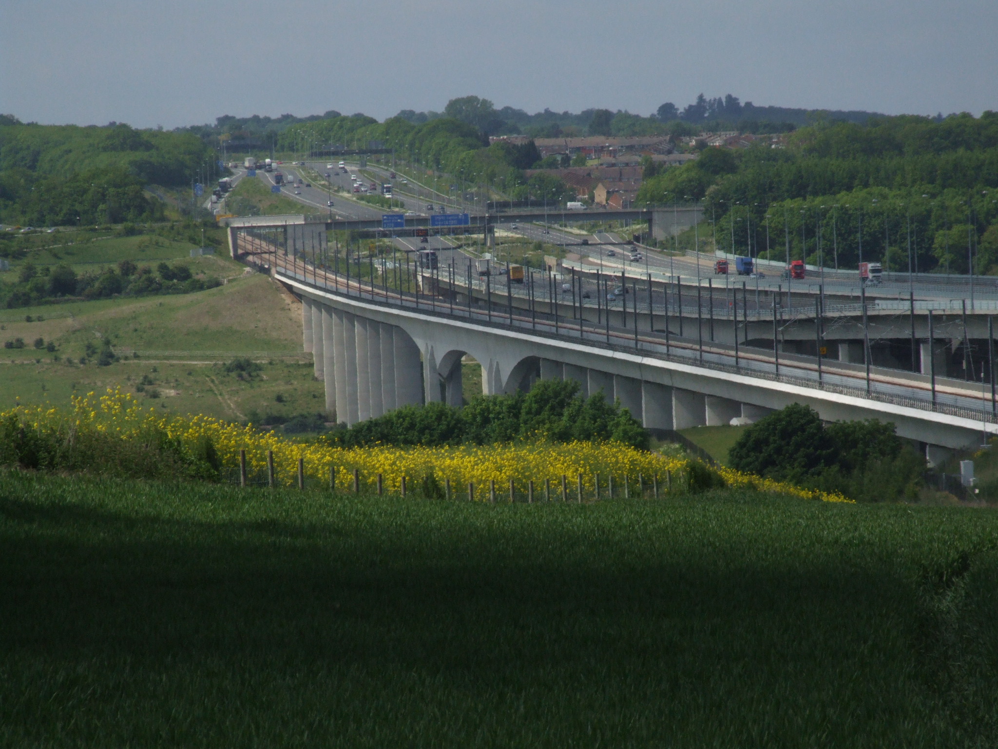
The rail-link viaduct
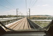 Driver's eye-view of crossing the Medway rail viaduct, during pre-service testing in 2003
The western bridge carries High Speed 1 (HS1), the high speed rail link that connects London with the Channel Tunnel.
The rail viaduct is 1.3 kilometres long, making it the longest high-speed rail span in the world.[citation needed] The viaduct is a multi-span structure, with typical approach spans of 40.5 m, spanning the River Medway with a central navigation span of 152 m. The viaduct substructure is of reinforced concrete pier columns supported on bored piles. A unique feature of the columns is that they are in a "V" shape. This is to provide greater lateral support and stability in the event of two high-speed trains using their emergency brakes. (More orthodox vertical supports could, in a worst-case scenario, topple like dominoes.)
The bridge deck was pushed out from each bank of the river during construction, using hydraulic pistons.
On 4 September 2007, Eurostar 9021 driven by Neil Meare crossed the viaduct at up to 200 miles per hour, during the record breaking inaugural run from Paris Gare du Nord to London St Pancras.[2]
References
- ^ Kier, Mogens; Hansen, Frode; Dunster, James Anthony (1964). "Medway Bridge: Construction". Proceedings of the Institution of Civil Engineers (ICE): 53–100. http://www.icevirtuallibrary.com/docserver/fulltext/iicep.1964.9626.pdf.
- ^ Barkham, Patrick (2007-07-05). "205mph but still three minutes late". London: The Guardian. http://www.guardian.co.uk/frontpage/story/0,,2162674,00.html. Retrieved 2007-09-05.
External links
Categories:- Bridges in Kent
- Channel Tunnel
- Eurostar
- Motorway bridges in England
- Transport in Medway
- Bridges completed in 1963
- Bridges completed in 2002
- Bridges completed in 2003
- Viaducts in the United Kingdom


Wikimedia Foundation. 2010.