- Marmirolo
-
Marmirolo — Comune — Comune di Marmirolo 
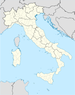
Coat of armsLocation of Marmirolo in Italy Coordinates: 45°13′N 10°45′E / 45.217°N 10.75°E Country Italy Region Lombardy Province Mantua (MN) Frazioni Marengo, Rotta, Pero, Pozzolo, San Brizio, Scaraglio Government - Mayor Paolo Rasori Area - Total 42.2 km2 (16.3 sq mi) Elevation 29 m (95 ft) Population (31 December 2009)[1] - Total 7,734 - Density 183.3/km2 (474.7/sq mi) Demonym Marmirolesi Time zone CET (UTC+1) - Summer (DST) CEST (UTC+2) Postal code 46045 Dialing code 0376 Patron saint St. Sebastian Saint day January 20 Website Official website Marmirolo is a comune (municipality) in the Province of Mantua in the Italian region Lombardy, located about 130 km east of Milan and about 7 km northwest of Mantua. Its territory, which is totally plain as part of the Pianura Padana, is crossed by the Mincio river.
Marmirolo borders the following municipalities: Goito, Porto Mantovano, Roverbella, Valeggio sul Mincio, Volta Mantovana.
History
Marmirolo is mentioned for the first time in 970, and was a possession of the Canossa family. In 1055 it was acquired by the commune of Mantua by an imperial diplom. Later it was ruled by the House of Gonzaga, who hold it from 1328 until 1707. Here Gianfrancesco Gonzaga built a castle in 1435, enlarged in 1480 under design by Luca Fancelli and later finished by architect Giulio Romano in 1539. This edifice was however destroyed in 1798.
References
- ^ All demographics and other statistics: Istituto Nazionale di Statistica (Istat).
External links
Categories:- Cities and towns in Lombardy
- Communes of the Province of Mantua
- Province of Mantua geography stubs
Wikimedia Foundation. 2010.

