- Curtatone
-
Curtatone — Comune — Città di Curtatone 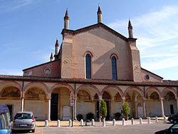 Location of Curtatone in Italy
 Curtatone
Coordinates: 45°9′N 10°43′E / 45.15°N 10.717°ECoordinates: 45°9′N 10°43′E / 45.15°N 10.717°E Country Italy Region Lombardy Province Province of Mantua (MN) Frazioni Buscoldo, Eremo, Grazie, Levata, Montanara, Ponteventuno, San Lorenzo, San Silvestro Area - Total 67.5 km2 (26.1 sq mi) Elevation 26 m (85 ft) Population (Dec. 2004) - Total 12,877 - Density 190.8/km2 (494.1/sq mi) Time zone CET (UTC+1) - Summer (DST) CEST (UTC+2) Postal code 46010 Dialing code 0376 Website Official website Curtatone is a comune (municipality) in the Province of Mantua in the Italian region Lombardy, located about 130 km southeast of Milan and about 7 km southwest of Mantua. As of 31 December 2004[update], it had a population of 12,877 and an area of 67.5 km².[1]
The municipality of Curtatone contains the frazioni (subdivisions, mainly villages and hamlets) Buscoldo, Eremo, Grazie, Levata, Montanara, Ponteventuno, San Lorenzo, and San Silvestro.
Curtatone borders the following municipalities: Borgoforte, Castellucchio, Mantua, Marcaria, Porto Mantovano, Rodigo, Virgilio.
Curtatone received the honorary title of city with a presidential decree on July 2, 2002.
Demographic evolution

References
- ^ All demographics and other statistics: Istituto Nazionale di Statistica (Istat).
External links
Categories:- Cities and towns in Lombardy
- Communes of the Province of Mantua
- Province of Mantua geography stubs


Wikimedia Foundation. 2010.