Outer Brewster Island

Outer Brewster Island

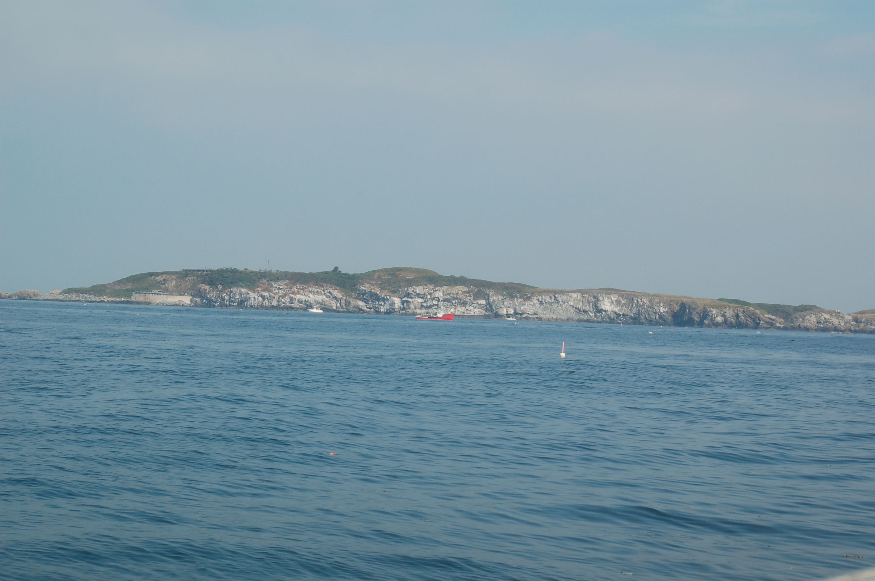
Outer Brewster Island, also known as Outward Island, is a one of the outer islands in the Boston Harbor Islands National Recreation Area and is situated some 10 miles offshore of downtown Boston. The island has a permanent size of 20 acres, and consists of exposed bedrock covered by fertile soil bounded by a rocky shore with steep cliffs. It provides a nesting habitat for coastal water birds, including Cormorants, Gulls, Common Eider Ducks, Glossy Ibis and American Oystercatchers. The birds are aggressive during their nesting season and access by humans, which is by private boat only, is discouraged during this period.[1]

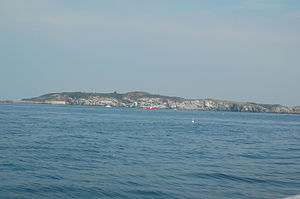
Outer Brewster Island.
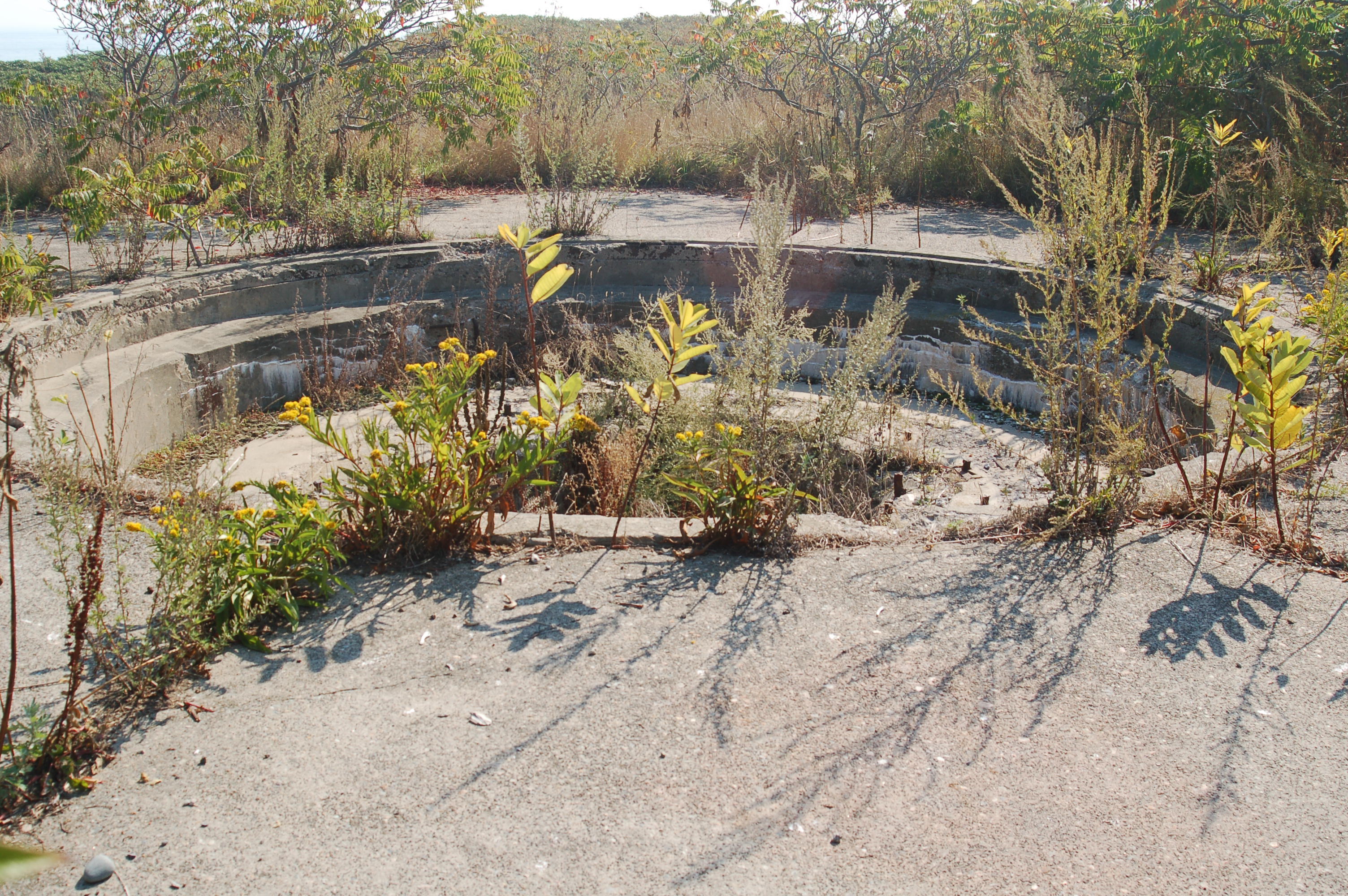
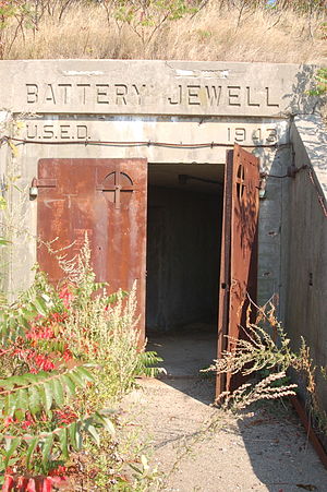
Battery Jewell constructed during WW II.
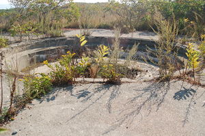
Battery Jewell's #2 gun emplacement.

The Outer Brewster Island was recently the subject of much debate in the Massachusetts State Legislature. A Virginia based Energy company wanted to place a Natural Gas facility on this island, however the measure was defeated due to pressure from environmental groups such as Environment Massachusetts.

Like the neighbouring islands of Great Brewster, Little Brewster and Middle Brewster, Outer Brewster Island is named after William Brewster, the first preacher and teacher for the Plymouth Colony. The relative barrenness and rocky shoreline of Outer Brewster has resulted in limited human usage. A granite quarry was operated on the island in the 19th century, and a coastal defense battery, known as Battery Jewell, was built on the island during World War II. Both are now disused and abandoned.[1]

References

  1. ^ a b "Outer Brewster Island Factsheet". Boston Harbor Islands Partnership. Archived from the original on August 26, 2006. http://web.archive.org/web/20060826131943/http://www.bostonislands.org/factsheet_template.asp?rsIslands__MMColParam=oubr. Retrieved August 11, 2006. 


Coordinates: 42°20′30.41″N 70°52′39.65″W / 42.3417806°N 70.8776806°W / 42.3417806; -70.8776806


Wikimedia Foundation. 2010.

Игры ⚽ Нужно решить контрольную?

Look at other dictionaries:

  • Great Brewster Island — is a one of the outer islands in the Boston Harbor Islands National Recreation Area, situated some convert|9|mi|km offshore of downtown Boston. The island has a permanent size of 18 acres, plus an intertidal zone of a further 49 acres. Unlike the …   Wikipedia

  • Little Brewster Island — is a rocky outer island in the Boston Harbor Islands National Recreation Area. It is best known as the location of Boston Light, the only remaining manned lighthouse in the United States, and an important navigation aid for traffic to and from… …   Wikipedia

  • Middle Brewster Island — is a rugged outer island in the Boston Harbor Islands National Recreation Area, located 9 miles (14 km) offshore from downtown Boston. The island has a permanent size of 13 acres (53,000 m2), reaches a height of 52 feet (16 m) above sea …   Wikipedia

  • William Brewster (pilgrim) — Infobox musical artist Name = William Brewster Img capt = An imaginary likeness of William Brewster. There is no known portrait of him from life. Landscape = yes Birth name = William Brewster Father = William Brewster Mother = Mary Smythe Born =… …   Wikipedia

  • Calf Island (Massachusetts) — Calf Island, also known as Apthorps Island, is a windswept island situated some convert|9|mi|km offshore of downtown Boston in the Boston Harbor Islands National Recreation Area. The island has a permanent size of convert|18|acre|m2, plus an… …   Wikipedia

  • Green Island (Massachusetts) — Green Island, also known as North Brewster Island, is a rocky outer island in the Boston Harbor Islands National Recreation Area, to the north of Calf Island and Hypocrite Channel. The island has a permanent size of 2.5 acres (10,000 m2),… …   Wikipedia

  • Long Island (Massachusetts) — This article is about the island Long Island, Boston. For other islands called Long Island, see Long Island (disambiguation). Long Island is situated in Quincy Bay, in the middle of Boston Harbor, Massachusetts. The island forms part of the City… …   Wikipedia

  • Newport Tower (Rhode Island) — Newport Tower The Newport Tower. Origin Mill name Newport Tower Mill location …   Wikipedia

  • Boston Harbor — This article is about Boston Harbor, Massachusetts. For other uses, see Boston Harbor (disambiguation). Topographic map of Boston Harbor Boston Harbor is a natural harbor and estuary of Massachusetts Bay, and is located adjacent to the city of… …   Wikipedia

  • List of islands of Massachusetts — Rainsford Island is part of the Boston Harbor Islands National Recreation Area, a National Recreation Area situated among the islands of Boston Harbor of Boston, Massachusetts The islands of Massachusetts range from barren, almost completely… …   Wikipedia

Share the article and excerpts

Direct link
Do a right-click on the link above
and select “Copy Link”