- Nunawading, Victoria
-
Nunawading
Melbourne, Victoria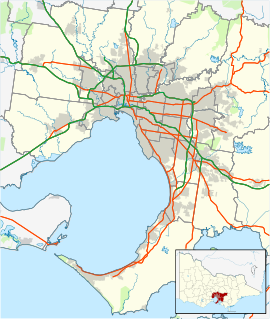
 Nunawading
Population: 10,661 (2006)[1] Established: 1870s Postcode: 3131 Area: 5.4 km² (2.1 sq mi) Location: 19 km (12 mi) from Melbourne LGA: City of Whitehorse State District: Mitcham Federal Division: Deakin Suburbs around Nunawading: Doncaster East Donvale Donvale Blackburn North Nunawading Mitcham Blackburn Forest Hill Vermont Nunawading (
 /ˌnʌnəˈwɒdɪŋ/) is a suburb in Melbourne, Victoria, Australia, 19 km east from Melbourne's central business district.[2] Its Local Government Area is the City of Whitehorse. At the 2006 Census, Nunawading had a population of 10,661.
The suburb is centered at the intersection of Whitehorse Road and Springvale Road in Melbourne's eastern suburbs, and features the City of Whitehorse's main offices, as well as large retail (e.g. furniture, auto dealerships, hardware, and electrical), and wholesale businesses along Whitehorse Road.
Contents
History
The name Nunawading, thought to be derived from an Aboriginal word meaning battlefield or ceremonial ground, was initially applied to a vast area which now incorporates Box Hill, Blackburn, Mitcham, Forest Hill, and Vermont.
The township of Nunawading began life in the 1870s as a producer of bricks and clay. The name Tunstall, named after the famed pottery producing English town, was given to the area, based at the intersection of Whitehorse Road and Springvale Road. The name is still reflected in Tunstall Park on Luckie Street, Tunstall Avenue off Springvale Road and the Tunstall Square Shopping Centre on Tunstall Road, in nearby Donvale. The opening of Tunstall railway station contributed to the growth of the brick and clay industries. Orchards soon followed. Tunstall Post Office opened on 1 February 1889 and was renamed Nunawading in 1945. [3] Following a series of shire subdivisions throughout the 1920s, the name Nunawading fell from use. The name was reinstated in 1945 when it replaced Tunstall.
The period following World War II saw a housing boom in the area, as residential blocks began to replace orchards. The civic centre was opened in 1968 and became the administrative centre for the City of Nunawading, which was later incorporated into the City of Whitehorse.
Today
Whitehorse Road is the largest retail strip for bulkgoods in Melbourne. The City of Whitehorse has named this strip the Mega Mile in an attempt to provide brand recognition for retailers. Nunawading is home to a large Pacific Brands clothing factory and a brick factory. A large Seventh-day Adventist campus exists on Central Road with a church, church offices, a retail book shop, Coronella Retirement Village, and the coeducational Nunawading Christian College (Primary and Secondary) as well as a combined kindergarten and Primary School Located on Mount Pleasant Road - Mount Pleasant Road Primary School. The head office of Bird Observation & Conservation Australia is in Springvale Road. It was formerly home to the Winlaton Youth Training Centre, Wobbies World amusement park and the Melbourne studios of the Network Ten television network. The soap opera Neighbours is still filmed in this studio, now owned by Fremantle Media Australia.
Nunawading has benefited from the new train station and the Springvale Road crossing going underground. The South and North areas of Nunawading are now more unified with better access to the Eastern freeway.
The Nunawading Primary school is amalgamating with Springview Primary to form a new 'super' school - Whitehorse Primary.
Sport
The suburb has an Australian Rules football team, The Nunawading Lions, competing in the Eastern Football League. However their home ground is in the Suburb of Blackburn North[4]
Nunawading is also home to the Nunawading Swimming Club. The Nunawading Swimming Club is the largest Swimming Club in the Southern Hemisphere.Nunawading is also home to the Beavers Basketball Team. The side currently plays section 9 on Sundays and is aiming to win the championship this season under the guidance of ex-Warrior Nick Papaziakas.
References
- ^ Australian Bureau of Statistics (25 October 2007). "Nunawading (State Suburb)". 2006 Census QuickStats. http://www.censusdata.abs.gov.au/ABSNavigation/prenav/LocationSearch?collection=Census&period=2006&areacode=SSC21513&producttype=QuickStats&breadcrumb=PL&action=401. Retrieved 2007-10-01.
- ^ http://www.postcodes-australia.com/areas/vic/ferntree+gully/nunawading
- ^ Premier Postal History, Post Office List, https://www.premierpostal.com/cgi-bin/wsProd.sh/Viewpocdwrapper.p?SortBy=VIC&country=, retrieved 2008-04-11
- ^ Full Point Footy, Eastern Football League, http://www.fullpointsfooty.net/eastern_football_league.htm, retrieved 2008-10-21
Coordinates: 37°49′01″S 145°10′37″E / 37.817°S 145.177°E
Suburbs of the City of Whitehorse | Melbourne | Victoria Blackburn · Blackburn North · Blackburn South · Box Hill · Box Hill North · Box Hill South · Burwood · Burwood East · Forest Hill · Mitcham · Mont Albert · Mont Albert North · Nunawading · Surrey Hills · Vermont · Vermont South
Categories:- Suburbs of Melbourne

Wikimedia Foundation. 2010.