- Blackburn North, Victoria
-
Blackburn North
Melbourne, Victoria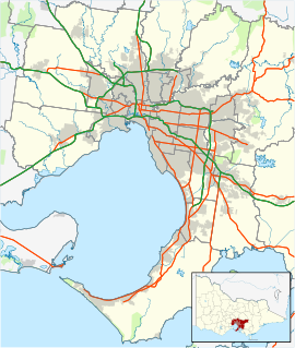
 Blackburn North
Population: 6,816 (2006)[1] Postcode: 3130 Area: 2.6 km² (1.0 sq mi) Location: 17 km (11 mi) from Melbourne LGA: City of Whitehorse State District: Mitcham Federal Division: Deakin Suburbs around Blackburn North: Doncaster Doncaster East Donvale Box Hill North Blackburn North Nunawading Box Hill Blackburn Nunawading Blackburn North is a suburb in Melbourne, Victoria, Australia, 17 km east from Melbourne's central business district.[2] Its Local Government Area is the City of Whitehorse. At the 2006 Census, Blackburn North had a population of 6816.
North Blackburn is a predominantly residential suburb, with wide green and leafy streets and houses on quarter acre blocks. The suburb had its start in the early 1960s, much of it being built on land formerly used as an apple orchard. North Blackburn Shopping Centre was originally known as Old Orchard Shopping Centre for this reason, as is Old Orchard Primary School today. North Blackburn Post Office opened on 2 May 1955 and was renamed Blackburn North around 1990.[3]
Property prices have risen markedly in the last 10 years, especially since the Eastern Freeway was extended to run past the suburb.
Prior to the formation of the City of Whitehorse in 1994, North Blackburn was a part of the now defunct City of Nunawading.
Contents
Industry
A small light industrial area is sited in the North East corner of the suburb, along Joseph Street. A former clay pipe factory on Springfield Road has been closed and replaced by housing.
Shopping
No major shopping centre exists in North Blackburn, while it is well served by North Blackburn Square Shopping Centre on Springfield Road, it is in fact located in Blackburn. The large Westfield Doncaster is in nearby Doncaster.
Centro Box Hill, formerly Box Hill Central and now incorporating the former Centro Whitehorse, can also be found in Box Hill. It can be accessed through several busses, notably Busses 270/271, which can also be taken in the opposite direction to Eastland Shopping Centre and other shopping locations.
Small strip shopping areas exist in Raymond Street, Katrina Street and Diana Drive.
Transport
No railway station serves North Blackburn. However Melbourne Metlink bus routes service the area.
These route run through the suburb to the nearby public transport hub at Box Hill, where a bus terminus, tram terminus and Box Hill Railway Station can be found.
Other nearby train stations are Laburnum and Blackburn. Blackburn Station can be reached by bus from North Blackburn.
On its Northern Boundary is the Eastern Freeway, along which also runs a bicycle track, the Koonung Creek Trail. The northern boundary is also marked by Koonung Creek, which flows into the Yarra River further downstream. Exit the Freeway at Middleborough Road or Blackburn Road, to best reach North Blackburn.
Schools
There are two public primary schools in North Blackburn, Old Orchard Primary School and St. Phillips (Catholic) on Junction Road. Springview Primary School which although is next door to St. Phillips is actually in neighbouring Nunawading.
Middlefield Primary School, formerly located on Verbena street, has now been torn down and replaced with housing. It's soccer pitch survives as part of koonung reserve. It amalgamated with Blackburn North Primary School in 1992 to form Old Orchard Primary School. Once located on Springfield Road, it has now also been replaced by housing on the new street of Kurrajong Way.
There are no secondary schools in North Blackburn. Blackburn High School can be found in nearby Blackburn. The former Blackburn Technical School has closed down, and since 1995, Old Orchard Primary School has used a portion of that site.
Sport/Recreation
The area is well serviced by Koonung Reserve located on Springfield Road. It has cricket nets, a Cricket/football oval, a tennis club and a soccer field. It is the sporting home of several cricket and football teams, including the Eastern Football League (Australia)'s Nunawading Football Club.
Notable residents
- Ronnie Biggs - In 1970, the English fugitive Ronnie Biggs arrived in Australia while on the run from the UK authorities for his part in the Great Train Robbery of 1963.
After a stint in Adelaide, he and his family settled in Hibiscus Road, North Blackburn under the assumed name of Cook. There the family briefly lived a normal life, before Biggs fled alone to Brazil the day before police raided his house. His now ex-wife, Charmaine, and children still reside in Melbourne, albeit not in Blackburn North.
- Guy Pearce - Actor Guy Pearce lived in Fithie Street, Blackburn North in the late 1980s. Pearce appeared in the Australian Television soap opera Neighbours and has a successful film career.[4]
References
- ^ Australian Bureau of Statistics (25 October 2007). "Blackburn North (State Suburb)". 2006 Census QuickStats. http://www.censusdata.abs.gov.au/ABSNavigation/prenav/LocationSearch?collection=Census&period=2006&areacode=SSC21085&producttype=QuickStats&breadcrumb=PL&action=401. Retrieved 2007-10-01.
- ^ http://www.postcodes-australia.com/areas/vic/ferntree+gully/blackburn+north
- ^ Premier Postal History, Post Office List, https://www.premierpostal.com/cgi-bin/wsProd.sh/Viewpocdwrapper.p?SortBy=VIC&country=, retrieved 2008-04-11
- ^ Guy Pearce
External links
Coordinates: 37°48′36″S 145°09′14″E / 37.81°S 145.154°E
Suburbs of the City of Whitehorse | Melbourne | Victoria Blackburn · Blackburn North · Blackburn South · Box Hill · Box Hill North · Box Hill South · Burwood · Burwood East · Forest Hill · Mitcham · Mont Albert · Mont Albert North · Nunawading · Surrey Hills · Vermont · Vermont South
Categories:- Suburbs of Melbourne

Wikimedia Foundation. 2010.