- Oberösch
-
Oberösch Country Switzerland 
Canton Bern District Emmental 47°7′N 7°37′E / 47.117°N 7.617°ECoordinates: 47°7′N 7°37′E / 47.117°N 7.617°E Population 111 (Dec 2010)[1] - Density 53 /km2 (137 /sq mi) Area 2.15 km2 (0.83 sq mi)[2] Elevation 489 m (1,604 ft) Postal code 3424 SFOS number 0419 Surrounded by Ersigen, Niederösch, Rumendingen, Utzenstorf Website Oberösch.ch
SFSO statistics
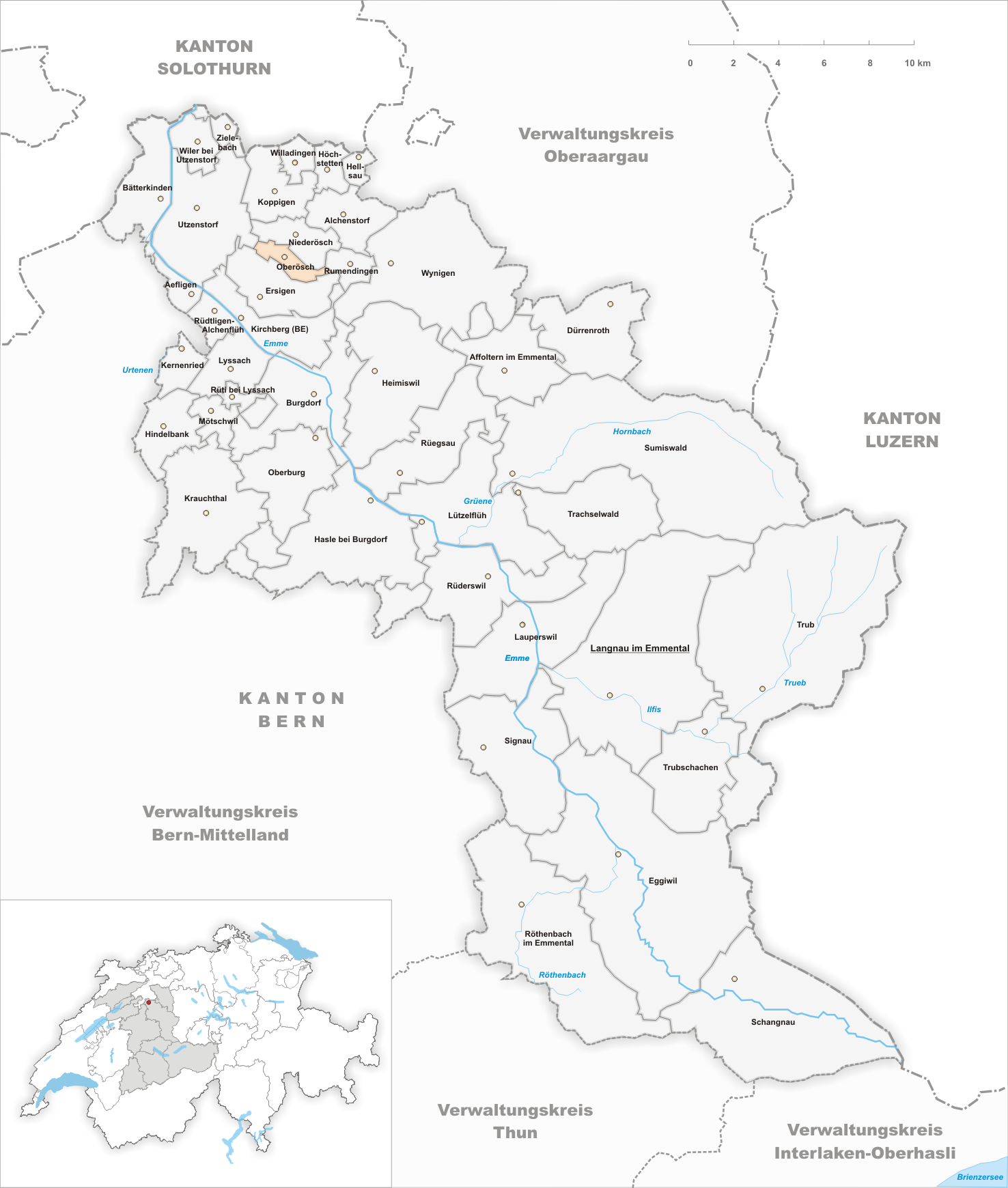
 OberöschMap of Oberösch
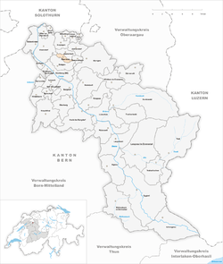
Oberösch is a municipality in the administrative district of Emmental in the canton of Bern in Switzerland.
Contents
History
Oberösch is first mentioned in 886 as Osse. It is mentioned again in 1310 as Oeschge superioris.[3]
Geography
Oberösch is located along the Ösch River north of Burgdorf.
Oberösch has an area, as of 2009[update], of 2.15 km2 (0.83 sq mi). Of this area, 1.28 km2 (0.49 sq mi) or 59.5% is used for agricultural purposes, while 0.73 km2 (0.28 sq mi) or 34.0% is forested. Of the rest of the land, 0.11 km2 (27 acres) or 5.1% is settled (buildings or roads).[4]
Of the built up area, housing and buildings made up 2.8% and transportation infrastructure made up 2.3%. 34.0% of the total land area is heavily forested. Of the agricultural land, 48.4% is used for growing crops and 9.8% is pastures, while 1.4% is used for orchards or vine crops.[4]
Demographics
Oberösch has a population (as of 31 December 2010) of 111.[1] As of 2007[update], 5.5% of the population was made up of foreign nationals. Over the last 10 years the population has grown at a rate of 18.5%. Most of the population (as of 2000[update]) speaks German (97.3%), with Polish being second most common ( 1.8%) and English being third ( 0.9%).
In the 2007 election the most popular party was the SVP which received 61.9% of the vote. The next three most popular parties were the SPS (13.9%), the Green Party (9.7%) and the FDP (5%).
The age distribution of the population (as of 2000[update]) is children and teenagers (0–19 years old) make up 18.6% of the population, while adults (20–64 years old) make up 63.7% and the seniors (over 64 years old) make up 17.7%. In Oberösch about 90.8% of the population (between age 25-64) have completed either non-mandatory upper secondary education or additional higher education (either university or a Fachhochschule).
Oberösch has an unemployment rate of 0.12%. As of 2005[update], there were 28 people employed in the primary economic sector and about 8 businesses involved in this sector. 2 people are employed in the secondary sector and 1 business in this sector. No one is employed in the tertiary sector.[5] The historical population is given in the following table:[3]
year population 1764 67 1850 162 1900 158 1950 132 2000 113 References
- ^ a b Swiss Federal Statistical Office - STAT-TAB, online database – Datenwürfel für Thema 01.2 - Bevölkerungsstand und -bewegung (German) accessed 29 September
- ^ Arealstatistik Standard - Gemeindedaten nach 4 Hauptbereichen
- ^ a b Oberösch in German, French and Italian in the online Historical Dictionary of Switzerland.
- ^ a b Swiss Federal Statistical Office-Land Use Statistics 2009 data (German) accessed 25 March 2010
- ^ Swiss Federal Statistical Office accessed 04-Jun-2009
Aefligen | Affoltern im Emmental | Alchenstorf | Bätterkinden | Burgdorf | Dürrenroth | Eggiwil | Ersigen | Hasle bei Burgdorf | Heimiswil | Hellsau | Hindelbank | Höchstetten | Kernenried | Kirchberg | Koppigen | Krauchthal | Langnau im Emmental | Lauperswil | Lützelflüh | Lyssach | Mötschwil | Niederösch | Oberburg | Oberösch | Röthenbach im Emmental | Rüderswil | Rüdtligen-Alchenflüh | Rüegsau | Rumendingen | Rüti bei Lyssach | Schangnau | Signau | Sumiswald | Trachselwald | Trub | Trubschachen | Utzenstorf | Wiler bei Utzenstorf | Willadingen | Wynigen | Zielebach
Canton of Bern | Districts of Canton Bern | Municipalities of the canton of Bern
 Categories:
- Municipalities of Bern
- Municipalities of Switzerland


Wikimedia Foundation. 2010.