- McDonald Township, Hardin County, Ohio
-
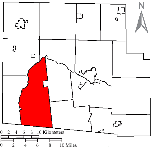
McDonald Township, Hardin County, Ohio — Township — Countryside in western McDonald Township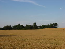 Location of McDonald Township, Hardin County, Ohio
Coordinates: 40°35′13″N 83°46′7″W / 40.58694°N 83.76861°WCoordinates: 40°35′13″N 83°46′7″W / 40.58694°N 83.76861°W Country United States State Ohio County Hardin Area – Total 42.9 sq mi (111.2 km2) – Land 42.9 sq mi (111.2 km2) – Water 0.0 sq mi (0.0 km2) Elevation[1] 1,050 ft (320 m) Population (2000) – Total 914 – Density 21.3/sq mi (8.2/km2) Time zone Eastern (EST) (UTC-5) – Summer (DST) EDT (UTC-4) FIPS code 39-45920[2] GNIS feature ID 1086265[1] McDonald Township is one of the fifteen townships of Hardin County, Ohio, United States. The 2000 census found 914 people in the township.[3]
Contents
Geography
Located in the southwestern part of the county, it borders the following townships:
- Cessna Township - north
- Lynn Township - northeast
- Taylor Creek Township - southeast
- Richland Township, Logan County - south
- Roundhead Township - west
- Marion Township - northwest
No municipalities are located in McDonald Township.
Name and history
It is the only McDonald Township statewide.[4]
McDonald Township is the location of the Zimmerman Kame, a burial site used by the ancient Glacial Kame Culture of Native Americans.[5]
Government
The township is governed by a three-member board of trustees, who are elected in November of odd-numbered years to a four-year term beginning on the following January 1. Two are elected in the year after the presidential election and one is elected in the year before it. There is also an elected township fiscal officer,[6] who serves a four-year term beginning on April 1 of the year after the election, which is held in November of the year before the presidential election. Vacancies in the fiscal officership or on the board of trustees are filled by the remaining trustees.
References
- ^ a b "US Board on Geographic Names". United States Geological Survey. 2007-10-25. http://geonames.usgs.gov. Retrieved 2008-01-31.
- ^ "American FactFinder". United States Census Bureau. http://factfinder.census.gov. Retrieved 2008-01-31.
- ^ Hardin County, Ohio — Population by Places Estimates Ohio State University, 2007. Accessed 16 May 2007.
- ^ "Detailed map of Ohio" (PDF). United States Census Bureau. 2000. http://www2.census.gov/geo/maps/general_ref/cousub_outline/cen2k_pgsz/oh_cosub.pdf. Retrieved 2007-02-16.
- ^ Drennen, Bert C., III. National Register of Historic Places Inventory/Nomination: Zimmerman Kame. National Park Service, 1974-01-22.
- ^ §503.24, §505.01, and §507.01 of the Ohio Revised Code. Accessed 4/30/2009.
External links
Municipalities and communities of Hardin County, Ohio Cities 
Villages Townships Unincorporated
communitiesFootnotes ‡This populated place also has portions in an adjacent county or counties
Categories:- Townships in Hardin County, Ohio


Wikimedia Foundation. 2010.