- Dotzigen
-
Dotzigen Country Switzerland 
Canton Bern District Seeland 47°7′N 7°20′E / 47.117°N 7.333°ECoordinates: 47°7′N 7°20′E / 47.117°N 7.333°E Population 1,332 (Dec 2010)[1] - Density 313 /km2 (812 /sq mi) Area 4.22 km2 (1.63 sq mi)[2] Elevation 435 m (1,427 ft) Postal code 3293 SFOS number 0386 Mayor Hansruedi Witkowski (as of 2008) Surrounded by Büetigen, Schwadernau, Scheuren, Meienried, Büren an der Aare and Diessbach bei Büren Website www.dotzigen.ch
SFSO statistics
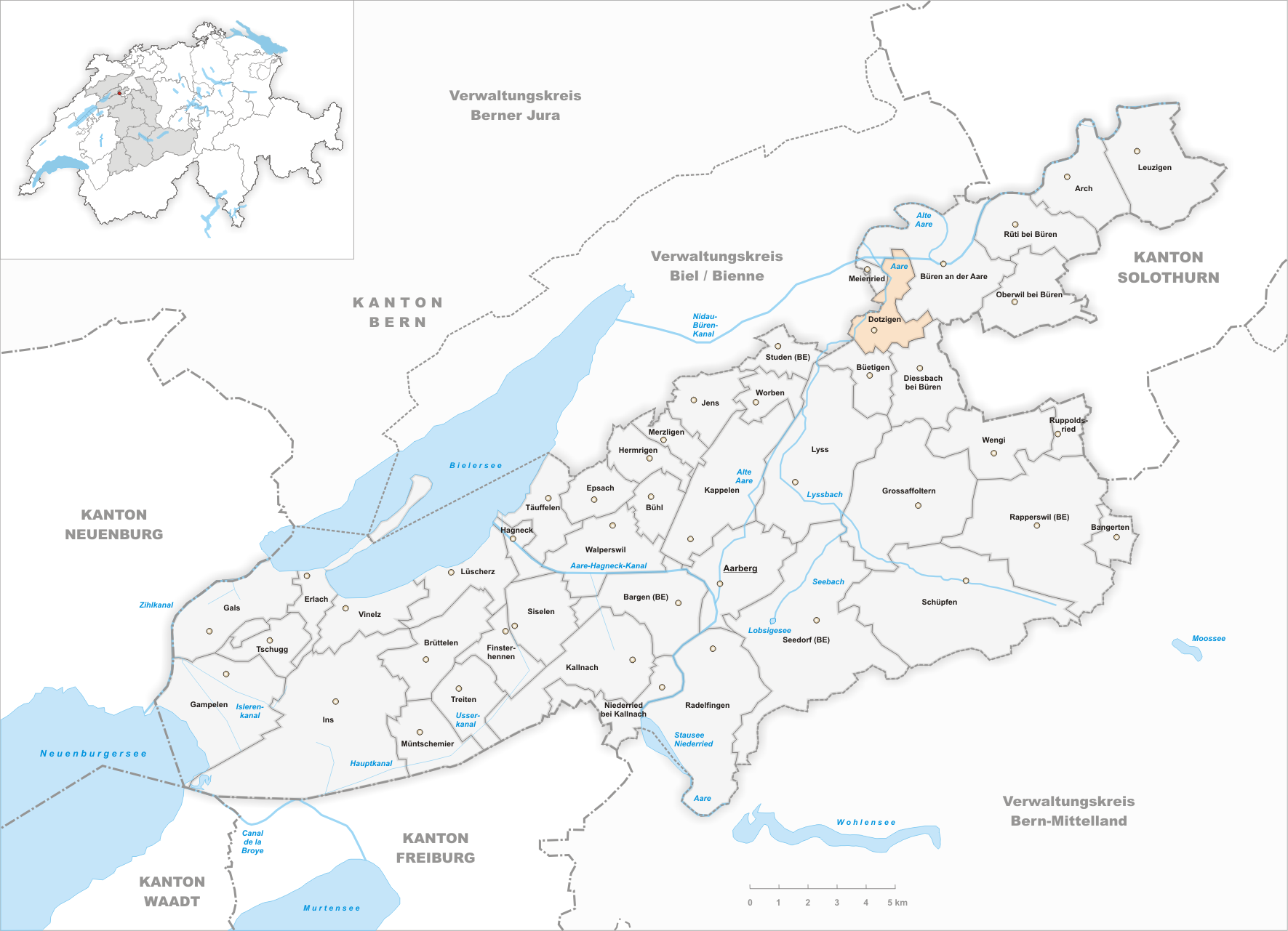
 DotzigenMap of Dotzigen

Dotzigen is a municipality in the Seeland administrative district in the canton of Bern in Switzerland.
Contents
Geography
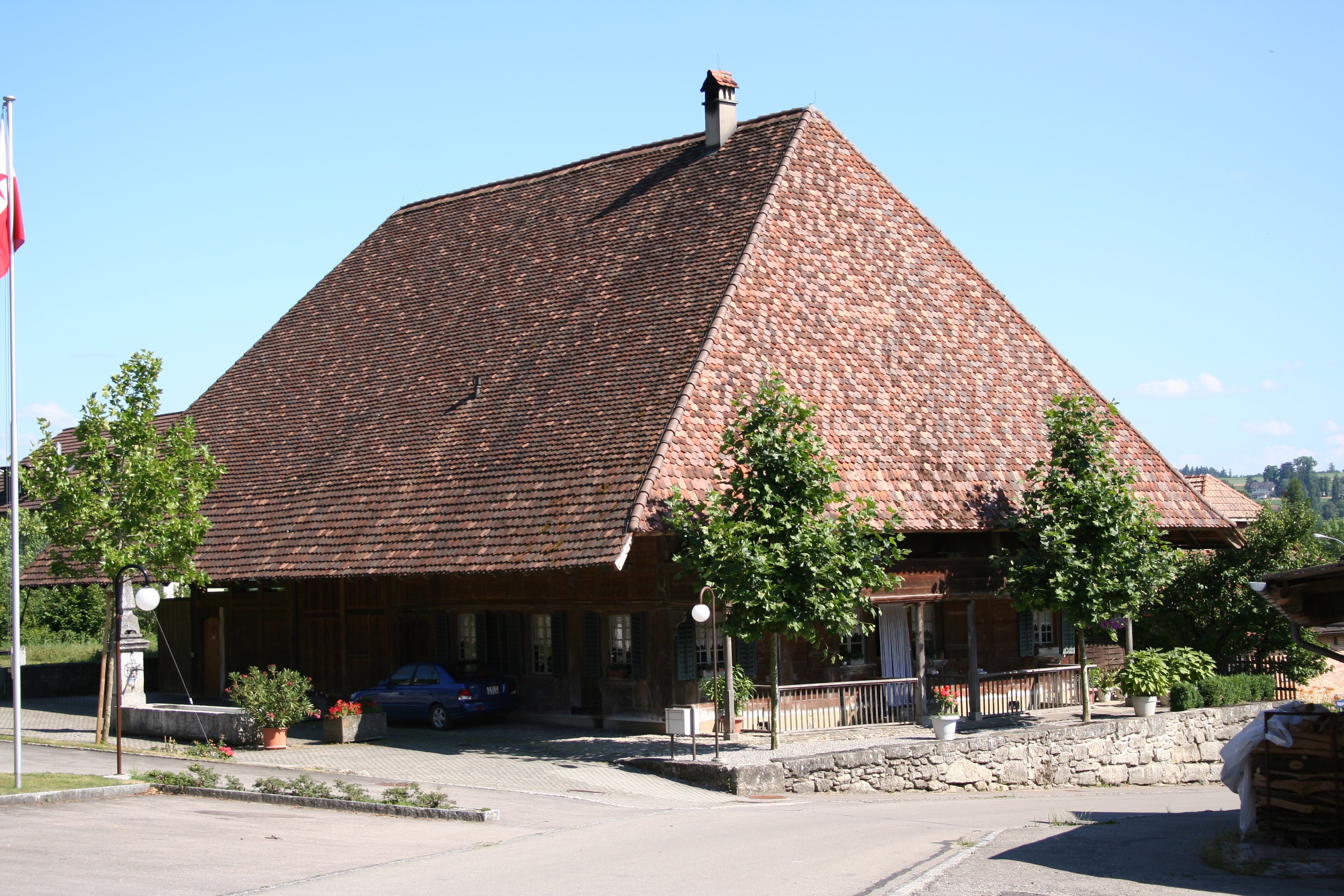
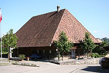 A farmhouse in Dotzigen
Dotzigen has an area, as of 2009[update], of 4.22 km2 (1.63 sq mi). Of this area, 2.35 km2 (0.91 sq mi) or 55.7% is used for agricultural purposes, while 1.1 km2 (0.42 sq mi) or 26.1% is forested. Of the rest of the land, 0.63 km2 (0.24 sq mi) or 14.9% is settled (buildings or roads), 0.09 km2 (22 acres) or 2.1% is either rivers or lakes and 0.05 km2 (12 acres) or 1.2% is unproductive land.[3]
Of the built up area, industrial buildings made up 1.7% of the total area while housing and buildings made up 7.8% and transportation infrastructure made up 3.8%. while parks, green belts and sports fields made up 1.4%. 25.1% of the total land area is heavily forested. Of the agricultural land, 46.2% is used for growing crops and 7.3% is pastures, while 2.1% is used for orchards or vine crops. All the water in the municipality is in rivers and streams.[3]
Dotzigen lies in Seeland at the edge of the Dotzigen/Stedtli Mountains. In the west the Old Aare flows (the part of the Aare River that flows after the Jura water correction); it is now a protected floodplain. The Jura water correction made possible the expansion of the town in the flat area of the municipality.
Demographics
Dotzigen has a population (as of 31 December 2010) of 1,332.[1] As of 2007[update], 6.2% of the population was made up of foreign nationals. Over the last 10 years the population has grown at a rate of 0.9%. Most of the population (as of 2000[update]) speaks German (93.7%), with French being second most common ( 1.5%) and Italian being third ( 0.9%).
In the 2007 election the most popular party was the SVP which received 36.7% of the vote. The next three most popular parties were the SPS (28.7%), the Green Party (12.4%) and the FDP (9.5%).
The age distribution of the population (as of 2000[update]) is children and teenagers (0–19 years old) make up 26.5% of the population, while adults (20–64 years old) make up 60.4% and the seniors (over 64 years old) make up 13.2%. The entire Swiss population is generally well educated. In Dotzigen about 74.9% of the population (between age 25-64) have completed either non-mandatory upper secondary education or additional higher education (either university or a Fachhochschule).
In Dotzigen there is a local primary school and a secondary school for it and the surrounding municipalities Busswil bei Büren, Diessbach bei Büren and Büetigen. The nearest Gymnasium is in Biel/Bienne.
Dotzigen has an unemployment rate of 1.16%. As of 2005[update], there were 30 people employed in the primary economic sector and about 11 businesses involved in this sector. 53 people are employed in the secondary sector and there are 18 businesses in this sector. 397 people are employed in the tertiary sector, with 30 businesses in this sector.[4]
Transportation
Dotzigen was connected to the Swiss railway network by the construction of the Solothurn-Lyss-Bahn in 1876. Today the trains run only to Büren an der Aare, or Kerzers on the other side. Dotzigen can be reached in a car via A5 (Solothurn-Biel).
Sights
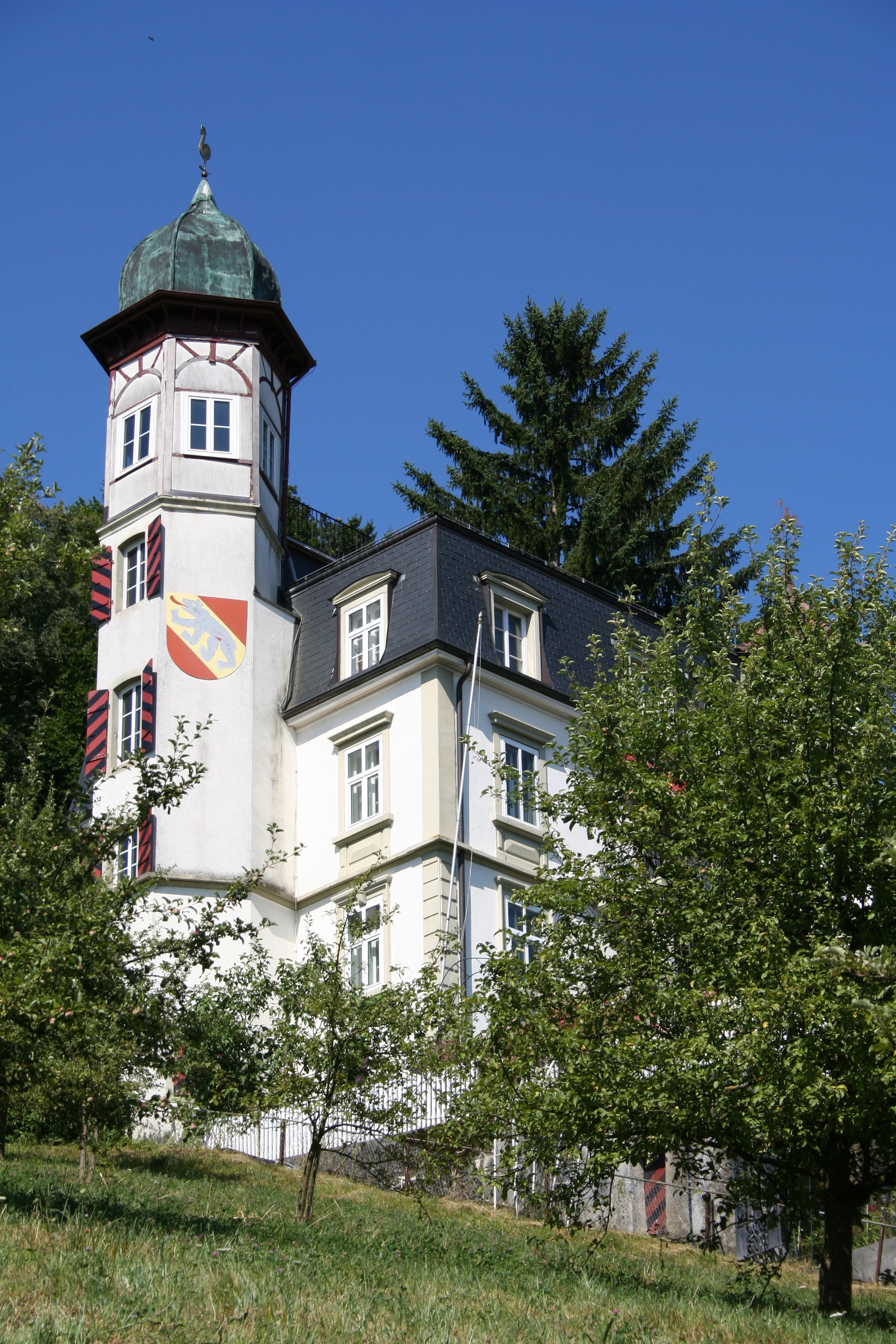
 The castle
Jeremias Gotthelf mentioned the sour Dotziger wine in one of his books, which grew and continues to grow at the foot of the mountains.
At the foot of the Dotzigen Mountains is a small castle, known for its gilded copper roof. At the exit of the town in the direction of Diessbach is an old flour mill powered by a water wheel. This has been restored and is available to visitors by reservation.
Further reading
- Hornerblätter, from the Vereinigung für Heimatpflege Büren
References
- ^ a b Swiss Federal Statistical Office - STAT-TAB, online database – Datenwürfel für Thema 01.2 - Bevölkerungsstand und -bewegung (German) accessed 29 September
- ^ Arealstatistik Standard - Gemeindedaten nach 4 Hauptbereichen
- ^ a b Swiss Federal Statistical Office-Land Use Statistics 2009 data (German) accessed 25 March 2010
- ^ Swiss Federal Statistical Office accessed 01-Jun-2009
External links
- Dotzigen in German, French and Italian in the online Historical Dictionary of Switzerland.
- Vereinigung für Heimatpflege Büren Distributor of numerous publications about Dotzigen and the Büren district (German)
Municipalities in the Seeland administrative district, Switzerland Aarberg | Arch | Bangerten | Bargen | Brüttelen | Büetigen | Bühl | Büren an der Aare | Diessbach bei Büren | Dotzigen | Epsach | Erlach | Finsterhennen | Gals | Gampelen | Grossaffoltern | Hagneck | Hermrigen | Ins | Jens | Kallnach | Kappelen | Leuzigen | Lüscherz | Lyss | Meienried | Merzligen | Müntschemier | Niederried bei Kallnach | Oberwil bei Büren | Radelfingen | Rapperswil | Ruppoldsried | Rüti bei Büren | Schüpfen | Seedorf | Siselen | Studen (BE) | Täuffelen | Treiten | Tschugg | Vinelz | Walperswil | Wengi | Worben
Canton of Bern | Districts of Canton Bern | Municipalities of the canton of Bern
 Categories:
- Municipalities of Bern
- Municipalities of Switzerland


Wikimedia Foundation. 2010.