- Meienried
-
Meienried Country Switzerland 
Canton Bern District Seeland 47°8′N 7°20′E / 47.133°N 7.333°ECoordinates: 47°8′N 7°20′E / 47.133°N 7.333°E Population 53 (Dec 2010)[1] - Density 76 /km2 (196 /sq mi) Area 0.70 km2 (0.27 sq mi) Elevation 430 m (1,411 ft) Postal code 3294 SFOS number 0389 Surrounded by Büren an der Aare, Dotzigen, Safnern, Scheuren Website Meienried.ch
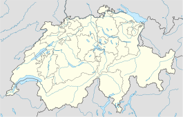
SFSO statisticsView map of Meienried Meienried is a municipality in the Seeland administrative district in the canton of Bern in Switzerland.
Geography
Meienried has an area, as of 2009[update], of 0.66 square kilometers (0.25 sq mi). Of this area, 0.47 km2 (0.18 sq mi) or 71.2% is used for agricultural purposes, while 0.11 km2 (0.042 sq mi) or 16.7% is forested. Of the rest of the land, 0.02 km2 (4.9 acres) or 3.0% is settled (buildings or roads), 0.04 km2 (9.9 acres) or 6.1% is either rivers or lakes and 0.03 km2 (7.4 acres) or 4.5% is unproductive land.[2]
Of the built up area, housing and buildings made up 1.5% and transportation infrastructure made up 1.5%. Out of the forested land, 13.6% of the total land area is heavily forested and 3.0% is covered with orchards or small clusters of trees. Of the agricultural land, 56.1% is used for growing crops and 13.6% is pastures, while 1.5% is used for orchards or vine crops. Of the water in the municipality, 4.5% is in lakes and 1.5% is in rivers and streams. All of the unproductive area is unproductive vegetation.[2]
Demographics
Meienried has a population (as of 31 December 2010) of 53,[1] who are all Swiss citizens. Over the last 10 years the population has decreased at a rate of -21.9%. Most of the population (as of 2000[update]) speaks German (93.2%), with French being second most common ( 5.1%) and Czech being third ( 1.7%).
In the 2007 election the most popular party was the SVP which received 33.6% of the vote. The next three most popular parties were the SPS (31.3%), the FDP (15%) and the Green Party (6.5%).
The age distribution of the population (as of 2000[update]) is children and teenagers (0–19 years old) make up 28.8% of the population, while adults (20–64 years old) make up 61% and the seniors (over 64 years old) make up 10.2%. The entire Swiss population is generally well educated. In Meienried about 79.4% of the population (between age 25-64) have completed either non-mandatory upper secondary education or additional higher education (either university or a Fachhochschule).
Meienried has an unemployment rate of 0%. As of 2005[update], there were 13 people employed in the primary economic sector and about 5 businesses involved in this sector. 15 people are employed in the tertiary sector, with 1 businesses in this sector.[3]
References
- ^ a b Swiss Federal Statistical Office - STAT-TAB, online database – Datenwürfel für Thema 01.2 - Bevölkerungsstand und -bewegung (German) accessed 29 September
- ^ a b Swiss Federal Statistical Office-Land Use Statistics 2009 data (German) accessed 25 March 2010
- ^ Swiss Federal Statistical Office accessed 01-Jun-2009
Municipalities in the Seeland administrative district, Switzerland Aarberg | Arch | Bangerten | Bargen | Brüttelen | Büetigen | Bühl | Büren an der Aare | Diessbach bei Büren | Dotzigen | Epsach | Erlach | Finsterhennen | Gals | Gampelen | Grossaffoltern | Hagneck | Hermrigen | Ins | Jens | Kallnach | Kappelen | Leuzigen | Lüscherz | Lyss | Meienried | Merzligen | Müntschemier | Niederried bei Kallnach | Oberwil bei Büren | Radelfingen | Rapperswil | Ruppoldsried | Rüti bei Büren | Schüpfen | Seedorf | Siselen | Studen (BE) | Täuffelen | Treiten | Tschugg | Vinelz | Walperswil | Wengi | Worben
Canton of Bern | Districts of Canton Bern | Municipalities of the canton of Bern
 Categories:
- Municipalities of Bern
- Municipalities of Switzerland
Wikimedia Foundation. 2010.

