- Melchnau
-
Melchnau Country Switzerland 
Canton Bern District Oberaargau 47°11′N 7°51′E / 47.183°N 7.85°ECoordinates: 47°11′N 7°51′E / 47.183°N 7.85°E Population 1,540 (Dec 2010)[1] - Density 148 /km2 (384 /sq mi) Area 10.4 km2 (4.0 sq mi) Elevation 481 m (1,578 ft) Postal code 4917 SFOS number 0333 Surrounded by Altbüron (LU), Busswil bei Melchnau, Gondiswil, Grossdietwil (LU), Madiswil, Pfaffnau (LU), Reisiswil, Untersteckholz Website www.melchnau.ch
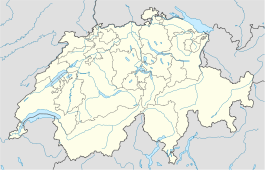
SFSO statisticsView map of Melchnau Melchnau is a municipality in the Oberaargau administrative district in the canton of Bern in Switzerland.
Contents
History
Melchnau celebrated its 900th anniversary in 2000. The earliest written evidence for the town dates from about 1100.
In the last century, Melchnau has developed from a farming town to a municipality with a diversified economy. As well as small businesses, light industry (for example Lanten Textiles) has emerged. In 1917 a narrow-gauge railway was opened between Langenthal and Melchnau, which was superseded by buses in 1982 . The railway and the station remain and are now used occasionally for special events.
Geography
Melchnau lies in a small valley near the border with the canton of Luzern. It is about equidistant from Bern (40 km) to the southwest and Luzern (35 km) to the southeast.
Melchnau has an area of 10.3 square kilometers (4.0 sq mi). Of this area, 5.92 km2 (2.29 sq mi) or 57.5% is used for agricultural purposes, while 3.63 km2 (1.40 sq mi) or 35.2% is forested. Of the rest of the land, 0.8 km2 (0.31 sq mi) or 7.8% is settled (buildings or roads), 0.01 km2 (2.5 acres) or 0.1% is either rivers or lakes and 0.01 km2 (2.5 acres) or 0.1% is unproductive land.[2]
Of the built up area, housing and buildings made up 5.0% and transportation infrastructure made up 1.8%. Out of the forested land, 33.4% of the total land area is heavily forested and 1.8% is covered with orchards or small clusters of trees. Of the agricultural land, 27.5% is used for growing crops and 28.2% is pastures, while 1.8% is used for orchards or vine crops. All the water in the municipality is in rivers and streams.[2]
Demographics
Melchnau has a population (as of 31 December 2010) of 1,540.[1] As of 2007[update], 11.5% of the population was made up of foreign nationals. Over the last 10 years the population has decreased at a rate of -6.3%. Most of the population (as of 2000[update]) speaks German (90.7%), with Serbo-Croatian being second most common ( 3.5%) and Turkish being third ( 1.8%).
In the 2007 election the most popular party was the SVP which received 45.3% of the vote. The next three most popular parties were the SPS (15%), the CSP (13.8%) and the FDP (12.5%).
The age distribution of the population (as of 2000[update]) is children and teenagers (0–19 years old) make up 26.1% of the population, while adults (20–64 years old) make up 53.9% and the seniors (over 64 years old) make up 20%. In Melchnau about 70.4% of the population (between age 25-64) have completed either non-mandatory upper secondary education or additional higher education (either university or a Fachhochschule).
Melchnau has an unemployment rate of 1.21%. As of 2005[update], there were 131 people employed in the primary economic sector and about 45 businesses involved in this sector. 247 people are employed in the secondary sector and there are 19 businesses in this sector. 312 people are employed in the tertiary sector, with 44 businesses in this sector.[3]
References
- ^ a b Swiss Federal Statistical Office - STAT-TAB, online database – Datenwürfel für Thema 01.2 - Bevölkerungsstand und -bewegung (German) accessed 29 September
- ^ a b Swiss Federal Statistical Office-Land Use Statistics 2009 data (German) accessed 25 March 2010
- ^ Swiss Federal Statistical Office accessed 29-May-2009
Aarwangen | Attiswil | Auswil | Bannwil | Berken | Bettenhausen | Bleienbach | Busswil bei Melchnau | Eriswil | Farnern | Gondiswil | Graben | Heimenhausen | Hermiswil | Herzogenbuchsee | Huttwil | Inkwil | Langenthal | Lotzwil | Madiswil | Melchnau | Niederbipp | Niederönz | Oberbipp | Obersteckholz | Ochlenberg | Oeschenbach | Reisiswil | Roggwil | Rohrbach | Rohrbachgraben | Rumisberg | Rütschelen | Schwarzhäusern | Seeberg | Thörigen | Thunstetten | Ursenbach | Walliswil bei Niederbipp | Walliswil bei Wangen | Walterswil | Wangen an der Aare | Wangenried | Wiedlisbach | Wolfisberg | Wynau | Wyssachen
Canton of Bern | Districts of Canton Bern | Municipalities of the canton of Bern
 Categories:
- Municipalities of Bern
- Municipalities of Switzerland
Wikimedia Foundation. 2010.

