- Oberbipp
-
Oberbipp Country Switzerland 
Canton Bern District Oberaargau 47°16′N 7°40′E / 47.267°N 7.667°ECoordinates: 47°16′N 7°40′E / 47.267°N 7.667°E Population 1,576 (Dec 2010)[1] - Density 185 /km2 (480 /sq mi) Area 8.47 km2 (3.27 sq mi)[2] Elevation 500 m (1,640 ft) Postal code 4538 SFOS number 0983 Surrounded by Bannwil, Niederbipp, Rumisberg, Walliswil bei Niederbipp, Wiedlisbach, Wolfisberg Website www.oberbipp.ch
SFSO statistics
 OberbippMap of Oberbipp
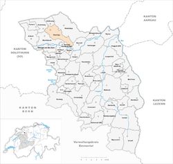
Oberbipp is a municipality in the Oberaargau administrative district in the canton of Bern in Switzerland.
 Aerial view of Oberbipp
Contents
History
Oberbipp is first mentioned in 968 as Pippa. In 1327 it was mentioned as Obern Bipp.[3]
Geography
Oberbipp has an area, as of 2009[update], of 8.47 square kilometers (3.27 sq mi). Of this area, 3.98 km2 (1.54 sq mi) or 47.0% is used for agricultural purposes, while 3.35 km2 (1.29 sq mi) or 39.6% is forested. Of the rest of the land, 1.1 km2 (0.42 sq mi) or 13.0% is settled (buildings or roads), 0.03 km2 (7.4 acres) or 0.4% is either rivers or lakes and 0.03 km2 (7.4 acres) or 0.4% is unproductive land.[4]
Of the built up area, housing and buildings made up 5.4% and transportation infrastructure made up 5.3%. Out of the forested land, 37.7% of the total land area is heavily forested and 1.9% is covered with orchards or small clusters of trees. Of the agricultural land, 32.0% is used for growing crops and 14.2% is pastures. All the water in the municipality is in rivers and streams.[4]
The municipality is located on the southern slope of the Jura mountains. It includes the village of Oberbipp, the section of Buchli and other scattered settlements.
Demographics
Oberbipp has a population (as of 31 December 2010) of 1,576.[1] As of 2007[update], 8.9% of the population was made up of foreign nationals. Over the last 10 years the population has grown at a rate of 10.4%. Most of the population (as of 2000[update]) speaks German (91.9%), with Albanian being second most common ( 1.8%) and Serbo-Croatian being third ( 1.5%).
In the 2007 election the most popular party was the SVP which received 46% of the vote. The next two most popular parties were the FDP (17.3%), and the SP (17.3%).
The age distribution of the population (as of 2000[update]) is children and teenagers (0–19 years old) make up 27.6% of the population, while adults (20–64 years old) make up 59.3% and seniors (over 64 years old) make up 13%. In Oberbipp about 76.5% of the population (between age 25-64) have completed either non-mandatory upper secondary education or additional higher education (either university or a Fachhochschule).
Oberbipp has an unemployment rate of 2.24%. As of 2005[update], there were 64 people employed in the primary economic sector and about 22 businesses involved in this sector. 181 people are employed in the secondary sector and there are 14 businesses in this sector. 174 people are employed in the tertiary sector, with 30 businesses in this sector.[5] The historical population is given in the following table:[3]
year population 1764 447 1850 801 1900 801 1950 981 2000 1,407 References
- ^ a b Swiss Federal Statistical Office - STAT-TAB, online database – Datenwürfel für Thema 01.2 - Bevölkerungsstand und -bewegung (German) accessed 29 September
- ^ Arealstatistik Standard - Gemeindedaten nach 4 Hauptbereichen
- ^ a b Oberbipp in German, French and Italian in the online Historical Dictionary of Switzerland.
- ^ a b Swiss Federal Statistical Office-Land Use Statistics 2009 data (German) accessed 25 March 2010
- ^ Swiss Federal Statistical Office accessed 21-Jul-2009
External links
- Oberbipp in German, French and Italian in the online Historical Dictionary of Switzerland.
Aarwangen | Attiswil | Auswil | Bannwil | Berken | Bettenhausen | Bleienbach | Busswil bei Melchnau | Eriswil | Farnern | Gondiswil | Graben | Heimenhausen | Hermiswil | Herzogenbuchsee | Huttwil | Inkwil | Langenthal | Lotzwil | Madiswil | Melchnau | Niederbipp | Niederönz | Oberbipp | Obersteckholz | Ochlenberg | Oeschenbach | Reisiswil | Roggwil | Rohrbach | Rohrbachgraben | Rumisberg | Rütschelen | Schwarzhäusern | Seeberg | Thörigen | Thunstetten | Ursenbach | Walliswil bei Niederbipp | Walliswil bei Wangen | Walterswil | Wangen an der Aare | Wangenried | Wiedlisbach | Wolfisberg | Wynau | Wyssachen
Canton of Bern | Districts of Canton Bern | Municipalities of the canton of Bern
 Categories:
- Municipalities of Bern
- Municipalities of Switzerland


Wikimedia Foundation. 2010.