- North Kynouria
-
North Kynouria
Βόρεια ΚυνουρίαLocation 
 North Kynouria
Coordinates 37°24′N 22°43′E / 37.4°N 22.717°ECoordinates: 37°24′N 22°43′E / 37.4°N 22.717°E Location within the region250x250pxGovernment Country: Greece Region: Peloponnese Regional unit: Arcadia Districts: 26 Population statistics (as of 2001) Municipality - Population: 12,825 - Area: 576.981 km2 (223 sq mi) - Density: 22 /km2 (58 /sq mi) Other Time zone: EET/EEST (UTC+2/3) Elevation: 0 m (0 ft) Postal: 22001 North Kynouria or Vóreia Kynouría (Βόρεια Κυνουρία) is a municipality in Arcadia, Greece. It is located in the eastern part of the peripheral unit, between the northwestern shores of the Argolic Gulf and northern Laconia. Its land area is 576.981 km². Its population is 12,825 (2001 census). The seat of the municipality is in Astros (pop. 2,359).[1] Its largest other towns or villages are Ágios Andréas (pop. 1,063), Ágios Pétros (949), Parálio Ástros (874), Kato Doliana (780), Cheimeriní Meligoú (771), Korakovoúni (710), Kastrí (626), and Prastós (548).
Subdivisions
The municipality is divided into 26 communities:
- Agia Sofia
- Agios Andreas (Agios Andreas, Arkadiko Chorio, Paralia Agiou Andreou)
- Agios Georgios (Aetochori, Vathia, Melissi)
- Agios Petros (Agios Petros, Moni Malevis, Xirokampi)
- Astros (Astros, Agios Ioannis, Agios Stefanos, Varvogli, Iera Moni Loukous, Chantakia)
- Charadros (Charadros, Agioi Asomatoi)
- Doliana (Ano Doliana, Dragouni, Kato Doliana, Kouvlis, Prosilia, Rounaiika)
- Elatos
- Karatoulas Kynourias
- Kastanitsa
- Korakovouni (Korakovouni, Neochori, Oreino Korakovouni)
- Koutroufa
- Meligou (Oreini Meligou, Agia Anastasia, Portes, Cheimerini Meligou)
- Mesorrachi
- Nea Chora
- Oria
- Paralio Astros
- Perdikovrysi
- Platana
- Platanos
- Prastos (Prastos, Agios Panteleimon, Moni Eortakoustis)
- Sitaina
- Stolos (Stolos, Fountoma)
- Vervena (Vervena, Kato Vervena)
- Xiropigado (Xiropigado, Metamorfosi, Plaka)
References
- ^ Kallikratis law Greece Ministry of Interior (Greek)
Administrative division of the Peloponnese Region 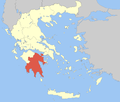 Categories:
- Populated places in Arcadia
- Municipalities of the Peloponnese Periphery
- Peloponnese geography stubs


Wikimedia Foundation. 2010.