Nachikatsuura, Wakayama

Nachikatsuura, Wakayama
Nachikatsuura
那智勝浦町
—  Town  —
Location of Nachikatsuura in Wakayama Prefecture
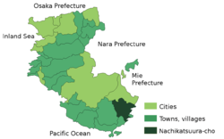
Nachikatsuura is located in Japan
Nachikatsuura
 
Coordinates: 33°38′N 135°56′E / 33.633°N 135.933°E / 33.633; 135.933Coordinates: 33°38′N 135°56′E / 33.633°N 135.933°E / 33.633; 135.933
Country Japan
Region Kansai
Prefecture Wakayama Prefecture
District Higashimuro
Area
 – Total 183.45 km2 (70.8 sq mi)
Population (2003)
 – Total 18,795
 – Density 102.5/km2 (265.4/sq mi)
Time zone Japan Standard Time (UTC+9)
Website Town of Nachikatsuura
Nanki-Katsuura Onsen
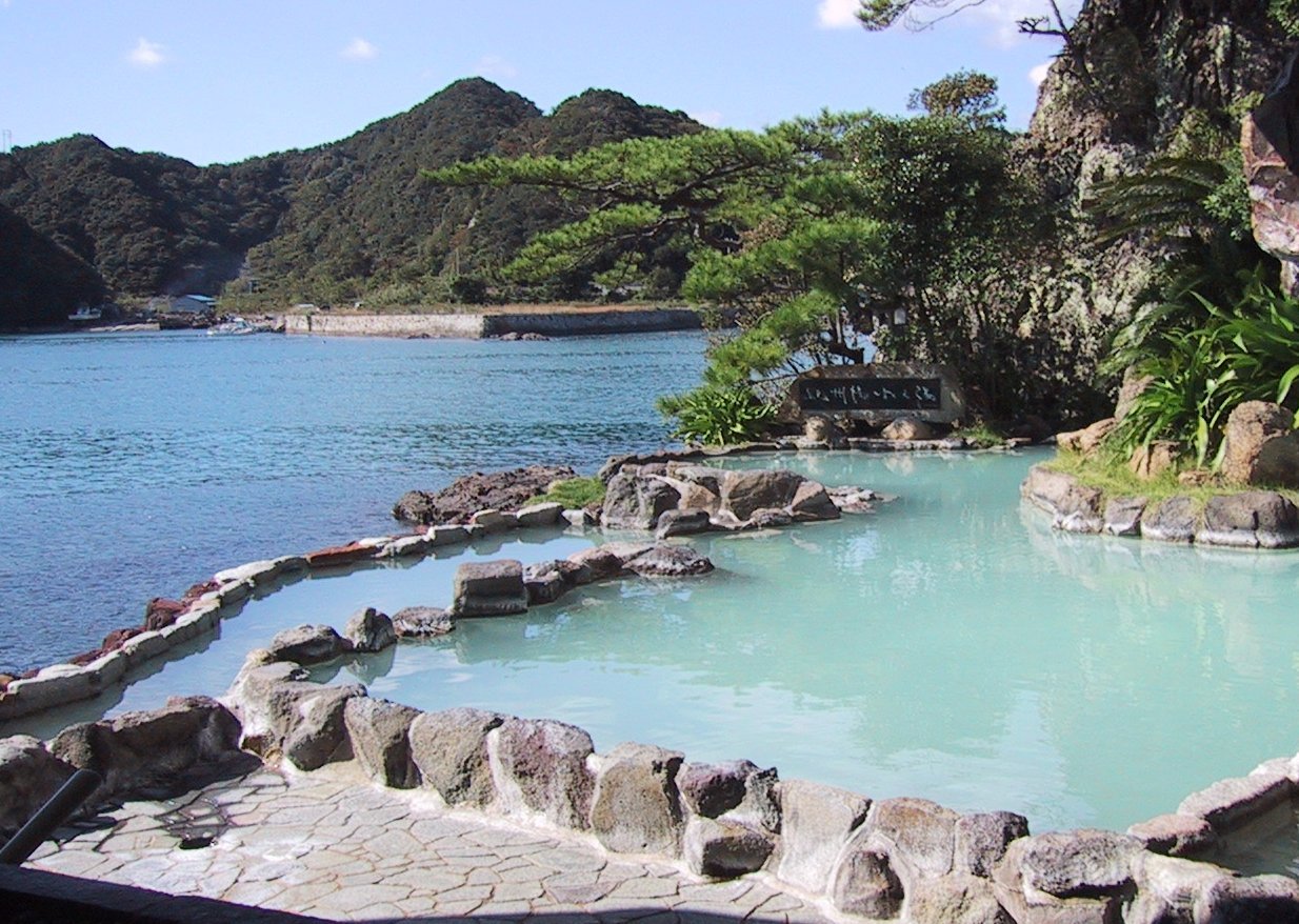
Nachikatsuura (那智勝浦町 Nachikatsuura-chō?) is a town located in Higashimuro District, Wakayama, Japan.

As of 2003, the town has an estimated population of 18,795 and a density of 102.45 persons per km². The total area is 183.45 km².

The Kumano Nachi Taisha, one of the three Kumano Shrines, is in Nachi Katsuura. These shrines form part of the "Sacred Sites and Pilgrimage Routes in the Kii Mountain Range" UNESCO World Heritage Site.

External links

Media related to Nachikatsuura, Wakayama at Wikimedia Commons


Wikimedia Foundation. 2010.

Игры ⚽ Поможем написать реферат

Look at other dictionaries:

  • Prefectura de Wakayama — Wakayama 和歌山県 Wakayama ken Prefectura de Japón …   Wikipedia Español

  • Prefecture de Wakayama — Préfecture de Wakayama Préfecture de Wakayama · 和歌山県 Wakayama ken Carte du Japon avec la Préfecture de Wakayama mise en évidence. Pays  Japon …   Wikipédia en Français

  • Préfecture de wakayama — · 和歌山県 Wakayama ken Carte du Japon avec la Préfecture de Wakayama mise en évidence. Pays  Japon …   Wikipédia en Français

  • Préfecture de Wakayama — 和歌山県 Wakayama ken Carte du Japon avec la Préfecture de Wakayama mise en évidence. Pays …   Wikipédia en Français

  • Präfektur Wakayama — 和歌山県 Präfektur Wakayama Basisdaten Verwaltungssitz: Wakayama …   Deutsch Wikipedia

  • Shingū (Wakayama) — Shingū shi 新宮市 Geographische Lage in Japan …   Deutsch Wikipedia

  • Taiji, Wakayama — nihongo|Taiji|太地町|Taiji chō is a town located in Higashimuro District, Wakayama, Japan.As of 2007, the town has an estimated population of 3,444 and a density of 577.85 persons per km². The total area is 5.96 km². Taiji is the smallest local… …   Wikipedia

  • Higashimuro District, Wakayama — Higashimuro (東牟婁郡; gun) is a district located in Wakayama, Japan.As of 2003, the district has an estimated population of 37,945 and a density of 39.62 persons per km². The total area is 957.68 km².Around March 31, 2010, the city of Shingū and… …   Wikipedia

  • Shingū, Wakayama — Infobox City Japan Name= Shingū JapaneseName= 新宮市 Map Region= Kansai Prefecture= Wakayama District= Area km2= 255.43 PopDate= January 2008 Population= 32,623 Density km2= 128 Coords= LatitudeDegrees= 33 LatitudeMinutes= 43 LatitudeSeconds=… …   Wikipedia

  • List of mergers in Wakayama Prefecture — The following is a list of mergers that occurred in the 2000s in Wakayama Prefecture, Japan.(as of April 1, 2006)Mergers from April 1, 2004 to March 31, 2005*On October 1, 2004 the village of Minabegawa and the town of Minabe (both from Hidaka… …   Wikipedia

Share the article and excerpts

Direct link
Do a right-click on the link above
and select “Copy Link”