- Fier County
-
Fier County
Qarku i Fierit— County — Location of Fier County within Albania.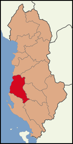
Country  Albania
Number of Districts 3 Capital Fier Area – Total 1,890 km2 (729.7 sq mi) Population (2010)[1] – Total 374,074 – Density 197.9/km2 (512.6/sq mi) Time zone CET (UTC+1) – Summer (DST) CEST (UTC+2) Website www.qarkufier.gov.al The County of Fier (Albanian: Qarku i Fierit) is one of the 12 counties of Albania. It consists of the districts of Fier, Lushnjë and Mallakastër and its capital is Fier.
Fier's western edge is the shoreline of the Adriatic Sea. On land, it borders the following counties:
- Tirana: north
- Elbasan: northeast
- Berat: east
- Gjirokastër: southeast
- Vlorë: south
Contents
Administrative divisions
District Capital District
Population (2010)[2]Area (km²) Municipalities Fier District Fier 199,442 785 Cakran, Dërmenas, Fier, Frakull, Kuman, Kurjan, Levan, Libofshë, Mbrostar, Patos, Portëz, Qendër, Roskovec, Ruzhdie, Strum, Topojë, Zharrëz Lushnjë District Lushnjë 143,276 712 Allkaj, Ballagat, Bubullimë, Divjakë, Dushk, Fier-Shegan, Golem, Grabian, Gradishtë, Hysgjokaj, Karbunarë, Kolonjë, Krutje, Lushnjë, Rremas, Tërbuf Mallakastër District Ballsh 31,356 393 Aranitas, Ballsh, Fratar, Greshicë, Hekal, Kutë, Ngraçan, Qendër, Selitë See also
References
- ^ "POPULLSIA SIPAS PREFEKTURAVE, 2001-2010". Albanian Institute of Statistics. http://www.instat.gov.al/graphics/doc/tabelat/Treguesit%20Sociale/Popullsia/POP%202009/t4%20.xls. Retrieved 2010-09-09.
- ^ "POPULLSIA SIPAS RRETHEVE, 2001-2010". Albanian Institute of Statistics. http://www.instat.gov.al/graphics/doc/tabelat/Treguesit%20Sociale/Popullsia/POP%202009/t2.xls. Retrieved 2010-09-09.
External links
Counties of Albania Municipalities of Fier County Capital: FierFier District 
Lushnjë District Mallakastër District Coordinates: 40°45′N 19°35′E / 40.75°N 19.583°E
Categories:- Fier County
- Counties of Albania
- Fier County geography stubs

Wikimedia Foundation. 2010.