- Fier District
-
Fier District
Rrethi i Fierit— District — Map showing the district within Albania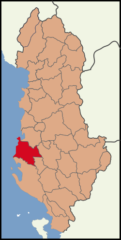
Country  Albania
County Fier County Capital Fier Area – Total 785 km2 (303.1 sq mi) Population (2010)[1] – Total 199,442 – Density 254.1/km2 (658/sq mi) The District of Fier (Albanian: Rrethi i Fierit) is one of the thirty-six districts of Albania, part of Fier County. It has a population of 199,442[2] (2010 estimate), and an area of 785 km². It is in the south-west of the country, and its capital is Fier. The district consists of the following municipalities:
- Cakran
- Dërmenas
- Fier
- Frakull
- Kuman
- Kurjan
- Levan
- Libofshë
- Mbrostar
- Patos
- Portëz
- Qendër
- Roskovec
- Ruzhdie
- Strum
- Topojë
- Zharrëz
Fier is well known for its ancient city, known as "Apollonia", where Cicero, the famous Roman orator had studied for a small period of time.
References
- ^ "POPULLSIA SIPAS PREFEKTURAVE, 2001–2010". Albanian Institute of Statistics. http://www.instat.gov.al/graphics/doc/tabelat/Treguesit%20Sociale/Popullsia/POP%202009/t4%20.xls. Retrieved 2010-09-09.
- ^ "POPULLSIA SIPAS RRETHEVE, 2001-2010". Albanian Institute of Statistics. http://www.instat.gov.al/graphics/doc/tabelat/Treguesit%20Sociale/Popullsia/POP%202009/t2.xls. Retrieved 2010-09-09.
Districts of Albania Berat · Bulqizë · Delvinë · Devoll · Dibër · Durrës · Elbasan · Fier · Gjirokastër · Gramsh · Has · Kavajë · Kolonjë · Korçë · Krujë · Kuçovë · Kukës · Kurbin · Lezhë · Librazhd · Lushnjë · Malësi e Madhe · Mallakastër · Mat · Mirditë · Peqin · Përmet · Pogradec · Pukë · Sarandë · Shkodër · Skrapar · Tepelenë · Tirana · Tropojë · VlorëCoordinates: 40°42′N 19°32′E / 40.7°N 19.533°E
Categories:- Districts of Albania
- Fier County
- Fier County geography stubs

Wikimedia Foundation. 2010.